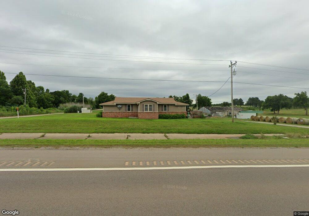
331036 E Highway 62 McLoud, OK 74851
Midway NeighborhoodEstimated Value: $64,000 - $417,002
4
Beds
3
Baths
3,118
Sq Ft
$81/Sq Ft
Est. Value
About This Home
This home is located at 331036 E Highway 62, McLoud, OK 74851 and is currently estimated at $251,667, approximately $80 per square foot. 331036 E Highway 62 is a home located in Lincoln County with nearby schools including McLoud Elementary School, McLoud Intermediate School, and McLoud Junior High School.
Ownership History
Date
Name
Owned For
Owner Type
Purchase Details
Closed on
Jan 28, 2026
Sold by
Staples Henry Leo and Staples Julia Lynn
Bought by
Staples Family Trust and Staples
Current Estimated Value
Purchase Details
Closed on
Jul 10, 2014
Sold by
Staples Family Revocable Trust
Bought by
Staples Henry Leo and Staples Julia Lynn
Purchase Details
Closed on
Jun 7, 2012
Sold by
Staples Henry L and Staples Billie Jean
Bought by
Staples Henry Loe and Staples George Brian
Purchase Details
Closed on
Jan 11, 1971
Sold by
Staples Sr Henry L and Staples Billi
Create a Home Valuation Report for This Property
The Home Valuation Report is an in-depth analysis detailing your home's value as well as a comparison with similar homes in the area
Home Values in the Area
Average Home Value in this Area
Purchase History
| Date | Buyer | Sale Price | Title Company |
|---|---|---|---|
| Staples Family Trust | -- | None Listed On Document | |
| Staples Henry Leo | -- | None Available | |
| Staples Henry Loe | -- | None Available | |
| -- | -- | -- |
Source: Public Records
Tax History
| Year | Tax Paid | Tax Assessment Tax Assessment Total Assessment is a certain percentage of the fair market value that is determined by local assessors to be the total taxable value of land and additions on the property. | Land | Improvement |
|---|---|---|---|---|
| 2025 | $5,878 | $60,014 | $1,775 | $58,239 |
| 2024 | $5,997 | $58,266 | $1,448 | $56,818 |
| 2023 | $5,391 | $61,229 | $1,880 | $59,349 |
| 2022 | $4,977 | $51,632 | $1,880 | $49,752 |
| 2021 | $6,190 | $50,127 | $1,880 | $48,247 |
| 2020 | $4,690 | $48,667 | $1,880 | $46,787 |
| 2019 | $1,359 | $14,339 | $1,472 | $12,867 |
| 2018 | $1,392 | $13,921 | $913 | $13,008 |
| 2017 | $846 | $8,710 | $1,192 | $7,518 |
| 2016 | $826 | $8,457 | $1,183 | $7,274 |
| 2015 | $726 | $8,210 | $1,051 | $7,159 |
| 2014 | $326 | $4,847 | $1,021 | $3,826 |
Source: Public Records
Map
Nearby Homes
- 0000 3310 Rd
- 334169 E 1010 Rd
- 29273 Spur Cir
- 29261 Spur Cir
- 15961 Prairie Rose Dr
- 15952 Prairie Rose Dr
- 333033 E 1065 Rd
- 105802 Parkwood Meadows Dr
- 333144 E 1066 Dr
- 4318 Driftwood Dr
- 4640 Lincoln Landing
- 4656 Lincoln Landing
- 4616 Lincoln Landing
- 4624 Lincoln Landing
- 4680 Lincoln Landing
- 329020 S 3290 Rd
- 2154 Houston Ave
- 4632 Lincoln St
- 4608 Lincoln St
- 101956 S 3303 Rd
- 104895 S 3310 Rd
- 330963 Williams Dr
- 331193 E Highway 62
- 330868 E Highway 62
- 105180 S 3310 Rd
- 105099 S Gary Dr
- 330863 Williams Dr
- 0 Diane St Unit 2318510
- 0 Diane St Unit 2242689
- 0 Diane St Unit 2201991
- 330960 Williams Dr
- 462 Rr 2
- 331326 U S 62
- 330746 E Highway 62
- 17 Gary Dr
- 76 Steven Dr
- 330771 Williams Dr
- 105280 Captain Creek Rd
- 105143 S Steven Dr
- 74 Steven Dr
Your Personal Tour Guide
Ask me questions while you tour the home.