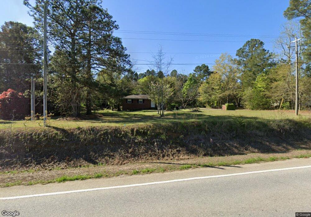
3311 Augusta Hwy Dearing, GA 30808
Estimated Value: $123,814 - $183,000
2
Beds
1
Bath
1,014
Sq Ft
$153/Sq Ft
Est. Value
About This Home
This home is located at 3311 Augusta Hwy, Dearing, GA 30808 and is currently estimated at $154,954, approximately $152 per square foot. 3311 Augusta Hwy is a home located in McDuffie County with nearby schools including Thomson High School.
Ownership History
Date
Name
Owned For
Owner Type
Purchase Details
Closed on
Aug 23, 2004
Sold by
Prescott Loyce A
Bought by
Williams Ii Preston A
Current Estimated Value
Purchase Details
Closed on
Jun 2, 2004
Sold by
Prescott Walter G Est
Bought by
Prescott Loyce A
Purchase Details
Closed on
Apr 1, 2004
Sold by
Prescott Spurgeon L
Bought by
Prescott Walter Kent
Purchase Details
Closed on
Mar 6, 2004
Sold by
Prescott Loyce A
Bought by
Prescott Walter Kent
Purchase Details
Closed on
Jul 21, 1995
Sold by
Mensing Omnila M
Bought by
Prescott Walter G
Purchase Details
Closed on
Aug 4, 1981
Bought by
Mensing Omnila M
Create a Home Valuation Report for This Property
The Home Valuation Report is an in-depth analysis detailing your home's value as well as a comparison with similar homes in the area
Home Values in the Area
Average Home Value in this Area
Purchase History
| Date | Buyer | Sale Price | Title Company |
|---|---|---|---|
| Williams Ii Preston A | -- | -- | |
| Williams Ii Preston A | $73,500 | -- | |
| Prescott Loyce A | -- | -- | |
| Prescott Walter Kent | -- | -- | |
| Prescott Walter Kent | -- | -- | |
| Prescott Walter G | $49,900 | -- | |
| Mensing Omnila M | -- | -- |
Source: Public Records
Tax History Compared to Growth
Tax History
| Year | Tax Paid | Tax Assessment Tax Assessment Total Assessment is a certain percentage of the fair market value that is determined by local assessors to be the total taxable value of land and additions on the property. | Land | Improvement |
|---|---|---|---|---|
| 2024 | $797 | $34,989 | $2,013 | $32,976 |
| 2023 | $776 | $33,074 | $1,447 | $31,627 |
| 2022 | $723 | $30,228 | $1,447 | $28,781 |
| 2021 | $561 | $23,904 | $1,405 | $22,499 |
| 2020 | $359 | $16,738 | $1,780 | $14,958 |
| 2019 | $363 | $16,738 | $1,780 | $14,958 |
| 2018 | $363 | $16,738 | $1,780 | $14,958 |
| 2017 | $367 | $17,338 | $1,780 | $15,558 |
| 2016 | $367 | $17,338 | $1,780 | $15,558 |
| 2015 | $374 | $18,920 | $3,363 | $15,558 |
| 2014 | $375 | $18,921 | $3,363 | $15,558 |
| 2013 | -- | $18,920 | $3,363 | $15,557 |
Source: Public Records
Map
Nearby Homes
- 2522 Ellington Airline Rd
- 0 Mitchner Rd Unit 548843
- 3171 Old Augusta Rd
- 3191 Old Augusta Rd
- 259 S Main St
- 122 First St
- 1463 Lokey Dr
- 4327 Iron Hill Rd
- 290 Neals Mill Rd
- 789 George McDuffie Rd
- 1761 Augusta Hwy
- 0 Randall Hunt Rd Unit 24088941
- 1086 Boneville Rd
- 1076 Boneville Rd
- 651 Moose Club Rd
- 4099 Randall Hunt Rd
- 0 Liberty St
- 4062 Horsham Trail
- 0 Adams-Reeves Rd Unit 523648
- 1761 Augusta Rd
- 3327 Augusta Hwy
- 3297 Augusta Hwy
- 3341 Augusta Hwy
- 2706 Pine Forest Dr
- 2702 Pine Forest Dr
- 2701 Pine Forest Dr
- 2714 Pine Forest Dr
- 3389 Augusta Hwy
- 3244 Augusta Hwy
- 2707 Pine Forest Dr
- 2713 Pine Forest Dr
- 2671 Ellington Airline Rd
- 2731 Pine Forest Dr
- 2748 Pine Forest Dr
- 2683 Ellington Airline Rd
- 2658 Ellington Airline Rd
- 2764 Pine Forest Dr
- 2689 Ellington Airline Rd
- 2634 Ellington Airline Rd
- 2701 Ellington Airline Rd