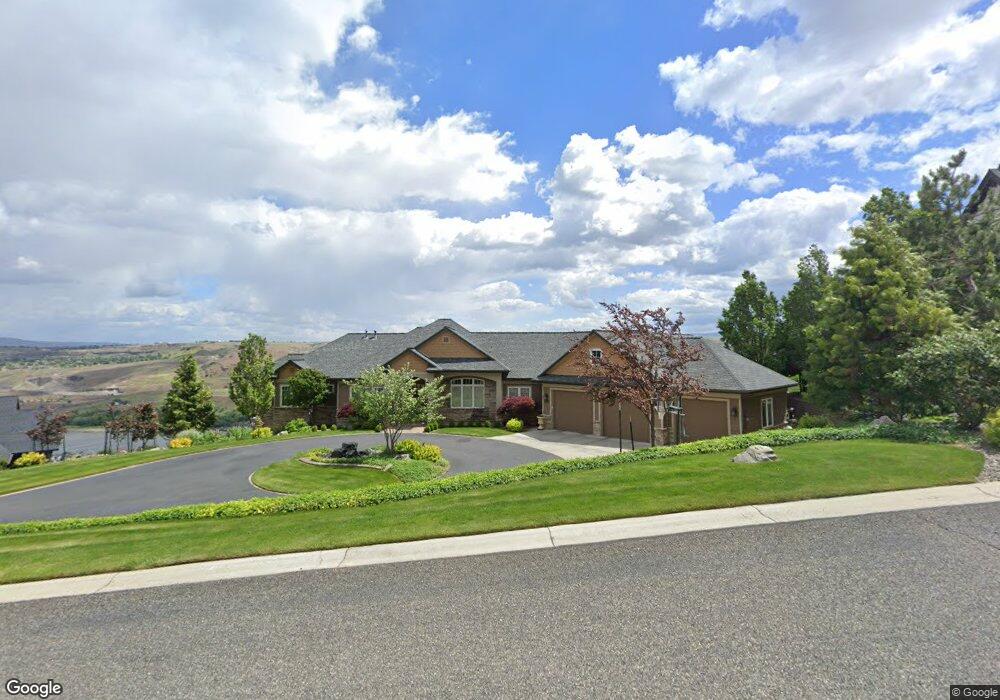
3311 Michael Dr Clarkston, WA 99403
Estimated Value: $699,754 - $849,000
About This Home
This home is located at 3311 Michael Dr, Clarkston, WA 99403 and is currently estimated at $760,939, approximately $283 per square foot. 3311 Michael Dr is a home located in Asotin County with nearby schools including Asotin Elementary School and Asotin Junior/Senior High School.
Ownership History
We collect this data history from publicly available records. To have your information removed, we recommend requesting removal directly through your county’s website.
Purchase Details
Home Values in the Area
Average Home Value in this Area
Purchase History
We collect this data history from publicly available records. To have your information removed, we recommend requesting removal directly through your county’s website.
| Date | Buyer | Sale Price | Title Company |
|---|---|---|---|
| $92,500 | Alliance Title & Escrow Corp |
Tax History
We collect this data history from publicly available records. To have your information removed, we recommend requesting removal directly through your county’s website.
| Year | Tax Paid | Tax Assessment Tax Assessment Total Assessment is a certain percentage of the fair market value that is determined by local assessors to be the total taxable value of land and additions on the property. | Land | Improvement |
|---|---|---|---|---|
| 2025 | $6,602 | $601,676 | $103,476 | $498,200 |
| 2023 | $6,602 | $601,676 | $103,476 | $498,200 |
| 2022 | $6,966 | $601,676 | $103,476 | $498,200 |
| 2021 | $6,658 | $601,676 | $103,476 | $498,200 |
| 2020 | $8,300 | $601,676 | $103,476 | $498,200 |
| 2019 | $7,916 | $741,300 | $95,000 | $646,300 |
| 2018 | $9,533 | $741,300 | $95,000 | $646,300 |
| 2017 | $8,540 | $741,300 | $95,000 | $646,300 |
| 2016 | $8,540 | $741,300 | $95,000 | $646,300 |
| 2015 | $850 | $711,600 | $95,000 | $616,600 |
| 2013 | $8,230 | $705,100 | $95,000 | $610,100 |
Map
- 1771 River Canyon Dr
- 1783 Marshall Ct
- 3305 Michael Dr
- 1785 River Canyon Dr
- 1780 Cherry St
- 3433 Skyline Dr
- 3824 Pleasant View Dr
- 3780 Nicklaus Dr
- 3705 Nicklaus Dr
- 3775 Swallows Nest Ct
- 3015 Clemans Rd
- 3010 Riverside Dr
- 2300 & 2304 Chukar Dr
- 2274 Chukar Dr
- 2275 Chukar Dr
- 2271 Chukar Dr
- Lot 10 Cactus Ln
- Lot 10 Cactus Ln Unit 10
- 13761 Asotin Creek Rd
- 2242 Chukar Ln
- 3309 Michael Dr
- 3313 Michael Dr
- 1788 River Canyon Dr
- 3308 Michael Dr
- 1782 Marshall Ct
- 3312 Michael Dr
- 3315 Michael Dr
- 3307 Michael Dr
- 1743 River Canyon Dr
- 3316 Michael Dr
- 1780 River Canyon Dr
- 3306 Michael Dr
- 1784 Marshall Ct Unit Sunrise at River's B
- 1784 Marshall Ct
- 1783 Marshall Ct Unit 19
- 1782 River Canyon Dr
- 1750 Cherry St
- 1785 Marshall Ct
- 3304 Michael Dr
- 3303 Michael Dr
Ask me questions while you tour the home.