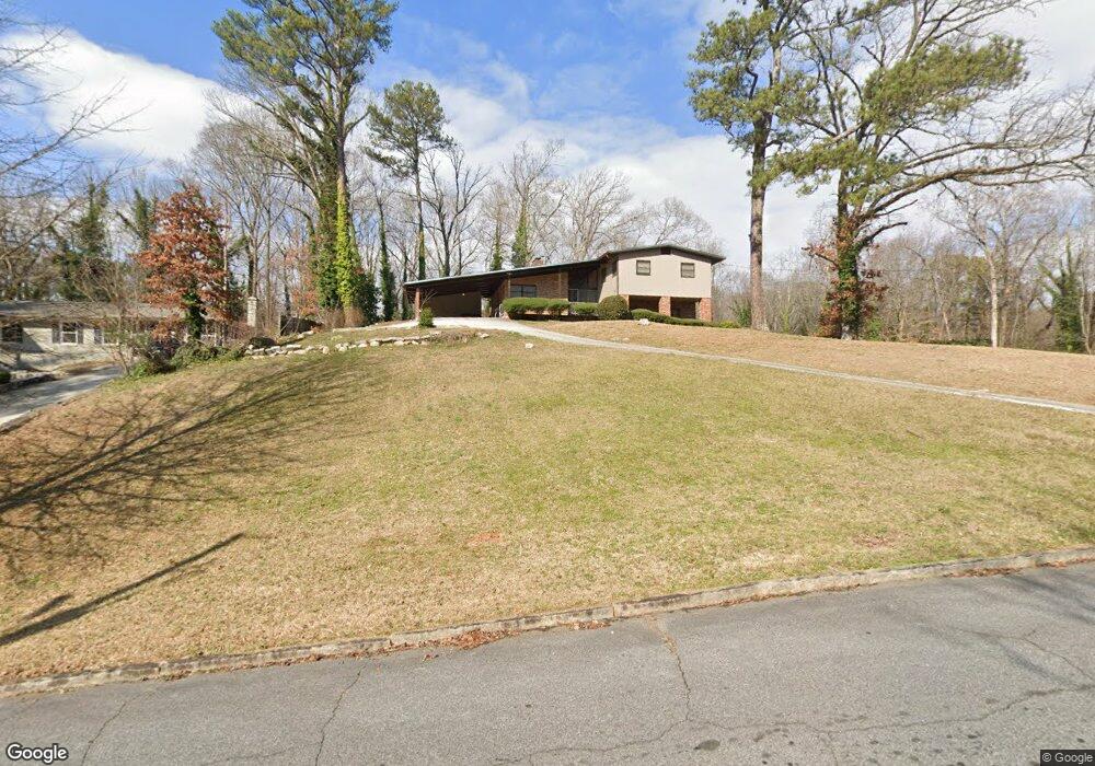
3311 Rabun Dr SW Atlanta, GA 30311
Estimated Value: $233,771 - $321,000
3
Beds
2
Baths
1,523
Sq Ft
$186/Sq Ft
Est. Value
About This Home
This home is located at 3311 Rabun Dr SW, Atlanta, GA 30311 and is currently estimated at $283,943, approximately $186 per square foot. 3311 Rabun Dr SW is a home located in Fulton County with nearby schools including West Manor Elementary School, Young Middle School, and Mays High School.
Ownership History
Date
Name
Owned For
Owner Type
Purchase Details
Closed on
May 14, 2021
Sold by
Baker Arthur Lynn
Bought by
3311 Rabun Dr Llc
Current Estimated Value
Purchase Details
Closed on
Oct 21, 2020
Sold by
Hardison Ameshia P
Bought by
Baker Arthur Lynn
Home Financials for this Owner
Home Financials are based on the most recent Mortgage that was taken out on this home.
Original Mortgage
$108,000
Interest Rate
2.9%
Mortgage Type
New Conventional
Purchase Details
Closed on
Sep 6, 2016
Sold by
Harris Eloise Lyons Estate
Bought by
Hardison Ameshia P and Eloise Lyons Harris Rev Trust
Create a Home Valuation Report for This Property
The Home Valuation Report is an in-depth analysis detailing your home's value as well as a comparison with similar homes in the area
Home Values in the Area
Average Home Value in this Area
Purchase History
| Date | Buyer | Sale Price | Title Company |
|---|---|---|---|
| 3311 Rabun Dr Llc | -- | -- | |
| Baker Arthur Lynn | -- | -- | |
| Baker Arthur Lynn | $135,000 | -- | |
| Hardison Ameshia P | -- | -- |
Source: Public Records
Mortgage History
| Date | Status | Borrower | Loan Amount |
|---|---|---|---|
| Previous Owner | Baker Arthur Lynn | $108,000 |
Source: Public Records
Tax History Compared to Growth
Tax History
| Year | Tax Paid | Tax Assessment Tax Assessment Total Assessment is a certain percentage of the fair market value that is determined by local assessors to be the total taxable value of land and additions on the property. | Land | Improvement |
|---|---|---|---|---|
| 2025 | $2,997 | $82,200 | $27,280 | $54,920 |
| 2023 | $3,890 | $93,960 | $37,480 | $56,480 |
| 2022 | $2,846 | $70,320 | $22,440 | $47,880 |
| 2021 | $580 | $68,280 | $21,800 | $46,480 |
| 2020 | $304 | $47,160 | $8,200 | $38,960 |
| 2019 | $366 | $38,080 | $7,240 | $30,840 |
| 2018 | $225 | $37,160 | $7,080 | $30,080 |
| 2017 | $33 | $20,280 | $3,800 | $16,480 |
| 2016 | $33 | $20,280 | $3,800 | $16,480 |
| 2015 | $35 | $20,280 | $3,800 | $16,480 |
| 2014 | $20 | $14,680 | $2,840 | $11,840 |
Source: Public Records
Map
Nearby Homes
- 3390 Cedar Island Dr SW
- 3175 W Manor Cir SW
- 3211 Hollydale Dr SW
- 650 Lynhurst Dr SW
- 3330 Pamlico Dr SW
- 3542 Lynfield Dr SW
- 400 Brownlee Rd SW
- 852 Venture Way SW
- 847 Venture Way SW
- 844 Venture Way
- 602 Lofty Ln
- 668 Lynn Cir SW Unit 3
- 837 Crestwell Cir SW
- 839 Crestwell Cir SW
- 3311 Spreading Oak Dr SW
- 761 Lynn Cir SW
- 659 Lynn Valley Rd SW
- 882 Ambient Way SW
- 728 Crestwell Cir SW
- 734 Celeste Ln SW Unit 84
- 3299 Rabun Dr SW
- 3319 Rabun Dr SW
- 3310 Rabun Dr SW
- 3322 Rabun Dr SW
- 3298 Rabun Dr SW
- 3298 Rabun Dr SW Unit 6
- 555 Hiawassee Dr SW
- 586 Brownlee Rd SW
- 0 Rabun Dr SW Unit 22 10149504
- 0 Rabun Dr SW Unit 324208
- 0 Rabun Dr SW Unit 7201572
- 0 Rabun Dr SW Unit 7347767
- 0 Rabun Dr SW Unit 7179975
- 0 Rabun Dr SW Unit 3228836
- 0 Rabun Dr SW Unit 3204544
- 0 Rabun Dr SW Unit 8646730
- 0 Rabun Dr SW Unit 7549664
- 0 Rabun Dr SW Unit 3237258
- 0 Rabun Dr SW Unit 3204448
- 0 Rabun Dr SW Unit 3144864