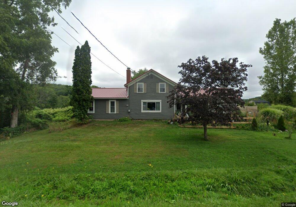
3311 Stetson Rd Bloomfield, NY 14469
Estimated Value: $132,000 - $251,000
3
Beds
1
Bath
1,480
Sq Ft
$130/Sq Ft
Est. Value
About This Home
This home is located at 3311 Stetson Rd, Bloomfield, NY 14469 and is currently estimated at $192,668, approximately $130 per square foot. 3311 Stetson Rd is a home located in Ontario County with nearby schools including Bloomfield Elementary School, Bloomfield Middle School, and Bloomfield High School.
Ownership History
Date
Name
Owned For
Owner Type
Purchase Details
Closed on
Sep 28, 2018
Sold by
Nelson Gwendolyn D
Bought by
Kraft Patricia
Current Estimated Value
Home Financials for this Owner
Home Financials are based on the most recent Mortgage that was taken out on this home.
Original Mortgage
$32,000
Interest Rate
4.5%
Mortgage Type
Unknown
Purchase Details
Closed on
Oct 27, 2006
Sold by
Canandaigua Natl Bank
Bought by
Nelson Gwendolyn
Purchase Details
Closed on
Apr 4, 2006
Purchase Details
Closed on
May 28, 1996
Create a Home Valuation Report for This Property
The Home Valuation Report is an in-depth analysis detailing your home's value as well as a comparison with similar homes in the area
Home Values in the Area
Average Home Value in this Area
Purchase History
| Date | Buyer | Sale Price | Title Company |
|---|---|---|---|
| Kraft Patricia | $62,000 | -- | |
| Nelson Gwendolyn | $45,000 | Michael Tobin | |
| -- | $60,000 | -- | |
| -- | -- | -- |
Source: Public Records
Mortgage History
| Date | Status | Borrower | Loan Amount |
|---|---|---|---|
| Closed | Kraft Patricia | $32,000 |
Source: Public Records
Tax History Compared to Growth
Tax History
| Year | Tax Paid | Tax Assessment Tax Assessment Total Assessment is a certain percentage of the fair market value that is determined by local assessors to be the total taxable value of land and additions on the property. | Land | Improvement |
|---|---|---|---|---|
| 2024 | $1,826 | $161,000 | $39,000 | $122,000 |
| 2023 | $2,376 | $90,000 | $34,000 | $56,000 |
| 2022 | $2,732 | $90,000 | $34,000 | $56,000 |
| 2021 | $2,732 | $90,000 | $34,000 | $56,000 |
| 2020 | $1,396 | $63,000 | $30,000 | $33,000 |
| 2019 | $0 | $63,000 | $30,000 | $33,000 |
| 2018 | $2,978 | $90,000 | $30,000 | $60,000 |
| 2017 | $2,741 | $80,000 | $22,400 | $57,600 |
| 2016 | $2,686 | $80,000 | $22,400 | $57,600 |
| 2015 | -- | $80,000 | $22,400 | $57,600 |
| 2014 | -- | $80,000 | $20,000 | $60,000 |
Source: Public Records
Map
Nearby Homes
- Lot State Route 444 Rd
- 3100 County Road 40
- 0 Wesley Rd
- 3029 Bailey Rd
- 3055 Sand Rd
- 7786 State Route 5 and 20
- 47 South Ave
- 39 South Ave
- 35 State St
- 3620 Oakmount Rd
- 3634 Oakmount Rd
- 2890 Conn Rd
- 3724 Oakmount Rd
- 8632 State Route 5 and 20
- 15 Elm St
- 6514 State Route 5 and 20
- 6511 Fisher Hill Rd
- 3354 Wheeler Station Rd
- VL County Road 14
- 4743 Bear Wood Ln
- 3305 County Road 40
- 0 Co Road 40 Unit R1081584
- 0 County Road 40 Unit R133049
- 0 County Road 40 Unit R263058
- 00 County Road 40
- 3351 Stetson Rd
- 3328 Stetson Rd
- 7588 State Route 5 & 20
- 0 Flat Iron Rd Lot#4 Unit R158458
- lot 4 Flat Iron Rd
- Lot 10 Wild Turkey Run
- Lot 12 Wild Turkey Run
- 3340 Stetson Rd
- 2 Rabbit
- 6 Rabbit
- 0 Grimble Rd Unit R1144534
- 0 Route 5 and 20 Unit R1106829
- 0 Wheeler Flatiron Rd Unit R825012
- 7929 State Route 5 & 20
- Parcel 4 Olmstead Rd