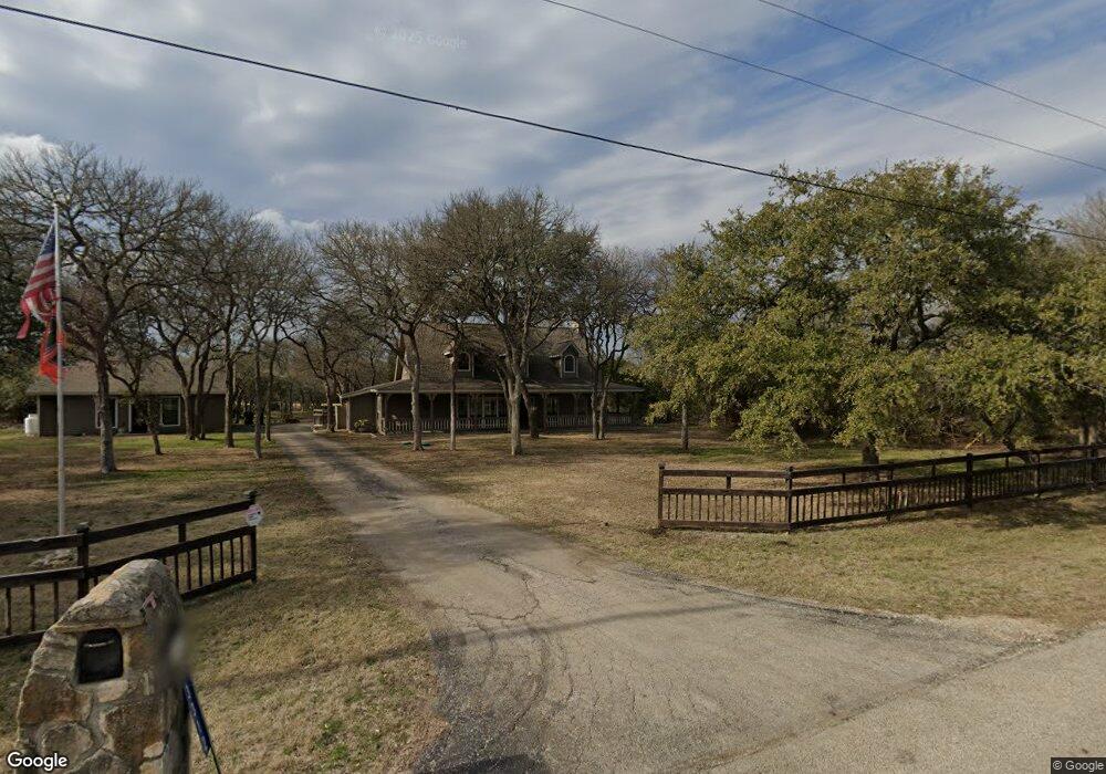
3312 Firethorn Path Spring Branch, TX 78070
Estimated Value: $643,000 - $774,000
3
Beds
3
Baths
2,722
Sq Ft
$253/Sq Ft
Est. Value
About This Home
This home is located at 3312 Firethorn Path, Spring Branch, TX 78070 and is currently estimated at $688,171, approximately $252 per square foot. 3312 Firethorn Path is a home located in Comal County with nearby schools including Arlon R Seay Elementary School, Spring Branch Middle School, and Smithson Valley High School.
Ownership History
Date
Name
Owned For
Owner Type
Purchase Details
Closed on
Sep 30, 2015
Sold by
Johnston Ronnie and Johnston Michele G
Bought by
Vander Weide Brad and Van Der Weide Jessica
Current Estimated Value
Home Financials for this Owner
Home Financials are based on the most recent Mortgage that was taken out on this home.
Original Mortgage
$365,500
Outstanding Balance
$288,447
Interest Rate
3.97%
Mortgage Type
New Conventional
Estimated Equity
$399,724
Create a Home Valuation Report for This Property
The Home Valuation Report is an in-depth analysis detailing your home's value as well as a comparison with similar homes in the area
Home Values in the Area
Average Home Value in this Area
Purchase History
| Date | Buyer | Sale Price | Title Company |
|---|---|---|---|
| Vander Weide Brad | -- | Texas Title Assurance |
Source: Public Records
Mortgage History
| Date | Status | Borrower | Loan Amount |
|---|---|---|---|
| Open | Vander Weide Brad | $365,500 |
Source: Public Records
Tax History
| Year | Tax Paid | Tax Assessment Tax Assessment Total Assessment is a certain percentage of the fair market value that is determined by local assessors to be the total taxable value of land and additions on the property. | Land | Improvement |
|---|---|---|---|---|
| 2025 | $4,859 | $545,125 | $268,220 | $276,905 |
| 2024 | $4,859 | $498,747 | -- | -- |
| 2023 | $4,859 | $453,406 | $0 | $0 |
| 2022 | $4,826 | $412,187 | -- | -- |
| 2021 | $6,675 | $402,100 | $155,230 | $246,870 |
| 2020 | $6,312 | $340,650 | $109,760 | $230,890 |
| 2019 | $6,768 | $363,580 | $109,760 | $253,820 |
| 2018 | $6,137 | $328,580 | $109,760 | $218,820 |
| 2017 | $5,535 | $294,700 | $58,940 | $235,760 |
| 2016 | $5,282 | $281,250 | $58,940 | $222,310 |
| 2015 | $3,755 | $273,160 | $58,940 | $214,220 |
| 2014 | $3,755 | $258,940 | $58,940 | $200,000 |
Source: Public Records
Map
Nearby Homes
- 122 Lantana Cerro
- 174 Lantana Gold
- 175 Lantana Cerro
- 463 Lantana Mesa
- 443 Lantana Mesa
- 1790 Springwood Dr
- 1337 Valley Springs Dr
- 2471 Rolling River View
- 1191 Mossy Hollow
- 1191 Mossy Hollow Rd
- 201 Yucca Canyon
- 1390 Misty Ln
- 1638 Rolling Creek Rd
- 1270 Misty Ln
- 1657 Acacia Pkwy
- 5250 Spring Branch Rd
- 1005 Deep Water Dr
- 5270 Spring Branch Rd
- 5310 Spring Branch Rd
- 660 Cypress Pass Rd
- 3284 Firethorn Path
- 3244 Firethorn Path
- 3191 Firethorn Path
- 3346 Firethorn Path
- 131 Lantana Ridge
- 115 Lantana Ridge
- 115 Lantana Ridge Unit 2
- 3196 Firethorn Path
- 143 Lantana Ridge
- 23 Lantana Ridge
- 0 Lantana Ridge Unit 759479
- 0 Lantana Ridge Unit 855261
- 0 Lantana Ridge Unit 1058021
- 0 (Lot 4) Lantana Ridge
- 0 Lantana Ridge Unit 203076
- 3141 Firethorn Path
- 155 Lantana Ridge
- 135 Lantana Ridge
- 101 Lantana Cerro
- 109 Lantana Cerro
Your Personal Tour Guide
Ask me questions while you tour the home.