Estimated Value: $497,746
--
Bed
--
Bath
7,935
Sq Ft
$63/Sq Ft
Est. Value
About This Home
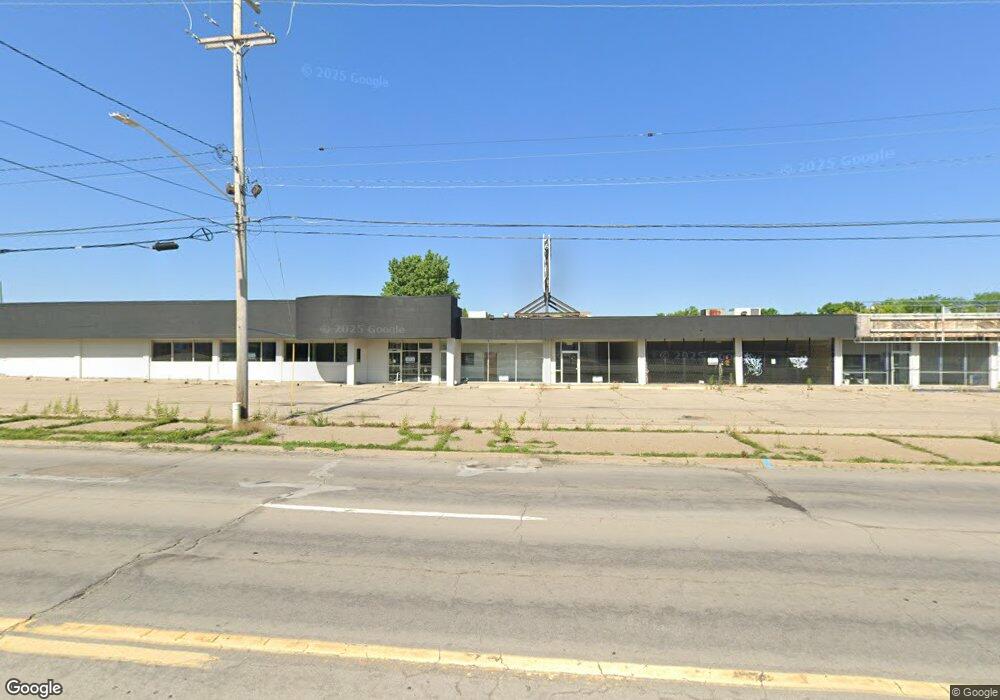
This home is located at 3312 S Dort Hwy Unit Bldg-Unit, Flint, MI 48507 and is currently estimated at $497,746, approximately $62 per square foot. 3312 S Dort Hwy Unit Bldg-Unit is a home located in Genesee County with nearby schools including South Bendle Elementary School, West Bendle Elementary School, and Bendle Middle School.
Ownership History
Date
Name
Owned For
Owner Type
Purchase Details
Closed on
Jun 27, 2024
Sold by
Dakki Andrew A and Dakki James A
Bought by
Backayou Saad
Current Estimated Value
Purchase Details
Closed on
Apr 22, 2021
Sold by
Dakki Andrew and Dakki James
Bought by
Backayou Saad
Purchase Details
Closed on
May 14, 2013
Sold by
The City Of Burton
Bought by
Dakki James A and Dakki Andrew A
Purchase Details
Closed on
Feb 13, 2009
Sold by
Emel Melvin E and Shaw Amanda M
Bought by
Chase Home Finance Llc
Purchase Details
Closed on
Dec 28, 2006
Sold by
Bush Leon B
Bought by
The City Of Burton
Create a Home Valuation Report for This Property
The Home Valuation Report is an in-depth analysis detailing your home's value as well as a comparison with similar homes in the area
Home Values in the Area
Average Home Value in this Area
Purchase History
| Date | Buyer | Sale Price | Title Company |
|---|---|---|---|
| Backayou Saad | $460,000 | Liberty Title | |
| Sonrise Properties Llc | $300,000 | Liberty Title | |
| Backayou Saad | -- | Liberty Title | |
| Dakki James A | $7,500 | None Available | |
| Chase Home Finance Llc | $86,197 | None Available | |
| The City Of Burton | -- | None Available |
Source: Public Records
Mortgage History
| Date | Status | Borrower | Loan Amount |
|---|---|---|---|
| Closed | Backayou Saad | $0 |
Source: Public Records
Tax History Compared to Growth
Tax History
| Year | Tax Paid | Tax Assessment Tax Assessment Total Assessment is a certain percentage of the fair market value that is determined by local assessors to be the total taxable value of land and additions on the property. | Land | Improvement |
|---|---|---|---|---|
| 2025 | $12,843 | $202,500 | $0 | $0 |
| 2024 | $8,204 | $201,800 | $0 | $0 |
| 2023 | $7,997 | $164,400 | $0 | $0 |
| 2022 | $6,014 | $122,600 | $0 | $0 |
| 2021 | $2,947 | $119,500 | $0 | $0 |
| 2020 | $3,213 | $116,200 | $0 | $0 |
| 2019 | $2,743 | $113,500 | $0 | $0 |
| 2018 | $3,921 | $111,700 | $0 | $0 |
| 2017 | $3,791 | $103,700 | $0 | $0 |
| 2016 | $3,755 | $98,500 | $0 | $0 |
| 2015 | $3,767 | $0 | $0 | $0 |
| 2012 | -- | $0 | $0 | $0 |
Source: Public Records
Map
Nearby Homes
- 3343 Cheyenne Ave
- 4424 Cheyenne Ave
- 810 Macdonald Ave
- 4310 Cheyenne Ave
- 0000 E Bristol Rd
- 621 Burroughs Ave
- 630 Buckingham Ave
- 3614 Comanche Ave
- 3512 Barcey Ct
- 3505 Comanche Ave
- 4127 Custer Ave
- 4205 Red Arrow Rd
- 2207 E Boatfield Ave
- 2231 E Bergin Ave
- 454 E Atherton Rd
- 3129 Christner St
- 2220 E Bergin Ave
- 326 Burroughs Ave
- 2130 E Whittemore Ave
- 3115 Circle Dr
- 3312 S Dort Hwy
- 3312 S Dort Hwy
- 3312 S Dort Hwy
- G3231 S Dort Hwy
- G3312 S Dort Hwy
- G3223 S Dort Hwy
- g3211 S Dort Hwy
- g3223 S Dort Hwy
- 3303 Menominee St
- 3299 Menominee St
- 3309 Menominee St
- 3295 Menominee St
- 3313 Menominee St
- 3289 Menominee St
- 3317 Menominee St
- 3285 Menominee St
- 3321 Menominee St
- 3281 Menominee St
- 3325 Menominee St
- 3266 S Dort Hwy