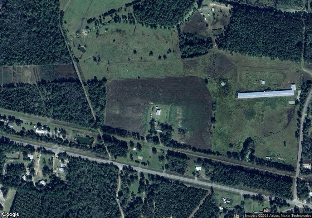
3313 Highway 32 Rd W Hortense, GA 31543
Estimated Value: $64,000 - $125,000
3
Beds
2
Baths
1,568
Sq Ft
$62/Sq Ft
Est. Value
About This Home
This home is located at 3313 Highway 32 Rd W, Hortense, GA 31543 and is currently estimated at $97,333, approximately $62 per square foot. 3313 Highway 32 Rd W is a home with nearby schools including Nahunta Primary School, Nahunta Elementary School, and Brantley County Middle School.
Ownership History
Date
Name
Owned For
Owner Type
Purchase Details
Closed on
Sep 12, 2019
Sold by
Newman David George
Bought by
Newman Harvey Clarence
Current Estimated Value
Home Financials for this Owner
Home Financials are based on the most recent Mortgage that was taken out on this home.
Original Mortgage
$1,000,000
Outstanding Balance
$875,922
Interest Rate
3.6%
Mortgage Type
New Conventional
Estimated Equity
-$778,589
Purchase Details
Closed on
Nov 19, 2012
Sold by
Great Investments Of Georg
Bought by
Newman David George and Newman April Maranda
Purchase Details
Closed on
Apr 30, 2012
Sold by
Curry Devin Earl
Bought by
Great Investments Of Georgia I
Purchase Details
Closed on
Dec 27, 2011
Sold by
Curry Devin E
Bought by
Curry Devin E
Create a Home Valuation Report for This Property
The Home Valuation Report is an in-depth analysis detailing your home's value as well as a comparison with similar homes in the area
Home Values in the Area
Average Home Value in this Area
Purchase History
| Date | Buyer | Sale Price | Title Company |
|---|---|---|---|
| Newman Harvey Clarence | $44,000 | -- | |
| Newman David George | $4,000 | -- | |
| Great Investments Of Georgia I | $4,000 | -- | |
| Curry Devin E | -- | -- |
Source: Public Records
Mortgage History
| Date | Status | Borrower | Loan Amount |
|---|---|---|---|
| Open | Newman Harvey Clarence | $1,000,000 |
Source: Public Records
Tax History Compared to Growth
Tax History
| Year | Tax Paid | Tax Assessment Tax Assessment Total Assessment is a certain percentage of the fair market value that is determined by local assessors to be the total taxable value of land and additions on the property. | Land | Improvement |
|---|---|---|---|---|
| 2024 | $156 | $4,065 | $1,991 | $2,074 |
| 2023 | $34 | $3,884 | $1,810 | $2,074 |
| 2022 | $114 | $17,628 | $0 | $17,628 |
| 2021 | $116 | $15,848 | $0 | $15,848 |
| 2020 | $119 | $16,239 | $0 | $16,239 |
| 2019 | $119 | $2,651 | $1,810 | $841 |
| 2018 | $100 | $2,940 | $2,340 | $600 |
| 2017 | $100 | $2,940 | $2,340 | $600 |
| 2016 | $132 | $2,940 | $2,340 | $600 |
Source: Public Records
Map
Nearby Homes
- 0 Roberson Rd
- 0 Roberson Rd Unit 21711381
- 17082 Hwy 341
- 0 Humpback Rd
- 6911 Old Hortense Rd
- 559 Cumberland Rd
- 603 Cumberland Rd
- 255 Spell Landing Rd
- 0 Johns Rd
- 0 Woodrow Ln
- 14375 Hwy 301 N
- 13929 Raybon Rd E
- 88 Minnesota Rd
- 00 Lewis Landing
- 3362 Seed Orchard Rd
- 6204 Cross Swamp Rd
- 18583 Raybon Rd E
- 6162 Griner Rd
- 3881 Cut Path Rd
- 4452 Pembers Rd
- 3273 Highway 32 W
- 1658 Hortense Screven Rd
- 3278 Highway 32 W
- 531 Satilla Church Rd
- 3062 Highway 32 W
- 3476 Highway 32 W
- 153 Baxter Rd
- 3516 Highway 32 W
- 3607 Highway 32 W
- 235 Horse Stomp Rd
- 1550 Old Hwy 32 Rd
- 150 Horse Stomp Rd
- 97 Honey Bee Rd
- 1294 Old Highway 32
- 817 Satilla Church Rd
- 121 Honey Bee Rd
- 3737 Highway 32 W
- 2841 Hwy 32 W
- 1689 Hortense Screven Rd
- 1357 Hortense Screven Rd
