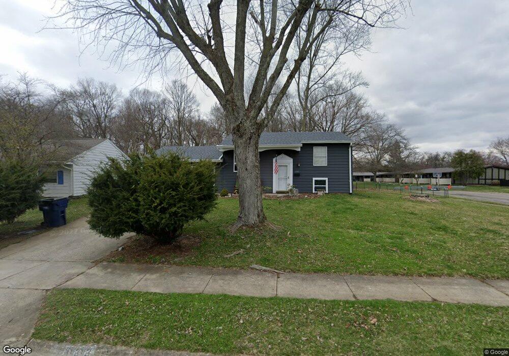
3313 Woonsocket St Springfield, OH 45503
Estimated Value: $212,534 - $220,000
4
Beds
2
Baths
1,450
Sq Ft
$150/Sq Ft
Est. Value
About This Home
This home is located at 3313 Woonsocket St, Springfield, OH 45503 and is currently estimated at $216,884, approximately $149 per square foot. 3313 Woonsocket St is a home located in Clark County with nearby schools including Kenton Elementary School, Roosevelt Middle School, and Springfield High School.
Ownership History
Date
Name
Owned For
Owner Type
Purchase Details
Closed on
Jul 16, 2012
Sold by
Kiskis Kenneth M and Kiskis Karen S
Bought by
Crawford Elizabeth A and Crawford Robert S
Current Estimated Value
Home Financials for this Owner
Home Financials are based on the most recent Mortgage that was taken out on this home.
Original Mortgage
$98,090
Outstanding Balance
$66,882
Interest Rate
3.64%
Mortgage Type
FHA
Estimated Equity
$150,002
Purchase Details
Closed on
May 31, 1988
Sold by
Girten Owen D and Girten Alice M
Bought by
Kiskis Kenneth M and Kiskis Karen S
Purchase Details
Closed on
Dec 24, 1986
Create a Home Valuation Report for This Property
The Home Valuation Report is an in-depth analysis detailing your home's value as well as a comparison with similar homes in the area
Home Values in the Area
Average Home Value in this Area
Purchase History
| Date | Buyer | Sale Price | Title Company |
|---|---|---|---|
| Crawford Elizabeth A | $99,900 | Ohio Real Estate Title | |
| Kiskis Kenneth M | $54,500 | -- | |
| -- | $46,000 | -- |
Source: Public Records
Mortgage History
| Date | Status | Borrower | Loan Amount |
|---|---|---|---|
| Open | Crawford Elizabeth A | $98,090 |
Source: Public Records
Tax History
| Year | Tax Paid | Tax Assessment Tax Assessment Total Assessment is a certain percentage of the fair market value that is determined by local assessors to be the total taxable value of land and additions on the property. | Land | Improvement |
|---|---|---|---|---|
| 2025 | $2,202 | $55,450 | $11,330 | $44,120 |
| 2024 | $2,145 | $44,500 | $10,760 | $33,740 |
| 2023 | $2,145 | $44,500 | $10,760 | $33,740 |
| 2022 | $2,197 | $44,500 | $10,760 | $33,740 |
| 2021 | $1,987 | $37,160 | $8,090 | $29,070 |
| 2020 | $1,992 | $37,160 | $8,090 | $29,070 |
| 2019 | $1,997 | $37,160 | $8,090 | $29,070 |
| 2018 | $1,855 | $33,160 | $8,580 | $24,580 |
| 2017 | $1,853 | $34,206 | $8,579 | $25,627 |
| 2016 | $1,856 | $34,206 | $8,579 | $25,627 |
| 2015 | $1,932 | $33,719 | $8,092 | $25,627 |
| 2014 | $1,923 | $33,719 | $8,092 | $25,627 |
| 2013 | $1,903 | $33,719 | $8,092 | $25,627 |
Source: Public Records
Map
Nearby Homes
- 1948 Falmouth Ave
- 1032 Armsgate Rd
- 1040 Carson Ln
- 1139 Bradford Dr
- 3300 Revels St
- 3214 Revels St
- 2022 Westboro Ave
- 1516 Hyannis Dr
- 1924 Marinette Dr
- 1136 Foxboro Rd Unit 202
- 1149 Foxboro Rd
- 3124 El Camino Dr
- 3135 Imperial Blvd
- 1811 Devon Dr
- 2043 Providence Ave
- 2529 Marinette Dr
- 3631 Kingsgate Ln
- 1507 Kingsgate Rd
- 1500 Kingsgate Rd
- 1502 Kingsgate Rd
- 3305 Woonsocket St
- 3301 Woonsocket St
- 1642 Falmouth Ave
- 1716 Falmouth Ave
- 3314 Woonsocket St
- 3306 Woonsocket St
- 1724 Falmouth Ave
- 3237 Woonsocket St
- 3300 Woonsocket St
- 3236 Woonsocket St
- 3229 Woonsocket St
- 3315 Glouster St
- 3307 Glouster St
- 3301 Glouster St
- 1740 Falmouth Ave
- 3230 Woonsocket St
- 3221 Woonsocket St
- 3239 Glouster St
- 3222 Woonsocket St
- 1347 Villa Rd
Your Personal Tour Guide
Ask me questions while you tour the home.