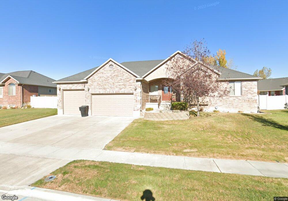
3314 Saint Andrews Dr Syracuse, UT 84075
Estimated Value: $606,000 - $686,000
3
Beds
2
Baths
1,774
Sq Ft
$362/Sq Ft
Est. Value
About This Home
This home is located at 3314 Saint Andrews Dr, Syracuse, UT 84075 and is currently estimated at $641,654, approximately $361 per square foot. 3314 Saint Andrews Dr is a home located in Davis County with nearby schools including Buffalo Point School, Syracuse Junior High School, and Syracuse High School.
Ownership History
Date
Name
Owned For
Owner Type
Purchase Details
Closed on
Mar 28, 2025
Sold by
Mecaleb Jennie Ruth and Barnes Dustin
Bought by
Mccaleb Jennie Ruth
Current Estimated Value
Purchase Details
Closed on
May 27, 2005
Sold by
Lynn Glauser Construction Lc
Bought by
Barnes Dustin and Barnes Jennie
Purchase Details
Closed on
May 24, 2005
Sold by
Blackburn Jones Real Estates Inc
Bought by
Lynn Glauser Construction Lc
Create a Home Valuation Report for This Property
The Home Valuation Report is an in-depth analysis detailing your home's value as well as a comparison with similar homes in the area
Home Values in the Area
Average Home Value in this Area
Purchase History
| Date | Buyer | Sale Price | Title Company |
|---|---|---|---|
| Mccaleb Jennie Ruth | -- | None Listed On Document | |
| Mccaleb Jennie Ruth | -- | None Listed On Document | |
| Barnes Dustin | -- | Security Title | |
| Lynn Glauser Construction Lc | -- | Us Title Company Of Utah |
Source: Public Records
Tax History Compared to Growth
Tax History
| Year | Tax Paid | Tax Assessment Tax Assessment Total Assessment is a certain percentage of the fair market value that is determined by local assessors to be the total taxable value of land and additions on the property. | Land | Improvement |
|---|---|---|---|---|
| 2025 | -- | $313,500 | $108,430 | $205,070 |
| 2024 | $0 | $314,600 | $86,174 | $228,426 |
| 2023 | $1,143 | $541,000 | $131,506 | $409,494 |
| 2022 | $1,143 | $309,650 | $65,607 | $244,043 |
| 2021 | $860 | $430,000 | $95,684 | $334,316 |
| 2020 | $1,892 | $374,000 | $76,838 | $297,162 |
| 2019 | $1,811 | $357,000 | $80,854 | $276,146 |
| 2018 | $1,673 | $333,000 | $78,767 | $254,233 |
| 2016 | $2,165 | $161,810 | $33,098 | $128,712 |
| 2015 | $2,160 | $153,725 | $33,098 | $120,627 |
| 2014 | $2,069 | $150,045 | $33,098 | $116,947 |
| 2013 | -- | $143,183 | $30,461 | $112,722 |
Source: Public Records
Map
Nearby Homes
- 3627 W Augusta Dr
- 1441 Brookshire Dr
- 3564 Princeville Dr
- 851 S 3525 W
- 3736 W 1225 S
- 3565 W 800 S
- 2840 W 1200 S
- 3649 W 800 S
- 3661 W 800 S
- 3867 Rungsted Cir
- 3882 Turnberry Dr
- 3579 W 1775 S
- 3951 Baltimore Cir
- 2982 S 3000 W
- 2912 S 3000 W
- 1084 S 4090 W
- 2679 W Antelope Dr
- 4191 W 1425 S
- 835 S Criddle Rd
- 1039 S 4250 W
- 3328 Saint Andrews Dr
- 3298 Saint Andrews Dr
- 3325 Falkirk Rd Unit 501
- 3325 Falkirk Rd
- 3266 Newcastle Cir
- 3321 St Andrews Dr
- 3321 Saint Andrews Dr
- 3307 Saint Andrews Dr
- 3258 Newcastle Cir
- 3282 Saint Andrews Dr
- 3303 Falkirk Rd
- 3303 Falkirk Rd Unit 502
- 3335 Saint Andrews Dr
- 3293 Saint Andrews Dr
- 3324 Falkirk Rd
- 3324 Falkirk Rd Unit 518
- 3342 Saint Andrews Dr
- 3264 St Andrews Dr
- 3264 Saint Andrews Dr
- 3349 Saint Andrews Dr