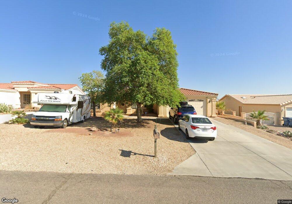
3314 Silverspoon Dr Lake Havasu City, AZ 86406
Estimated Value: $528,662 - $627,000
4
Beds
3
Baths
1,895
Sq Ft
$310/Sq Ft
Est. Value
About This Home
This home is located at 3314 Silverspoon Dr, Lake Havasu City, AZ 86406 and is currently estimated at $587,166, approximately $309 per square foot. 3314 Silverspoon Dr is a home located in Mohave County with nearby schools including Jamaica Elementary School, Thunderbolt Middle School, and Lake Havasu High School.
Ownership History
Date
Name
Owned For
Owner Type
Purchase Details
Closed on
Mar 20, 2024
Sold by
Mendoza Norman E and Mendoza Yulinda A
Bought by
Yulinda Norman E and Yulinda Aguirre
Current Estimated Value
Purchase Details
Closed on
Nov 18, 2010
Sold by
Mendoza Norman E and Mendoza Yulinda A
Bought by
Yulinda Norman E and Yulinda Aguirre
Purchase Details
Closed on
Aug 3, 2009
Sold by
Roose Robert K and Roose Sheryl D
Bought by
Mendoza Norman E and Mendoza Yulinda A
Home Financials for this Owner
Home Financials are based on the most recent Mortgage that was taken out on this home.
Original Mortgage
$260,200
Interest Rate
5.09%
Mortgage Type
New Conventional
Purchase Details
Closed on
Sep 4, 2003
Sold by
Merchant Raymond A and Merchant Irene M
Bought by
Roose Robert K and Roose Sheryl D
Create a Home Valuation Report for This Property
The Home Valuation Report is an in-depth analysis detailing your home's value as well as a comparison with similar homes in the area
Home Values in the Area
Average Home Value in this Area
Purchase History
| Date | Buyer | Sale Price | Title Company |
|---|---|---|---|
| Yulinda Norman E | -- | None Listed On Document | |
| Yulinda Norman E | -- | None Listed On Document | |
| Mendoza Norman E | -- | None Available | |
| Mendoza Norman E | $265,000 | Pioneer Title Agency Inc | |
| Roose Robert K | $60,000 | State Title Agency Inc |
Source: Public Records
Mortgage History
| Date | Status | Borrower | Loan Amount |
|---|---|---|---|
| Previous Owner | Mendoza Norman E | $260,200 |
Source: Public Records
Tax History Compared to Growth
Tax History
| Year | Tax Paid | Tax Assessment Tax Assessment Total Assessment is a certain percentage of the fair market value that is determined by local assessors to be the total taxable value of land and additions on the property. | Land | Improvement |
|---|---|---|---|---|
| 2026 | -- | -- | -- | -- |
| 2025 | $1,778 | $41,816 | $0 | $0 |
| 2024 | $1,778 | $47,114 | $0 | $0 |
| 2023 | $1,778 | $42,193 | $0 | $0 |
| 2022 | $1,712 | $32,158 | $0 | $0 |
| 2021 | $1,922 | $29,371 | $0 | $0 |
| 2019 | $1,826 | $26,016 | $0 | $0 |
| 2018 | $1,765 | $25,167 | $0 | $0 |
| 2017 | $1,734 | $23,894 | $0 | $0 |
| 2016 | $1,534 | $22,565 | $0 | $0 |
| 2015 | $1,493 | $18,941 | $0 | $0 |
Source: Public Records
Map
Nearby Homes
- 3317 Saddleback Dr
- 3267 Saddleback Dr
- 3330 Saddleback Dr
- 3260 Silverspoon Dr
- 3391 Bluegrass Dr
- 3235 Silverspoon Dr
- 3385 Saratoga Ave
- 3345 Cinnamon Dr
- 3201 Silver Saddle Dr
- 3415 Saratoga Ave
- 3306 Cinnamon Dr
- 3341 Thunderbird Dr
- 3143 Silversmith Dr
- 3449 Indian Peak Dr
- 3485 White Cap Dr
- 3475 Offshore Dr
- 3431 Offshore Dr
- 3400 Silver Saddle Dr
- 3150 Caravelle Dr
- 3515 Thunderhawk Dr
- 3312 Silverspoon Dr
- 3316 Silverspoon Dr
- 3313 Saddleback Dr
- 3311 Saddleback Dr
- 3315 Saddleback Dr
- 3310 Silverspoon Dr
- 3318 Silverspoon Dr
- 3313 Silverspoon Dr
- 3309 Saddleback Dr
- 3311 Silverspoon Dr
- 3277 Silversmith Dr
- 470 Hornet Dr
- 3301 Saddleback Dr
- 3321 Saddleback Dr
- 3301 Silverspoon Dr
- 3319 Silverspoon Dr
- 3312 Saddleback Dr
- 3316 Saddleback Dr
- 3268 Silversmith Dr
- 3310 Saddleback Dr