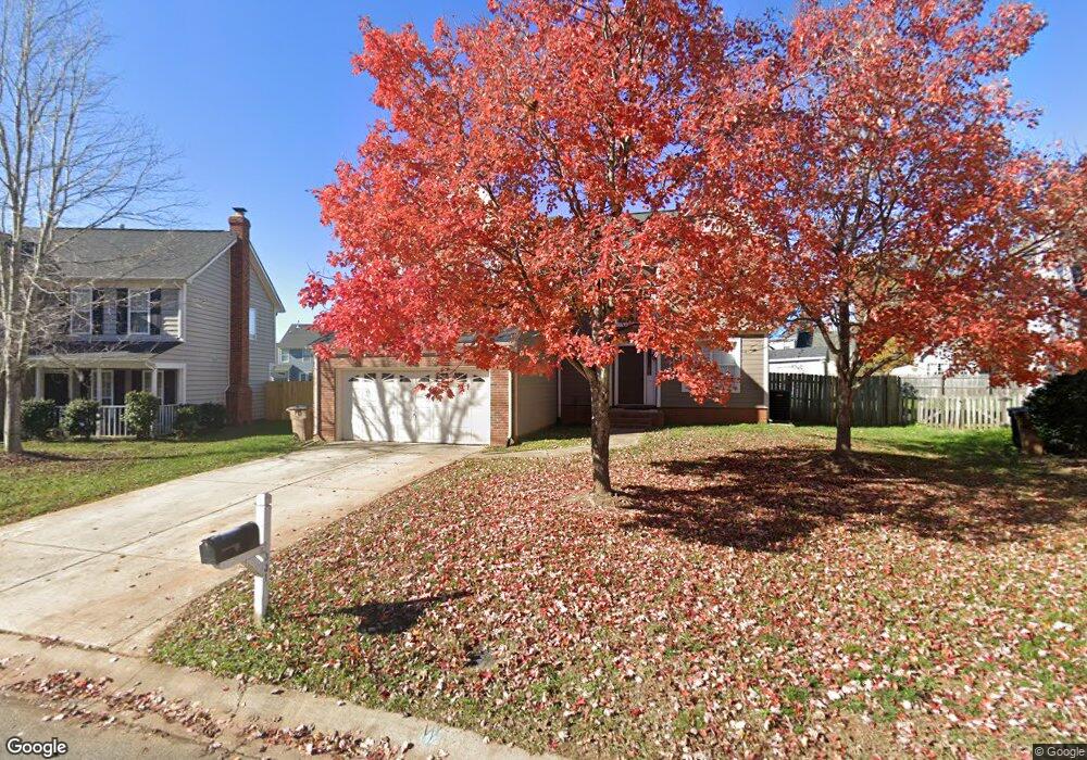
3315 Brooktree Ln Indian Trail, NC 28079
Estimated Value: $378,000 - $399,000
4
Beds
3
Baths
2,146
Sq Ft
$182/Sq Ft
Est. Value
About This Home
This home is located at 3315 Brooktree Ln, Indian Trail, NC 28079 and is currently estimated at $390,092, approximately $181 per square foot. 3315 Brooktree Ln is a home located in Union County with nearby schools including Sardis Elementary School, Porter Ridge Middle School, and Porter Ridge High School.
Ownership History
Date
Name
Owned For
Owner Type
Purchase Details
Closed on
Aug 10, 2000
Sold by
Nestianu Dan G and Nestianu Mariana D
Bought by
Silva Jose and Delatorre Maria
Current Estimated Value
Home Financials for this Owner
Home Financials are based on the most recent Mortgage that was taken out on this home.
Original Mortgage
$138,929
Outstanding Balance
$50,410
Interest Rate
8.23%
Mortgage Type
FHA
Estimated Equity
$339,682
Purchase Details
Closed on
Jan 24, 1997
Sold by
Nestianu Dan G and Wife Mariana D
Bought by
Nestianu Dan G and Wife Mariana D
Purchase Details
Closed on
Apr 9, 1996
Sold by
Springer Iv Earl E and Springer Wife
Bought by
Nestianu Dan G and Wife Mariana D
Create a Home Valuation Report for This Property
The Home Valuation Report is an in-depth analysis detailing your home's value as well as a comparison with similar homes in the area
Home Values in the Area
Average Home Value in this Area
Purchase History
| Date | Buyer | Sale Price | Title Company |
|---|---|---|---|
| Silva Jose | $139,000 | -- | |
| Nestianu Dan G | $200 | -- | |
| Nestianu Dan G | $120,500 | -- |
Source: Public Records
Mortgage History
| Date | Status | Borrower | Loan Amount |
|---|---|---|---|
| Open | Silva Jose | $138,929 |
Source: Public Records
Tax History Compared to Growth
Tax History
| Year | Tax Paid | Tax Assessment Tax Assessment Total Assessment is a certain percentage of the fair market value that is determined by local assessors to be the total taxable value of land and additions on the property. | Land | Improvement |
|---|---|---|---|---|
| 2024 | $1,972 | $232,800 | $41,600 | $191,200 |
| 2023 | $1,955 | $232,800 | $41,600 | $191,200 |
| 2022 | $2,164 | $258,300 | $41,600 | $216,700 |
| 2021 | $2,164 | $258,300 | $41,600 | $216,700 |
| 2020 | $1,347 | $172,800 | $26,500 | $146,300 |
| 2019 | $1,720 | $172,800 | $26,500 | $146,300 |
| 2018 | $0 | $172,800 | $26,500 | $146,300 |
| 2017 | $1,809 | $172,800 | $26,500 | $146,300 |
| 2016 | $1,770 | $172,800 | $26,500 | $146,300 |
| 2015 | $1,430 | $172,800 | $26,500 | $146,300 |
| 2014 | $1,244 | $174,220 | $25,000 | $149,220 |
Source: Public Records
Map
Nearby Homes
- 3602 Brookstone Trail
- 4715 Jacquelyne Dr
- 1009 Kemp Rd
- 3319 Creek Trail Rd
- 3508 Mayhurst Dr
- 2026 Union Grove Ln
- 6045 Creft Cir
- 6017 Creft Cir
- 3612 Esther St
- 3805 Balsam St Unit 321
- 3800 York Alley
- 1010 Mapletree Ln
- 5901 Creft Cir
- 3013 Doughton Ln
- 6303 Margaret Ct Unit 82
- 6107 Margaret Ct
- 3722 Society Ct
- 2006 Paddington Dr
- 7002 Creft Cir
- 6825 Creft Cir Unit 49
- 3317 Brooktree Ln
- 3313 Brooktree Ln
- 3316 Hard Rock Ct
- 3310 Hard Rock Ct
- 3319 Brooktree Ln
- 3311 Brooktree Ln
- 3318 Hard Rock Ct
- 3314 Hard Rock Ct
- 3308 Hard Rock Ct
- 3320 Hard Rock Ct
- 3318 Brooktree Ln
- 3309 Brooktree Ln
- 3321 Brooktree Ln
- 3312 Brooktree Ln
- 3306 Hard Rock Ct
- 3310 Brooktree Ln
- 3322 Hard Rock Ct
- 3304 Hard Rock Ct
- 3307 Brooktree Ln
- 3317 Hard Rock Ct