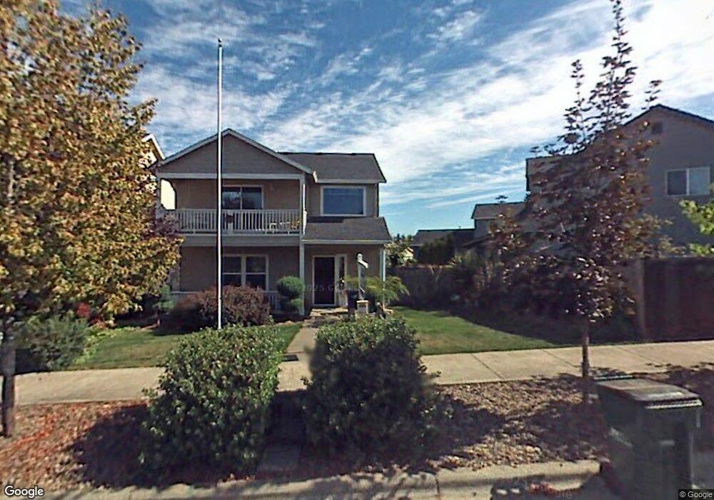
3315 Larrabee Oaks St Forest Grove, OR 97116
Estimated Value: $503,000 - $569,000
3
Beds
3
Baths
2,068
Sq Ft
$259/Sq Ft
Est. Value
About This Home
This home is located at 3315 Larrabee Oaks St, Forest Grove, OR 97116 and is currently estimated at $536,332, approximately $259 per square foot. 3315 Larrabee Oaks St is a home located in Washington County with nearby schools including Harvey Clarke Elementary School, Tom McCall Upper Elementary School, and Neil Armstrong Middle School.
Ownership History
Date
Name
Owned For
Owner Type
Purchase Details
Closed on
Nov 30, 2015
Sold by
Zamudio Nancy S and Whitehead Nancy S
Bought by
Miller Jacob L and Miller Erin B
Current Estimated Value
Home Financials for this Owner
Home Financials are based on the most recent Mortgage that was taken out on this home.
Original Mortgage
$246,000
Interest Rate
3.9%
Mortgage Type
New Conventional
Purchase Details
Closed on
Jun 19, 2002
Sold by
D R Horton Inc Portland
Bought by
Whitehead David L and Whitehead Nancy S
Home Financials for this Owner
Home Financials are based on the most recent Mortgage that was taken out on this home.
Original Mortgage
$162,720
Interest Rate
6.74%
Create a Home Valuation Report for This Property
The Home Valuation Report is an in-depth analysis detailing your home's value as well as a comparison with similar homes in the area
Home Values in the Area
Average Home Value in this Area
Purchase History
| Date | Buyer | Sale Price | Title Company |
|---|---|---|---|
| Miller Jacob L | $276,000 | First American | |
| Whitehead David L | $203,400 | First American Title Ins Co |
Source: Public Records
Mortgage History
| Date | Status | Borrower | Loan Amount |
|---|---|---|---|
| Previous Owner | Miller Jacob L | $246,000 | |
| Previous Owner | Whitehead David L | $162,720 | |
| Closed | Whitehead David L | $30,510 |
Source: Public Records
Tax History Compared to Growth
Tax History
| Year | Tax Paid | Tax Assessment Tax Assessment Total Assessment is a certain percentage of the fair market value that is determined by local assessors to be the total taxable value of land and additions on the property. | Land | Improvement |
|---|---|---|---|---|
| 2026 | $5,544 | $311,330 | -- | -- |
| 2025 | $5,544 | $302,270 | -- | -- |
| 2024 | $5,349 | $293,470 | -- | -- |
| 2023 | $5,349 | $284,930 | $0 | $0 |
| 2022 | $4,677 | $284,930 | $0 | $0 |
| 2021 | $4,616 | $268,590 | $0 | $0 |
| 2020 | $4,591 | $260,770 | $0 | $0 |
| 2019 | $4,489 | $253,180 | $0 | $0 |
| 2018 | $4,352 | $245,810 | $0 | $0 |
| 2017 | $4,217 | $238,660 | $0 | $0 |
| 2016 | $4,098 | $231,710 | $0 | $0 |
| 2015 | $3,941 | $224,970 | $0 | $0 |
| 2014 | $3,922 | $218,420 | $0 | $0 |
Source: Public Records
Map
Nearby Homes
- 1219 34th Place
- 3317 Butte Dr
- 3309 Butte Dr
- 922 Rosebud Ct
- 918 Rosebud Ct
- 895 Butte Dr
- 3316 Butte Dr
- Ashland Plan at Parkview Terrace
- Maggie Plan at Parkview Terrace
- Larview Plan at Parkview Terrace
- Ivy Plan at Parkview Terrace
- Trenton Plan at Parkview Terrace
- Burlington Plan at Parkview Terrace
- Hazel Plan at Parkview Terrace
- 507-FH Plan at Parkview Terrace
- 504-STD Plan at Parkview Terrace
- Poppy - Plan 308C at Parkview Terrace
- 430A Plan at Parkview Terrace
- Plan 400 at Parkview Terrace
- 506-FH Plan at Parkview Terrace
- 3321 Larrabee Oaks St
- 1099 33rd Ave
- 1105 33rd Ave
- 1111 33rd Ave
- 1092 33rd Place
- 1102 33rd Place
- 1086 33rd Place
- 1108 33rd Place
- 1117 33rd Ave
- 3322 Larrabee Oaks St
- 3316 Larrabee Oaks St
- 3328 Larrabee Oaks St
- 1080 33rd Place
- 2310 Larrabee Oaks St
- 1114 33rd Place
- 3310 Larrabee Oaks St
- 3334 Larrabee Oaks St
- 1123 33rd Ave
- 1120 33rd Place
- 3304 Larrabee Oaks St