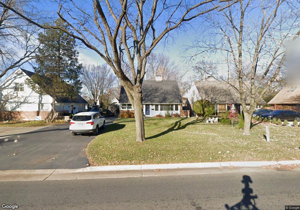
3315 Simpson St Evanston, IL 60201
North Evanston NeighborhoodEstimated Value: $558,000 - $686,000
4
Beds
2
Baths
1,504
Sq Ft
$409/Sq Ft
Est. Value
About This Home
This home is located at 3315 Simpson St, Evanston, IL 60201 and is currently estimated at $614,947, approximately $408 per square foot. 3315 Simpson St is a home located in Cook County with nearby schools including Willard Elementary School, Haven Middle School, and Evanston Township High School.
Ownership History
Date
Name
Owned For
Owner Type
Purchase Details
Closed on
Aug 16, 2013
Sold by
Rdg Fund 1 Llc
Bought by
Medhurst Mark and Medhurst Deborah
Current Estimated Value
Home Financials for this Owner
Home Financials are based on the most recent Mortgage that was taken out on this home.
Original Mortgage
$296,100
Outstanding Balance
$220,199
Interest Rate
4.39%
Mortgage Type
New Conventional
Estimated Equity
$394,748
Purchase Details
Closed on
Mar 26, 2010
Sold by
Leal Luz M
Bought by
Federal National Mortgage Association
Purchase Details
Closed on
Apr 24, 2008
Sold by
Reina Luz M and Reina Jose E
Bought by
Leal Luz M
Home Financials for this Owner
Home Financials are based on the most recent Mortgage that was taken out on this home.
Original Mortgage
$376,000
Interest Rate
5.88%
Mortgage Type
Unknown
Create a Home Valuation Report for This Property
The Home Valuation Report is an in-depth analysis detailing your home's value as well as a comparison with similar homes in the area
Home Values in the Area
Average Home Value in this Area
Purchase History
| Date | Buyer | Sale Price | Title Company |
|---|---|---|---|
| Medhurst Mark | $329,000 | Cti | |
| Federal National Mortgage Association | -- | None Available | |
| Leal Luz M | $470,000 | Multiple |
Source: Public Records
Mortgage History
| Date | Status | Borrower | Loan Amount |
|---|---|---|---|
| Open | Medhurst Mark | $296,100 | |
| Previous Owner | Leal Luz M | $376,000 |
Source: Public Records
Tax History Compared to Growth
Tax History
| Year | Tax Paid | Tax Assessment Tax Assessment Total Assessment is a certain percentage of the fair market value that is determined by local assessors to be the total taxable value of land and additions on the property. | Land | Improvement |
|---|---|---|---|---|
| 2024 | $4,518 | $20,320 | $5,280 | $15,040 |
| 2023 | $4,323 | $20,320 | $5,280 | $15,040 |
| 2022 | $4,323 | $20,320 | $5,280 | $15,040 |
| 2021 | $4,095 | $17,097 | $3,520 | $13,577 |
| 2020 | $4,070 | $17,097 | $3,520 | $13,577 |
| 2019 | $3,991 | $18,747 | $3,520 | $15,227 |
| 2018 | $4,268 | $17,297 | $2,880 | $14,417 |
| 2017 | $4,442 | $18,334 | $2,880 | $15,454 |
| 2016 | $4,570 | $19,306 | $2,880 | $16,426 |
| 2015 | $2,996 | $12,484 | $2,400 | $10,084 |
| 2014 | $3,210 | $13,371 | $2,400 | $10,971 |
| 2013 | $3,128 | $13,371 | $2,400 | $10,971 |
Source: Public Records
Map
Nearby Homes
- 2633 Crawford Ave
- 9628 Keystone Ave
- 9833 Keystone Ave
- 9555 Kildare Ave
- 2501 Crawford Ave
- 9333 Kildare Ave
- 9349 N Lowell Ave
- 2555 Gross Point Rd Unit 112
- 2518 Ridgeway Ave
- 2221 Lincolnwood Dr
- 2951 Colfax St
- 9246 Kildare Ave
- 2113 Forestview Rd
- 9101 Sleeping Bear Rd
- 3233 Central St
- 4354 Lyons St
- 3131 Central St
- 3500 Church St Unit 204
- 9445 Kenton Ave Unit P30
- 9445 Kenton Ave Unit P14
- 3315 Simpson St
- 3311 Simpson St
- 3311 Simpson St
- 3319 Simpson St
- 3309 Simpson St
- 3314 Payne St
- 3320 Payne St
- 3312 Payne St
- 3308 Payne St
- 2110 Prospect Ave
- 2111 Crawford Ave
- 3300 Payne St
- 3328 Payne St
- 9556 Harding Ave
- 9556 Harding Ave
- 9555 Harding Ave
- 9547 Crawford Ave
- 3333 Payne St
- 3317 Payne St
- 3319 Payne St