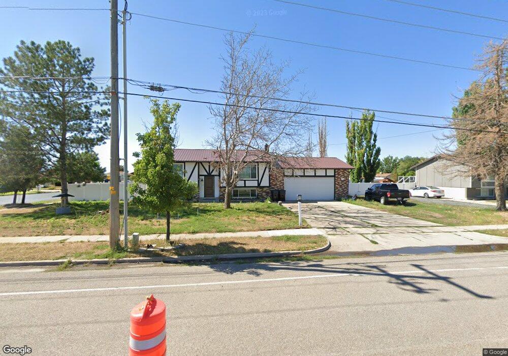
3315 W 1700 S Syracuse, UT 84075
Estimated Value: $426,000 - $487,234
5
Beds
2
Baths
1,934
Sq Ft
$240/Sq Ft
Est. Value
About This Home
This home is located at 3315 W 1700 S, Syracuse, UT 84075 and is currently estimated at $463,309, approximately $239 per square foot. 3315 W 1700 S is a home located in Davis County with nearby schools including Buffalo Point School, Syracuse Junior High School, and Syracuse High School.
Ownership History
Date
Name
Owned For
Owner Type
Purchase Details
Closed on
Feb 9, 2021
Sold by
Tribe Of Kings Llc
Bought by
Stratton Anthony
Current Estimated Value
Home Financials for this Owner
Home Financials are based on the most recent Mortgage that was taken out on this home.
Original Mortgage
$328,932
Outstanding Balance
$293,521
Interest Rate
2.7%
Mortgage Type
FHA
Estimated Equity
$169,788
Purchase Details
Closed on
Aug 24, 2020
Sold by
Coburn Pamela
Bought by
Tribe Of Kings Llc
Home Financials for this Owner
Home Financials are based on the most recent Mortgage that was taken out on this home.
Original Mortgage
$198,456
Interest Rate
3%
Mortgage Type
Commercial
Purchase Details
Closed on
Mar 7, 2019
Sold by
Eby Marigold Deanna
Bought by
Coburn Pamela
Purchase Details
Closed on
Aug 13, 1998
Sold by
Coburn Pamela E
Bought by
Eby M Deanne
Create a Home Valuation Report for This Property
The Home Valuation Report is an in-depth analysis detailing your home's value as well as a comparison with similar homes in the area
Home Values in the Area
Average Home Value in this Area
Purchase History
| Date | Buyer | Sale Price | Title Company |
|---|---|---|---|
| Stratton Anthony | -- | 1St Liberty Title L | |
| Tribe Of Kings Llc | -- | Title Guarantee | |
| Coburn Pamela | -- | None Available | |
| Eby M Deanne | -- | -- |
Source: Public Records
Mortgage History
| Date | Status | Borrower | Loan Amount |
|---|---|---|---|
| Open | Stratton Anthony | $328,932 | |
| Closed | Stratton Anthony | $1,725 | |
| Previous Owner | Tribe Of Kings Llc | $198,456 |
Source: Public Records
Tax History Compared to Growth
Tax History
| Year | Tax Paid | Tax Assessment Tax Assessment Total Assessment is a certain percentage of the fair market value that is determined by local assessors to be the total taxable value of land and additions on the property. | Land | Improvement |
|---|---|---|---|---|
| 2025 | $2,537 | $244,750 | $117,730 | $127,020 |
| 2024 | $2,469 | $239,800 | $106,077 | $133,723 |
| 2023 | $2,305 | $408,000 | $147,147 | $260,853 |
| 2022 | $2,443 | $237,050 | $80,700 | $156,350 |
| 2021 | $2,127 | $321,000 | $116,750 | $204,250 |
| 2020 | $1,561 | $227,000 | $102,388 | $124,612 |
| 2019 | $1,567 | $225,000 | $101,468 | $123,532 |
| 2018 | $1,383 | $197,000 | $96,102 | $100,898 |
| 2016 | $1,207 | $90,200 | $36,626 | $53,574 |
| 2015 | $1,163 | $82,775 | $36,626 | $46,149 |
| 2014 | $1,131 | $82,048 | $36,626 | $45,422 |
| 2013 | -- | $71,829 | $32,910 | $38,919 |
Source: Public Records
Map
Nearby Homes
- 2982 S 3000 W
- 2912 S 3000 W
- 1430 Heather Ln
- 3478 Brookshire Dr
- 3704 W 2170 S Unit 111
- 3360 W 2280 S
- 2679 W Antelope Dr
- 3867 Rungsted Cir
- 2840 W 1200 S
- 2961 S 2425 W Unit 1123
- 3951 Baltimore Cir
- 851 S 3525 W
- 2696 2495 S Unit 207
- 2524 S 3590 W Unit 602
- 2965 S 3000 W
- 2971 S 2425 W Unit 1124
- 2686 S 2440 W Unit 101
- 2635 S 2430 W Unit 114
- 3062 W Solace St
- 895 Dunes Dr