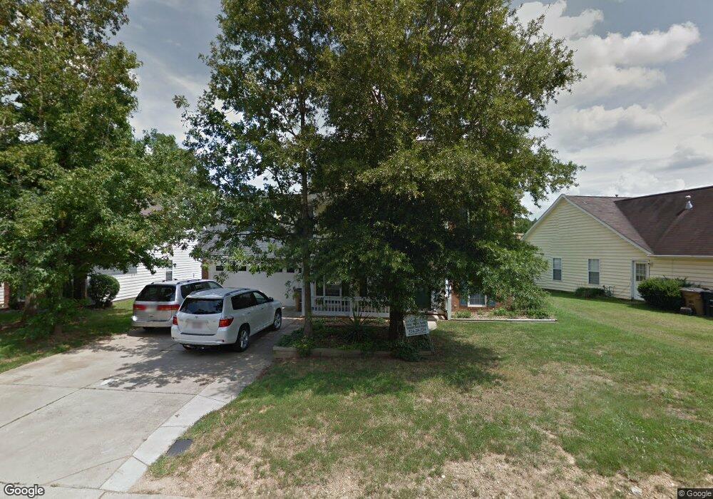
3316 Hard Rock Ct Indian Trail, NC 28079
Estimated Value: $371,000 - $376,682
4
Beds
3
Baths
1,784
Sq Ft
$209/Sq Ft
Est. Value
About This Home
This home is located at 3316 Hard Rock Ct, Indian Trail, NC 28079 and is currently estimated at $373,421, approximately $209 per square foot. 3316 Hard Rock Ct is a home located in Union County with nearby schools including Sardis Elementary School, Porter Ridge Middle School, and Porter Ridge High School.
Ownership History
Date
Name
Owned For
Owner Type
Purchase Details
Closed on
Sep 30, 2016
Sold by
Schill Joan E
Bought by
Schill Family Rentals Llc
Current Estimated Value
Purchase Details
Closed on
Jul 19, 2013
Sold by
Davis F Clark and Davis Karen L
Bought by
Schill Joan and The Schill Family Trust
Purchase Details
Closed on
Mar 24, 2005
Sold by
Manus Joe Keith and Manus Michelle
Bought by
Davis F Clark and Davis Karen L
Home Financials for this Owner
Home Financials are based on the most recent Mortgage that was taken out on this home.
Original Mortgage
$150,000
Interest Rate
5.5%
Mortgage Type
Unknown
Create a Home Valuation Report for This Property
The Home Valuation Report is an in-depth analysis detailing your home's value as well as a comparison with similar homes in the area
Home Values in the Area
Average Home Value in this Area
Purchase History
| Date | Buyer | Sale Price | Title Company |
|---|---|---|---|
| Schill Family Rentals Llc | -- | None Available | |
| Schill Joan | $147,000 | None Available | |
| Davis F Clark | $150,000 | -- |
Source: Public Records
Mortgage History
| Date | Status | Borrower | Loan Amount |
|---|---|---|---|
| Previous Owner | Davis F Clark | $150,000 |
Source: Public Records
Tax History Compared to Growth
Tax History
| Year | Tax Paid | Tax Assessment Tax Assessment Total Assessment is a certain percentage of the fair market value that is determined by local assessors to be the total taxable value of land and additions on the property. | Land | Improvement |
|---|---|---|---|---|
| 2024 | $2,016 | $238,200 | $41,600 | $196,600 |
| 2023 | $1,999 | $238,200 | $41,600 | $196,600 |
| 2022 | $1,999 | $238,200 | $41,600 | $196,600 |
| 2021 | $1,999 | $238,200 | $41,600 | $196,600 |
| 2020 | $1,233 | $158,100 | $26,500 | $131,600 |
| 2019 | $1,578 | $158,100 | $26,500 | $131,600 |
| 2018 | $1,233 | $158,100 | $26,500 | $131,600 |
| 2017 | $1,660 | $158,100 | $26,500 | $131,600 |
| 2016 | $1,289 | $158,100 | $26,500 | $131,600 |
| 2015 | $1,309 | $158,100 | $26,500 | $131,600 |
| 2014 | $1,127 | $157,740 | $25,000 | $132,740 |
Source: Public Records
Map
Nearby Homes
- 3602 Brookstone Trail
- 4715 Jacquelyne Dr
- 3319 Creek Trail Rd
- 3508 Mayhurst Dr
- 1009 Kemp Rd
- 1010 Mapletree Ln
- 2026 Union Grove Ln
- 6045 Creft Cir
- 6017 Creft Cir
- 3805 Balsam St Unit 321
- 3612 Esther St
- 3800 York Alley
- 5901 Creft Cir
- 6303 Margaret Ct Unit 82
- lot 4, 5 Brown Ln
- 3013 Doughton Ln
- 605 Allen Way
- 6107 Margaret Ct
- 3722 Society Ct
- 2006 Paddington Dr
- 3318 Hard Rock Ct
- 3314 Hard Rock Ct
- 3310 Hard Rock Ct
- 3315 Brooktree Ln
- 3320 Hard Rock Ct
- 3317 Brooktree Ln
- 3317 Hard Rock Ct
- 3313 Brooktree Ln
- 3319 Hard Rock Ct
- 3308 Hard Rock Ct
- 3319 Brooktree Ln
- 3315 Hard Rock Ct
- 3313 Hard Rock Ct
- 3313 Hard Rock Ct Unit 102
- 3321 Hard Rock Ct
- 3311 Hard Rock Ct
- 3322 Hard Rock Ct
- 3311 Brooktree Ln
- 3321 Brooktree Ln
- 3306 Hard Rock Ct