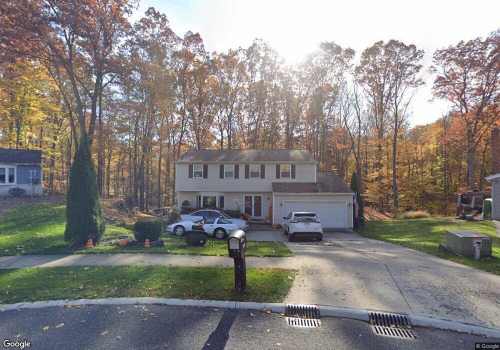
3316 Twain Cir Brunswick, OH 44212
Estimated Value: $321,495 - $348,000
4
Beds
3
Baths
1,952
Sq Ft
$171/Sq Ft
Est. Value
About This Home
This home is located at 3316 Twain Cir, Brunswick, OH 44212 and is currently estimated at $333,374, approximately $170 per square foot. 3316 Twain Cir is a home located in Medina County with nearby schools including Huntington Elementary School, Willets Middle School, and Brunswick High School.
Ownership History
Date
Name
Owned For
Owner Type
Purchase Details
Closed on
Mar 17, 2002
Sold by
Lipina Raymond J and Lipina Brenda J
Bought by
Taylor Rhonda G
Current Estimated Value
Home Financials for this Owner
Home Financials are based on the most recent Mortgage that was taken out on this home.
Original Mortgage
$134,300
Outstanding Balance
$55,666
Interest Rate
6.95%
Estimated Equity
$277,708
Create a Home Valuation Report for This Property
The Home Valuation Report is an in-depth analysis detailing your home's value as well as a comparison with similar homes in the area
Home Values in the Area
Average Home Value in this Area
Purchase History
| Date | Buyer | Sale Price | Title Company |
|---|---|---|---|
| Taylor Rhonda G | $155,000 | -- |
Source: Public Records
Mortgage History
| Date | Status | Borrower | Loan Amount |
|---|---|---|---|
| Open | Taylor Rhonda G | $134,300 |
Source: Public Records
Tax History Compared to Growth
Tax History
| Year | Tax Paid | Tax Assessment Tax Assessment Total Assessment is a certain percentage of the fair market value that is determined by local assessors to be the total taxable value of land and additions on the property. | Land | Improvement |
|---|---|---|---|---|
| 2024 | $1,968 | $79,600 | $23,810 | $55,790 |
| 2023 | $3,936 | $79,600 | $23,810 | $55,790 |
| 2022 | $3,723 | $79,600 | $23,810 | $55,790 |
| 2021 | $3,296 | $63,180 | $18,900 | $44,280 |
| 2020 | $2,966 | $63,180 | $18,900 | $44,280 |
| 2019 | $2,966 | $63,180 | $18,900 | $44,280 |
| 2018 | $2,588 | $52,280 | $15,900 | $36,380 |
| 2017 | $2,592 | $52,280 | $15,900 | $36,380 |
| 2016 | $2,589 | $52,280 | $15,900 | $36,380 |
| 2015 | $2,434 | $47,540 | $14,460 | $33,080 |
| 2014 | $2,547 | $47,540 | $14,460 | $33,080 |
| 2013 | $2,372 | $47,540 | $14,460 | $33,080 |
Source: Public Records
Map
Nearby Homes
- 3121 Blossom Trail Dr
- 3117 Blossom Trail Dr
- 1758 El Dorado Blvd
- 3532 Villa Casa Ct
- 3538 Monte Vista Dr
- 2883 Galway Dr
- 1689 Devonshire Dr
- 2865 Galway Dr
- 3818 Sleepy Hollow Rd
- BEDFORD Plan at Prairie Vista
- CRESTWOOD Plan at Prairie Vista
- VIOLA Plan at Prairie Vista
- CHAMP Plan at Prairie Vista
- ASH LAWN Plan at Prairie Vista
- SEBASTIAN Plan at Prairie Vista
- BRENNAN Plan at Prairie Vista
- LYNDHURST Plan at Prairie Vista
- 2644 Prairie Ln
- V/L Myrtle Ln
- 2633 Prairie Ln
- 3320 Twain Cir
- 3310 Twain Cir
- 3304 Twain Cir
- 3319 Twain Cir
- 3315 Twain Cir
- 3300 Twain Cir
- 3309 Twain Cir
- 1968 Hawthorne Blvd
- 3292 Twain Cir
- 1960 Hawthorne Blvd
- 1976 Hawthorne Blvd
- 3303 Twain Cir
- 1982 Hawthorne Blvd
- 3284 Twain Cir
- 1939 Thorpe Cir
- 1990 Hawthorne Blvd
- 1931 Thorpe Cir
- 3295 Twain Cir
- 1914 Shaw Cir
- 1941 Thorpe Cir