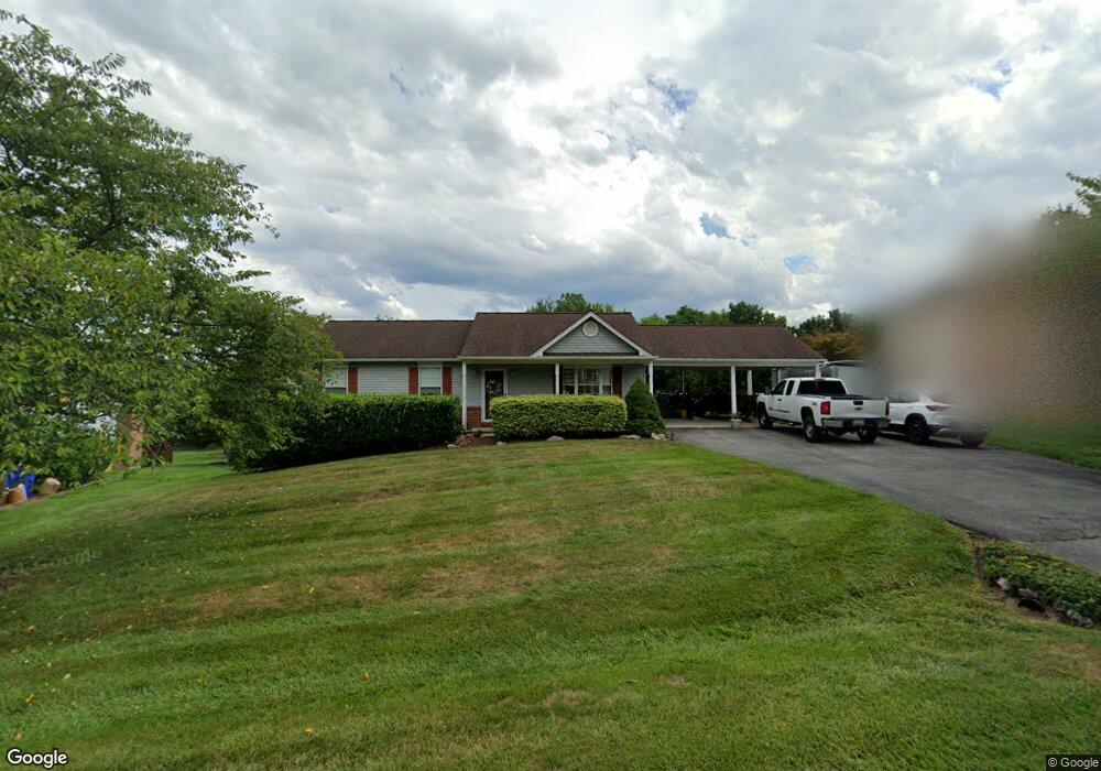
3319 Yorkshire Ct Adamstown, MD 21710
Estimated Value: $415,638 - $531,000
--
Bed
2
Baths
1,232
Sq Ft
$392/Sq Ft
Est. Value
About This Home
This home is located at 3319 Yorkshire Ct, Adamstown, MD 21710 and is currently estimated at $483,160, approximately $392 per square foot. 3319 Yorkshire Ct is a home located in Frederick County with nearby schools including Carroll Manor Elementary School, Ballenger Creek Middle School, and Tuscarora High School.
Ownership History
Date
Name
Owned For
Owner Type
Purchase Details
Closed on
Nov 22, 1999
Sold by
Clinedinst Boyd D
Bought by
Clinedinst Boyd D and Clinedinst Mary Lou
Current Estimated Value
Purchase Details
Closed on
Aug 19, 1993
Sold by
H.F. Payne Construction Co. Inc.
Bought by
Clinedinst Boyd D
Home Financials for this Owner
Home Financials are based on the most recent Mortgage that was taken out on this home.
Original Mortgage
$157,500
Interest Rate
7.17%
Create a Home Valuation Report for This Property
The Home Valuation Report is an in-depth analysis detailing your home's value as well as a comparison with similar homes in the area
Home Values in the Area
Average Home Value in this Area
Purchase History
| Date | Buyer | Sale Price | Title Company |
|---|---|---|---|
| Clinedinst Boyd D | -- | -- | |
| Clinedinst Boyd D | $165,800 | -- |
Source: Public Records
Mortgage History
| Date | Status | Borrower | Loan Amount |
|---|---|---|---|
| Previous Owner | Clinedinst Boyd D | $157,500 |
Source: Public Records
Tax History Compared to Growth
Tax History
| Year | Tax Paid | Tax Assessment Tax Assessment Total Assessment is a certain percentage of the fair market value that is determined by local assessors to be the total taxable value of land and additions on the property. | Land | Improvement |
|---|---|---|---|---|
| 2025 | $4,054 | $353,767 | -- | -- |
| 2024 | $4,054 | $327,500 | $126,300 | $201,200 |
| 2023 | $3,736 | $316,233 | $0 | $0 |
| 2022 | $3,566 | $304,967 | $0 | $0 |
| 2021 | $3,244 | $293,700 | $116,000 | $177,700 |
| 2020 | $3,244 | $277,767 | $0 | $0 |
| 2019 | $3,091 | $261,833 | $0 | $0 |
| 2018 | $2,970 | $245,900 | $95,600 | $150,300 |
| 2017 | $2,879 | $245,900 | $0 | $0 |
| 2016 | $3,112 | $234,700 | $0 | $0 |
| 2015 | $3,112 | $229,100 | $0 | $0 |
| 2014 | $3,112 | $229,100 | $0 | $0 |
Source: Public Records
Map
Nearby Homes
- 7119 Michaels Mill Rd
- 7106 Downing St
- 0 Michaels Mill Rd
- 6816 Buckingham Ln
- 3913 Baker Valley Rd
- 6216 Manor Woods Rd
- 2305 Mount Ephraim Rd
- 7403 Bear Branch Rd
- 3520 Starlight St Unit 302
- 3012 Wasatch View Dr
- 2684 Lydia Ct
- 5880 Union Ridge Dr
- 3658 Stone Barn Dr
- 5798 Morland Dr N
- 9002 Shady Pines Dr
- 7144 Ira Sears Rd
- 3509 Flatwoods Dr
- 8715 Shady Pines Dr
- 3639 Urbana Pike
- 6501 Walcott Ln Unit 202
- 3317 Yorkshire Ct
- 3321 Yorkshire Ct
- 3315 Yorkshire Ct
- 3323 Yorkshire Ct
- 3322 Yorkshire Ct
- 3313 Yorkshire Ct
- 3320 Yorkshire Ct
- 3325 Yorkshire Ct
- 3318 Yorkshire Ct
- 3326 Yorkshire Ct
- 3311 Yorkshire Ct
- 3316 Yorkshire Ct
- 3327 Yorkshire Ct
- 3328 Yorkshire Ct
- 3314 Yorkshire Ct
- 3329 Yorkshire Ct
- 3330 Yorkshire Ct
- 3312 Yorkshire Ct
- 3331 Yorkshire Ct
- 3310 Yorkshire Ct