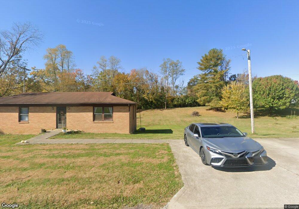
332 Anderson Rd Unit 328 Georgetown, KY 40324
Muddy Ford NeighborhoodEstimated Value: $580,000 - $897,989
--
Bed
--
Bath
1,872
Sq Ft
$413/Sq Ft
Est. Value
About This Home
This home is located at 332 Anderson Rd Unit 328, Georgetown, KY 40324 and is currently estimated at $772,996, approximately $412 per square foot. 332 Anderson Rd Unit 328 is a home located in Scott County with nearby schools including Creekside Elementary School, Northern Elementary School, and Scott County Middle School.
Ownership History
Date
Name
Owned For
Owner Type
Purchase Details
Closed on
Jan 20, 2023
Sold by
Ramsey Kenneth L
Bought by
Washington Partners Llc
Current Estimated Value
Purchase Details
Closed on
Nov 13, 2015
Sold by
Vance Ann B and Vance Earl K
Bought by
Rasmey Kenneth L and Ramsey Sarah K
Home Financials for this Owner
Home Financials are based on the most recent Mortgage that was taken out on this home.
Original Mortgage
$560,000
Interest Rate
3.87%
Mortgage Type
Unknown
Create a Home Valuation Report for This Property
The Home Valuation Report is an in-depth analysis detailing your home's value as well as a comparison with similar homes in the area
Home Values in the Area
Average Home Value in this Area
Purchase History
| Date | Buyer | Sale Price | Title Company |
|---|---|---|---|
| Washington Partners Llc | $6,000,000 | -- | |
| Rasmey Kenneth L | $583,330 | Attorney |
Source: Public Records
Mortgage History
| Date | Status | Borrower | Loan Amount |
|---|---|---|---|
| Previous Owner | Rasmey Kenneth L | $560,000 |
Source: Public Records
Tax History Compared to Growth
Tax History
| Year | Tax Paid | Tax Assessment Tax Assessment Total Assessment is a certain percentage of the fair market value that is determined by local assessors to be the total taxable value of land and additions on the property. | Land | Improvement |
|---|---|---|---|---|
| 2024 | $525 | $759,360 | $0 | $0 |
| 2023 | $529 | $58,385 | $49,025 | $9,360 |
| 2022 | $432 | $50,846 | $41,486 | $9,360 |
| 2021 | $446 | $50,846 | $50,846 | $0 |
| 2020 | $403 | $46,910 | $37,550 | $9,360 |
| 2019 | $409 | $46,910 | $0 | $0 |
| 2018 | $407 | $46,910 | $0 | $0 |
| 2017 | $409 | $46,910 | $0 | $0 |
| 2016 | $2,393 | $297,249 | $0 | $0 |
| 2015 | $633 | $79,159 | $0 | $0 |
| 2014 | $605 | $79,159 | $0 | $0 |
| 2011 | $748 | $102,889 | $0 | $0 |
Source: Public Records
Map
Nearby Homes
- 155 Blackberry Ln
- 173 Blackberry Ln
- 163 Blackberry Ln
- 161 Blackberry Ln
- 154 Blackberry Ln
- 165 Blackberry Ln
- 167 Blackberry Ln
- 157 Blackberry Ln
- 769 Anderson Rd
- 2491 Oxford Village Ln
- 141 Nuthatch Trail
- 139 Nuthatch Trail
- 110 Flamingo Cir
- 105 Ibis Cir
- Martha Plan at Barkley Meadows
- Elizabeth Plan at Barkley Meadows
- Barbara Plan at Barkley Meadows
- Eleanor Plan at Barkley Meadows
- Nancy Plan at Barkley Meadows
- Grace Plan at Barkley Meadows
- 340 Anderson Rd
- 350 Anderson Rd
- 354 Anderson Rd
- 358 Anderson Rd
- 315 Anderson Rd
- 304 Anderson Rd
- 282 Anderson Rd
- 280 Anderson Rd
- 280 Anderson Rd
- 289 Anderson Rd
- 349 Anderson Rd
- 359 Anderson Rd
- 278 Anderson Rd
- 281 Anderson Rd
- 262 Anderson Rd
- 267 Anderson Rd
- 258 Anderson Rd
- 261 Anderson Rd
- 398 Anderson Rd
- 254 Anderson Rd