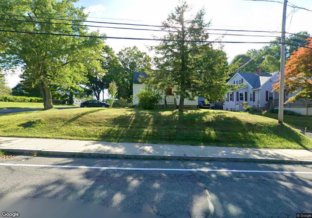
332 Benedict Rd Pittsfield, MA 01201
Estimated Value: $245,000 - $286,000
3
Beds
1
Bath
1,112
Sq Ft
$236/Sq Ft
Est. Value
About This Home
This home is located at 332 Benedict Rd, Pittsfield, MA 01201 and is currently estimated at $261,939, approximately $235 per square foot. 332 Benedict Rd is a home located in Berkshire County with nearby schools including Allendale Elementary School, Theodore Herberg Middle School, and Sinai Academy of the Berkshires.
Ownership History
Date
Name
Owned For
Owner Type
Purchase Details
Closed on
Jul 10, 2009
Sold by
Beattie John A and Beattie Elizabeth M
Bought by
Mckenna Deirdre
Current Estimated Value
Home Financials for this Owner
Home Financials are based on the most recent Mortgage that was taken out on this home.
Original Mortgage
$116,400
Outstanding Balance
$74,489
Interest Rate
4.93%
Mortgage Type
Purchase Money Mortgage
Estimated Equity
$187,450
Purchase Details
Closed on
Nov 16, 2007
Sold by
Est Martin Robert A and Martin Thomas L
Bought by
Beattie Elizabeth M and Beattie John A
Home Financials for this Owner
Home Financials are based on the most recent Mortgage that was taken out on this home.
Original Mortgage
$110,400
Interest Rate
6.41%
Mortgage Type
Purchase Money Mortgage
Purchase Details
Closed on
Jul 27, 2006
Sold by
Martin Carolyn E and Martin Robert A
Bought by
Martin Robert A
Create a Home Valuation Report for This Property
The Home Valuation Report is an in-depth analysis detailing your home's value as well as a comparison with similar homes in the area
Home Values in the Area
Average Home Value in this Area
Purchase History
| Date | Buyer | Sale Price | Title Company |
|---|---|---|---|
| Mckenna Deirdre | $145,500 | -- | |
| Beattie Elizabeth M | $138,000 | -- | |
| Martin Robert A | -- | -- |
Source: Public Records
Mortgage History
| Date | Status | Borrower | Loan Amount |
|---|---|---|---|
| Open | Mckenna Deirdre | $116,400 | |
| Previous Owner | Beattie Elizabeth M | $110,400 |
Source: Public Records
Tax History Compared to Growth
Tax History
| Year | Tax Paid | Tax Assessment Tax Assessment Total Assessment is a certain percentage of the fair market value that is determined by local assessors to be the total taxable value of land and additions on the property. | Land | Improvement |
|---|---|---|---|---|
| 2025 | $3,549 | $197,800 | $62,500 | $135,300 |
| 2024 | $3,277 | $177,600 | $62,500 | $115,100 |
| 2023 | $2,975 | $162,400 | $57,700 | $104,700 |
| 2022 | $2,745 | $147,900 | $55,300 | $92,600 |
| 2021 | $2,608 | $135,500 | $55,300 | $80,200 |
| 2020 | $2,641 | $134,000 | $55,300 | $78,700 |
| 2019 | $2,476 | $127,500 | $50,000 | $77,500 |
| 2018 | $2,495 | $124,700 | $50,000 | $74,700 |
| 2017 | $2,356 | $120,000 | $48,100 | $71,900 |
| 2016 | $2,236 | $119,200 | $48,100 | $71,100 |
| 2015 | $2,153 | $119,200 | $48,100 | $71,100 |
Source: Public Records
Map
Nearby Homes
- 52 Bossidy Dr
- 156 Draper Ave
- 135 Allengate Ave
- 36 Pittsfield Ave
- 122 Allengate Ave
- 67 Scammell Ave
- 153 Elberon Ave
- 81 Dartmouth St Unit 102
- I11001904 Scammell Ave
- 326 Dalton Ave
- 0 Faucett Ln
- 0 Brown St
- 919 Tyler St
- LOT 20 Plunkett St
- 24 Glenwood Ave
- 29 Glenwood Ave
- 16 Garland Ave
- 87 Maryland Ave
- 48 Brown St
- 41 Brown St
- 328 Benedict Rd
- 277 Allengate Ave
- Lt#307 Benedict Rd
- 0 Benedict Rd
- 320 Benedict Rd
- 331 Benedict Rd
- 335 Benedict Rd
- 340 Benedict Rd
- 271 Allengate Ave
- 270 Allengate Ave
- 312 Benedict Rd
- 329 Benedict Rd
- 341 Benedict Rd
- 267 Allengate Ave
- 266 Allengate Ave
- 345 Benedict Rd
- 325 Benedict Rd
- 263 Allengate Ave
- 310 Benedict Rd
- 308 Benedict Rd