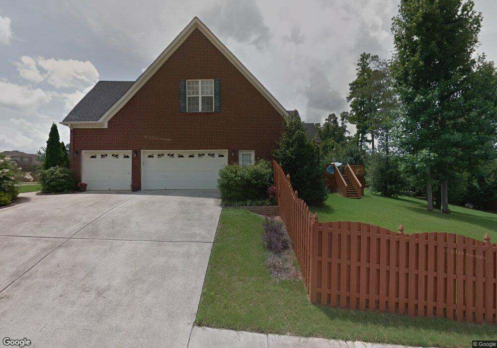
332 Cedar Trail Ln Harvest, AL 35749
Harvest-Cluttsville NeighborhoodEstimated Value: $503,113 - $553,000
4
Beds
4
Baths
3,221
Sq Ft
$162/Sq Ft
Est. Value
About This Home
This home is located at 332 Cedar Trail Ln, Harvest, AL 35749 and is currently estimated at $522,778, approximately $162 per square foot. 332 Cedar Trail Ln is a home located in Madison County with nearby schools including Harvest Elementary School, Sparkman Middle School, and Sparkman High School.
Ownership History
Date
Name
Owned For
Owner Type
Purchase Details
Closed on
Jun 27, 2006
Sold by
Ken Mcdaniel Homes Inc
Bought by
Newman Kirk E and Newman Karen C
Current Estimated Value
Home Financials for this Owner
Home Financials are based on the most recent Mortgage that was taken out on this home.
Original Mortgage
$279,068
Outstanding Balance
$164,208
Interest Rate
6.49%
Mortgage Type
New Conventional
Estimated Equity
$358,570
Create a Home Valuation Report for This Property
The Home Valuation Report is an in-depth analysis detailing your home's value as well as a comparison with similar homes in the area
Home Values in the Area
Average Home Value in this Area
Purchase History
| Date | Buyer | Sale Price | Title Company |
|---|---|---|---|
| Newman Kirk E | -- | -- |
Source: Public Records
Mortgage History
| Date | Status | Borrower | Loan Amount |
|---|---|---|---|
| Open | Newman Kirk E | $279,068 |
Source: Public Records
Tax History Compared to Growth
Tax History
| Year | Tax Paid | Tax Assessment Tax Assessment Total Assessment is a certain percentage of the fair market value that is determined by local assessors to be the total taxable value of land and additions on the property. | Land | Improvement |
|---|---|---|---|---|
| 2024 | $1,664 | $47,560 | $8,000 | $39,560 |
| 2023 | $1,664 | $45,360 | $8,000 | $37,360 |
| 2022 | $1,406 | $40,480 | $8,000 | $32,480 |
| 2021 | $1,286 | $37,080 | $6,500 | $30,580 |
| 2020 | $1,197 | $34,640 | $6,500 | $28,140 |
| 2019 | $1,183 | $34,250 | $6,500 | $27,750 |
| 2018 | $1,109 | $32,220 | $0 | $0 |
| 2017 | $1,109 | $32,220 | $0 | $0 |
| 2016 | $1,109 | $32,220 | $0 | $0 |
| 2015 | $1,109 | $32,220 | $0 | $0 |
| 2014 | $1,141 | $33,100 | $0 | $0 |
Source: Public Records
Map
Nearby Homes
- 325 Cedar Trail Ln
- 108 Ashby Pond Dr
- Residence 1837 Plan at Highlands Trail - Townhomes
- Barton II Plan at Highlands Trail - Ranchers
- Residence 1850 Plan at Highlands Trail - Townhomes
- Trevi II Plan at Highlands Trail - Cottages
- Tivoli II Plan at Highlands Trail - Ranchers
- Medallion II Plan at Highlands Trail - Ranchers
- Brio II Plan at Highlands Trail - Ranchers
- Princeton II Plan at Highlands Trail - Ranchers
- Charle II Plan at Highlands Trail - Cottages
- Independence II Plan at Highlands Trail - Ranchers
- Halle II Plan at Highlands Trail - Cottages
- 107 Ashby Pond Dr
- 110 Ashby Pond Dr
- 125 Sager Cir
- 145 Sager Cir
- 113 Kelly Valley Ln
- 110 Kelly Valley Ln
- 166 Fenwick Place
- 340 Cedar Trail Ln
- 112 Two Horse Trail
- 217 Burwell Ridge Trail
- 113 Two Horse Trail
- 333 Cedar Trail Ln
- 331 Cedar Trail Ln
- 215 Burwell Ridge Trail
- 110 Two Horse Trail
- 335 Cedar Trail Ln
- 329 Cedar Trail Ln
- 213 Burwell Ridge Trail
- 326 Cedar Trail Ln
- 101 Kelly Valley Ln
- 337 Cedar Trail Ln
- 108 Two Horse Trail
- 327 Cedar Trail Ln
- 211 Burwell Ridge Trail
- 324 Cedar Trail Ln
- 103 Kelly Valley Ln
- 216 Burwell Ridge Trail