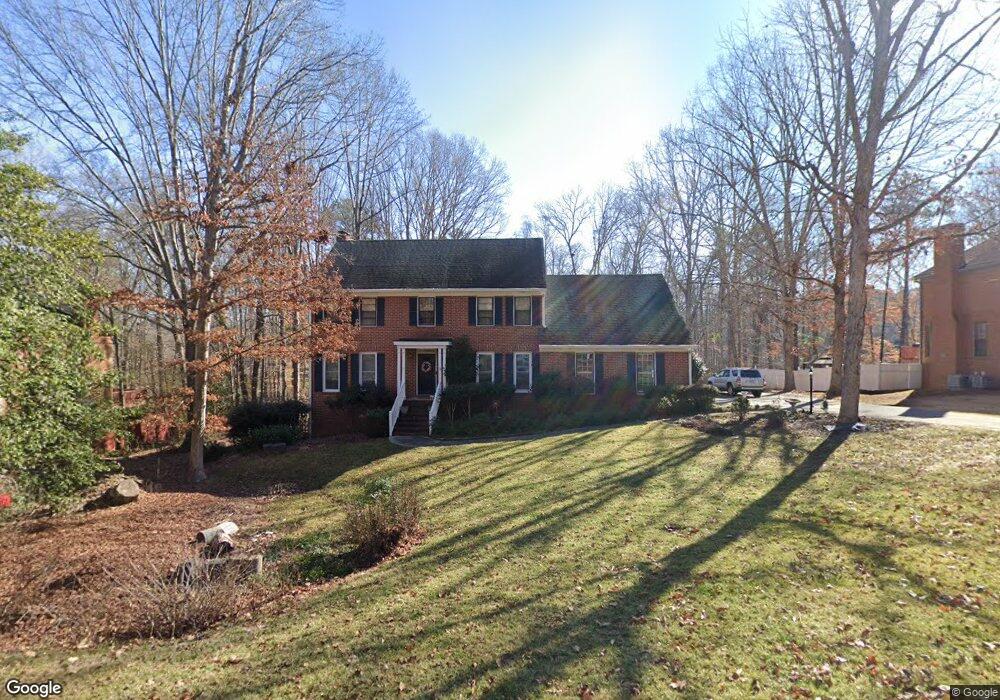
332 Chesterfield Rd Bogart, GA 30622
Estimated Value: $409,919 - $453,000
4
Beds
3
Baths
3,592
Sq Ft
$123/Sq Ft
Est. Value
About This Home
This home is located at 332 Chesterfield Rd, Bogart, GA 30622 and is currently estimated at $440,980, approximately $122 per square foot. 332 Chesterfield Rd is a home located in Clarke County with nearby schools including Cleveland Road Elementary School, Burney-Harris-Lyons Middle School, and Clarke Central High School.
Ownership History
Date
Name
Owned For
Owner Type
Purchase Details
Closed on
Jun 25, 2003
Sold by
Netter Jeffrey M and Poulsen Annerre B
Bought by
Shuman Shuman L and Shuman Maria W
Current Estimated Value
Create a Home Valuation Report for This Property
The Home Valuation Report is an in-depth analysis detailing your home's value as well as a comparison with similar homes in the area
Home Values in the Area
Average Home Value in this Area
Purchase History
| Date | Buyer | Sale Price | Title Company |
|---|---|---|---|
| Shuman Shuman L | $218,000 | -- |
Source: Public Records
Tax History Compared to Growth
Tax History
| Year | Tax Paid | Tax Assessment Tax Assessment Total Assessment is a certain percentage of the fair market value that is determined by local assessors to be the total taxable value of land and additions on the property. | Land | Improvement |
|---|---|---|---|---|
| 2024 | $3,760 | $136,291 | $18,000 | $118,291 |
| 2023 | $3,760 | $127,590 | $18,000 | $109,590 |
| 2022 | $3,226 | $111,138 | $18,000 | $93,138 |
| 2021 | $2,922 | $96,707 | $16,000 | $80,707 |
| 2020 | $2,884 | $95,578 | $16,000 | $79,578 |
| 2019 | $2,676 | $88,833 | $16,000 | $72,833 |
| 2018 | $2,592 | $86,363 | $16,000 | $70,363 |
| 2017 | $2,404 | $80,801 | $16,000 | $64,801 |
| 2016 | $2,374 | $79,928 | $16,000 | $63,928 |
| 2015 | $2,304 | $77,763 | $16,000 | $61,763 |
| 2014 | $2,406 | $80,626 | $16,000 | $64,626 |
Source: Public Records
Map
Nearby Homes
- 212 Huntington Shoals Dr
- 240 W Huntington Rd
- 141 Huntington Shoals Dr
- 682 Chesterfield Rd
- 190 W Huntington Rd
- 637 Huntington Rd Unit B1
- 532 Huntington Rd Unit 7
- 241 Meeler Cir
- 470 Huntington Rd Unit 5
- 256 Cherokee Ridge
- 212 Meeler Cir
- 575 Vaughn Rd
- 595 Vaughn Rd
- 450 River Bottom Rd
- 100 Hanover Dr
- 150 Callaway Dr
- 170 Huntington Ct
- 326 Chesterfield Rd
- 331 Chesterfield Rd
- 322 Chesterfield Rd
- 352 Chesterfield Rd
- 341 Chesterfield Rd
- 233 Huntington Shoals Dr
- 229 Huntington Shoals Dr
- 237 Huntington Shoals Dr
- 351 Chesterfield Rd
- 225 Huntington Shoals Dr
- 321 Chesterfield Rd
- 175 Yorkshire Rd
- 362 Chesterfield Rd
- 221 Huntington Shoals Dr
- 241 Huntington Shoals Dr
- 361 Chesterfield Rd
- 232 Huntington Shoals Dr
- 180 Yorkshire Rd
- 311 Chesterfield Rd
- 140 Eton Ct