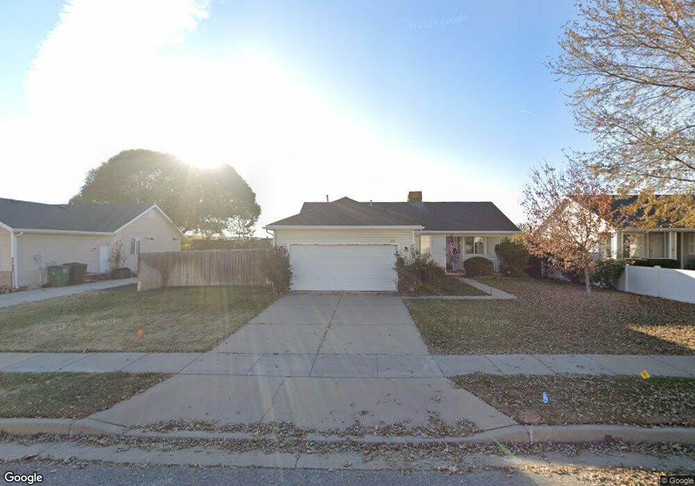
332 Christine Way Kaysville, UT 84037
Estimated Value: $426,000 - $474,000
3
Beds
2
Baths
1,179
Sq Ft
$382/Sq Ft
Est. Value
About This Home
This home is located at 332 Christine Way, Kaysville, UT 84037 and is currently estimated at $450,273, approximately $381 per square foot. 332 Christine Way is a home located in Davis County with nearby schools including Columbia Elementary School, Kaysville Junior High School, and Davis High School.
Ownership History
Date
Name
Owned For
Owner Type
Purchase Details
Closed on
Sep 21, 2000
Sold by
Connell Croston Kimberly A
Bought by
Connell Croston Kimberly A
Current Estimated Value
Purchase Details
Closed on
Sep 14, 2000
Sold by
Norton Madalyn A and Norton Madalyn
Bought by
Connell Croston Kimberly A
Purchase Details
Closed on
Nov 19, 1999
Sold by
Martin Sonda R and Smith Sonda R
Bought by
Norton Madalyn
Purchase Details
Closed on
Aug 6, 1996
Sold by
Seasons Llc
Bought by
Smith Sonda R
Home Financials for this Owner
Home Financials are based on the most recent Mortgage that was taken out on this home.
Original Mortgage
$89,411
Interest Rate
8.33%
Create a Home Valuation Report for This Property
The Home Valuation Report is an in-depth analysis detailing your home's value as well as a comparison with similar homes in the area
Home Values in the Area
Average Home Value in this Area
Purchase History
| Date | Buyer | Sale Price | Title Company |
|---|---|---|---|
| Connell Croston Kimberly A | -- | -- | |
| Connell Croston Kimberly A | -- | -- | |
| Norton Madalyn | -- | Superior Title Company | |
| Smith Sonda R | -- | Merrill Title Company |
Source: Public Records
Mortgage History
| Date | Status | Borrower | Loan Amount |
|---|---|---|---|
| Previous Owner | Smith Sonda R | $89,411 |
Source: Public Records
Tax History Compared to Growth
Tax History
| Year | Tax Paid | Tax Assessment Tax Assessment Total Assessment is a certain percentage of the fair market value that is determined by local assessors to be the total taxable value of land and additions on the property. | Land | Improvement |
|---|---|---|---|---|
| 2025 | $1,977 | $211,750 | $148,407 | $63,343 |
| 2024 | $1,977 | $208,449 | $147,865 | $60,584 |
| 2023 | $1,955 | $200,750 | $142,860 | $57,889 |
| 2022 | $1,963 | $374,000 | $218,623 | $155,377 |
| 2021 | $1,796 | $282,000 | $170,020 | $111,980 |
| 2020 | $1,589 | $243,000 | $123,003 | $119,997 |
| 2019 | $1,585 | $238,000 | $105,873 | $132,127 |
| 2018 | $1,436 | $215,000 | $96,249 | $118,751 |
| 2016 | $1,290 | $101,530 | $31,263 | $70,267 |
| 2015 | $1,178 | $88,000 | $31,263 | $56,737 |
| 2014 | $1,112 | $84,600 | $31,263 | $53,337 |
| 2013 | -- | $77,682 | $20,683 | $56,999 |
Source: Public Records
Map
Nearby Homes
- 384 Christine Way
- 300 S Larkin Ln
- 75 S Grandison Ct E Unit 69-R
- 86 S Grandison Ct E Unit 79-R
- 127 S Rock Loft Ridge Dr Unit 57-R
- 159 S Rock Loft Ridge Dr Unit 59-R
- 1346 W Blackbird Ln Unit 3
- 209 N Rock Loft Ridge E Unit 32-R
- 198 S Rock Loft Ridge Dr E Unit 6-R
- 246 N Rock Loft Ridge Dr Unit 36-R
- 167 S Grandison E Unit 74-R
- 109 S Rock Loft Ridge Dr Unit 56-R
- 93 S Rock Loft Ridge Dr Unit 55-R
- 34 S Rock Loft Ridge Dr Unit 85-R
- 52 S Grandison Ct E Unit 83-R
- 190 N Rock Loft Ridge Dr Unit 40-R
- 96 S Rock Loft Ridge Dr Unit 12-R
- 28 N Rock Loft Ridge Dr Unit 46-R
- 22 S Rock Loft Ridge Dr Unit 16-R
- 67 S Rock Loft Ridge Dr Unit 53-R
- 322 Christine Way
- 344 Christine Way
- 318 Christine Way
- 356 Christine Way
- 398 W 350 S
- 306 Christine Way
- 349 Christine Way
- 337 Christine Way
- 389 Autumn Park Cir
- 364 Christine Way
- 309 Christine Way
- 390 W 350 S
- 292 Christine Way
- 381 Autumn Park Cir
- 381 Autumn Park Cir
- 395 W 350 S
- 372 Christine Way
- 374 W 350 S
- 278 Christine Way
- 386 Autumn Park Cir