Estimated Value: $191,000 - $260,000
3
Beds
2
Baths
2,041
Sq Ft
$104/Sq Ft
Est. Value
About This Home
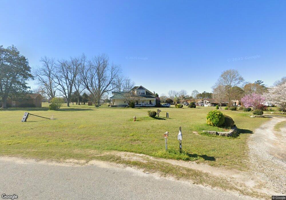
This home is located at 332 Cliett Rd, Byron, GA 31008 and is currently estimated at $212,933, approximately $104 per square foot. 332 Cliett Rd is a home with nearby schools including Kay Road Elementary School, Fort Valley Middle School, and Peach County High School.
Ownership History
Date
Name
Owned For
Owner Type
Purchase Details
Closed on
Dec 31, 2014
Sold by
Rogers John D
Bought by
M & J Properties Llc
Current Estimated Value
Purchase Details
Closed on
Aug 6, 2013
Sold by
M & J Properties Of Middle
Bought by
Rogers John D
Purchase Details
Closed on
May 21, 2010
Sold by
Rogers John D
Bought by
M & J Properties Of Middle Georgia Llc
Purchase Details
Closed on
Jan 23, 2008
Sold by
Rogers John D
Bought by
M & J Properties Of Middle Georgia Lcc
Purchase Details
Closed on
Aug 14, 2003
Sold by
Rogers Dana S
Bought by
Rogers John D
Purchase Details
Closed on
Jul 19, 1991
Sold by
Akins Akins L and Akins Grace C
Bought by
Rogers John D and Rogers Dana S
Create a Home Valuation Report for This Property
The Home Valuation Report is an in-depth analysis detailing your home's value as well as a comparison with similar homes in the area
Home Values in the Area
Average Home Value in this Area
Purchase History
| Date | Buyer | Sale Price | Title Company |
|---|---|---|---|
| M & J Properties Llc | -- | -- | |
| Rogers John D | -- | -- | |
| M & J Properties Of Middle Georgia Llc | -- | -- | |
| M & J Properties Of Middle Georgia Lcc | -- | -- | |
| Rogers John D | -- | -- | |
| Rogers John D | -- | -- |
Source: Public Records
Tax History Compared to Growth
Tax History
| Year | Tax Paid | Tax Assessment Tax Assessment Total Assessment is a certain percentage of the fair market value that is determined by local assessors to be the total taxable value of land and additions on the property. | Land | Improvement |
|---|---|---|---|---|
| 2024 | $1,072 | $32,520 | $10,320 | $22,200 |
| 2023 | $1,095 | $33,400 | $10,320 | $23,080 |
| 2022 | $955 | $30,440 | $10,320 | $20,120 |
| 2021 | $1,106 | $28,880 | $10,320 | $18,560 |
| 2020 | $1,413 | $38,720 | $10,320 | $28,400 |
| 2019 | $1,143 | $29,920 | $10,320 | $19,600 |
| 2018 | $1,148 | $29,920 | $10,320 | $19,600 |
| 2017 | $1,152 | $29,920 | $10,320 | $19,600 |
| 2016 | $1,148 | $29,920 | $10,320 | $19,600 |
| 2015 | $1,150 | $29,920 | $10,320 | $19,600 |
| 2014 | $1,151 | $29,920 | $10,320 | $19,600 |
| 2013 | -- | $30,720 | $11,120 | $19,600 |
Source: Public Records
Map
Nearby Homes
- 39 English Ct
- 165 Lakeview Rd
- 219 Rowland Cir
- 555 Kimberly Dr
- 117 Hawks Ridge Trace
- 120 Hawks Place
- 127 Hawks Ridge Trace
- 108 Early Dr
- 120 Hawks Ridge Trace
- 0 Barker Rd Unit 243030
- 0 Barker Rd Unit 14258525
- 0 Barker Rd Unit 175053
- 109 Early Dr
- 107 Red Tail Cir
- 109 Red Tail Cir
- 111 Early Dr
- 199 Red Tail Cir
- 152 Hawks Ridge Trace
- 119 Early Dr
- 115 Early Dr