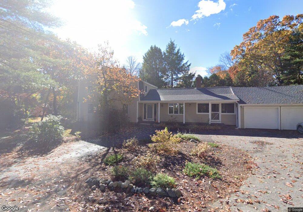
332 Conant Rd Weston, MA 02493
Estimated Value: $1,305,000 - $1,589,000
3
Beds
2
Baths
2,116
Sq Ft
$660/Sq Ft
Est. Value
About This Home
This home is located at 332 Conant Rd, Weston, MA 02493 and is currently estimated at $1,396,205, approximately $659 per square foot. 332 Conant Rd is a home located in Middlesex County with nearby schools including Country Elementary School, Woodland Elementary School, and Weston Middle School.
Ownership History
Date
Name
Owned For
Owner Type
Purchase Details
Closed on
Apr 16, 1974
Bought by
Hayes Malcolm R
Current Estimated Value
Create a Home Valuation Report for This Property
The Home Valuation Report is an in-depth analysis detailing your home's value as well as a comparison with similar homes in the area
Home Values in the Area
Average Home Value in this Area
Purchase History
| Date | Buyer | Sale Price | Title Company |
|---|---|---|---|
| Hayes Malcolm R | -- | -- |
Source: Public Records
Mortgage History
| Date | Status | Borrower | Loan Amount |
|---|---|---|---|
| Open | Hayes Malcolm R | $100,000 | |
| Closed | Hayes Malcolm R | $255,000 | |
| Closed | Hayes Malcolm R | $30,000 |
Source: Public Records
Tax History Compared to Growth
Tax History
| Year | Tax Paid | Tax Assessment Tax Assessment Total Assessment is a certain percentage of the fair market value that is determined by local assessors to be the total taxable value of land and additions on the property. | Land | Improvement |
|---|---|---|---|---|
| 2025 | $10,674 | $961,600 | $637,600 | $324,000 |
| 2024 | $10,224 | $919,400 | $637,600 | $281,800 |
| 2023 | $10,450 | $882,600 | $637,600 | $245,000 |
| 2022 | $10,530 | $822,000 | $611,800 | $210,200 |
| 2021 | $10,128 | $780,300 | $579,900 | $200,400 |
| 2020 | $9,862 | $768,700 | $579,900 | $188,800 |
| 2019 | $10,236 | $813,000 | $597,200 | $215,800 |
| 2018 | $10,171 | $813,000 | $597,200 | $215,800 |
| 2017 | $10,081 | $813,000 | $597,200 | $215,800 |
| 2016 | $9,886 | $813,000 | $597,200 | $215,800 |
| 2015 | $9,532 | $776,200 | $569,000 | $207,200 |
Source: Public Records
Map
Nearby Homes
- 59 Bradyll Rd
- 326 Conant Rd
- 0 Conant Rd L:2
- 334 Conant Rd
- 57 Bradyll Rd
- 331 Conant Rd
- 338 Conant Rd
- 320 Conant Rd
- 325 Conant Rd
- 58 Bradyll Rd
- 2 Washburn Cir
- 3 Spring Rd
- 337 Conant Rd
- 333 Conant Rd Unit A
- 333 Conant Rd
- 342 Conant Rd
- 312 Conant Rd Unit 1
- 312 Conant Rd Unit 312
- 312 Conant Rd
- 316 Conant Rd Unit 16