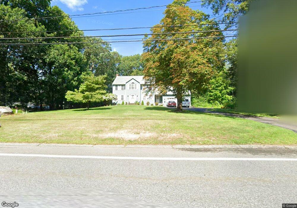
332 Elmwood St North Attleboro, MA 02760
North Attleboro NeighborhoodEstimated Value: $651,000 - $903,000
4
Beds
3
Baths
2,093
Sq Ft
$359/Sq Ft
Est. Value
About This Home
This home is located at 332 Elmwood St, North Attleboro, MA 02760 and is currently estimated at $750,703, approximately $358 per square foot. 332 Elmwood St is a home located in Bristol County with nearby schools including North Attleboro High School and Cadence Academy Preschool - North Attleborough.
Ownership History
Date
Name
Owned For
Owner Type
Purchase Details
Closed on
Nov 13, 1996
Sold by
Corporate Constr Ltd
Bought by
Santoro David P and Santoro Diane Tl
Current Estimated Value
Purchase Details
Closed on
Nov 3, 1995
Sold by
Stlawrence Walter G
Bought by
Prioux Paulette J
Create a Home Valuation Report for This Property
The Home Valuation Report is an in-depth analysis detailing your home's value as well as a comparison with similar homes in the area
Home Values in the Area
Average Home Value in this Area
Purchase History
| Date | Buyer | Sale Price | Title Company |
|---|---|---|---|
| Santoro David P | $219,000 | -- | |
| Prioux Paulette J | $61,500 | -- |
Source: Public Records
Mortgage History
| Date | Status | Borrower | Loan Amount |
|---|---|---|---|
| Open | Prioux Paulette J | $248,000 | |
| Closed | Prioux Paulette J | $50,000 | |
| Closed | Prioux Paulette J | $25,000 |
Source: Public Records
Tax History Compared to Growth
Tax History
| Year | Tax Paid | Tax Assessment Tax Assessment Total Assessment is a certain percentage of the fair market value that is determined by local assessors to be the total taxable value of land and additions on the property. | Land | Improvement |
|---|---|---|---|---|
| 2025 | $6,864 | $582,200 | $154,600 | $427,600 |
| 2024 | $6,900 | $597,900 | $154,600 | $443,300 |
| 2023 | $6,626 | $518,100 | $154,600 | $363,500 |
| 2022 | $6,285 | $451,200 | $154,600 | $296,600 |
| 2021 | $6,165 | $432,000 | $154,600 | $277,400 |
| 2020 | $6,086 | $424,100 | $154,600 | $269,500 |
| 2019 | $5,897 | $414,100 | $141,500 | $272,600 |
| 2018 | $5,311 | $398,100 | $141,500 | $256,600 |
| 2017 | $5,263 | $398,100 | $141,500 | $256,600 |
| 2016 | $4,864 | $367,900 | $156,300 | $211,600 |
| 2015 | $4,769 | $362,900 | $163,700 | $199,200 |
| 2014 | $4,650 | $351,200 | $152,000 | $199,200 |
Source: Public Records
Map
Nearby Homes
- 9 Sunnyside Dr Unit 9
- 5 Old Wood Rd
- 12 Houde St
- Lot 5 Jeffrey Dr
- 34 Hawthorne St
- 28 Messenger St
- 835 Mt Hope St Unit 39
- 64 Smith St
- 35-R Whiting St
- Lot 2 Jeffrey Dr
- 45 Moran St
- 2 Franklin Ave
- 271 N Washington St
- 194 Smith St
- 157 Fisher St
- 39 Columbia St
- 29 Broad St
- 57 Vine St
- 116 George St
- 633 E Washington St Unit 17
- 352 Elmwood St
- 362 Elmwood St
- 372 Elmwood St
- 313 Elmwood St
- 305 Elmwood St
- 382 Elmwood St
- 297 Elmwood St
- 392 Elmwood St
- 289 Elmwood St
- 329 Elmwood St
- 412 Elmwood St
- 273 Elmwood St
- 422 Elmwood St
- 35 Sunset Ln Unit 223
- 35 Sunset Ln
- 31 Sunset Ln
- 267 Elmwood St
- 391 Elmwood St
- 27 Sunset Ln
- 23 Sunset Ln Unit 238