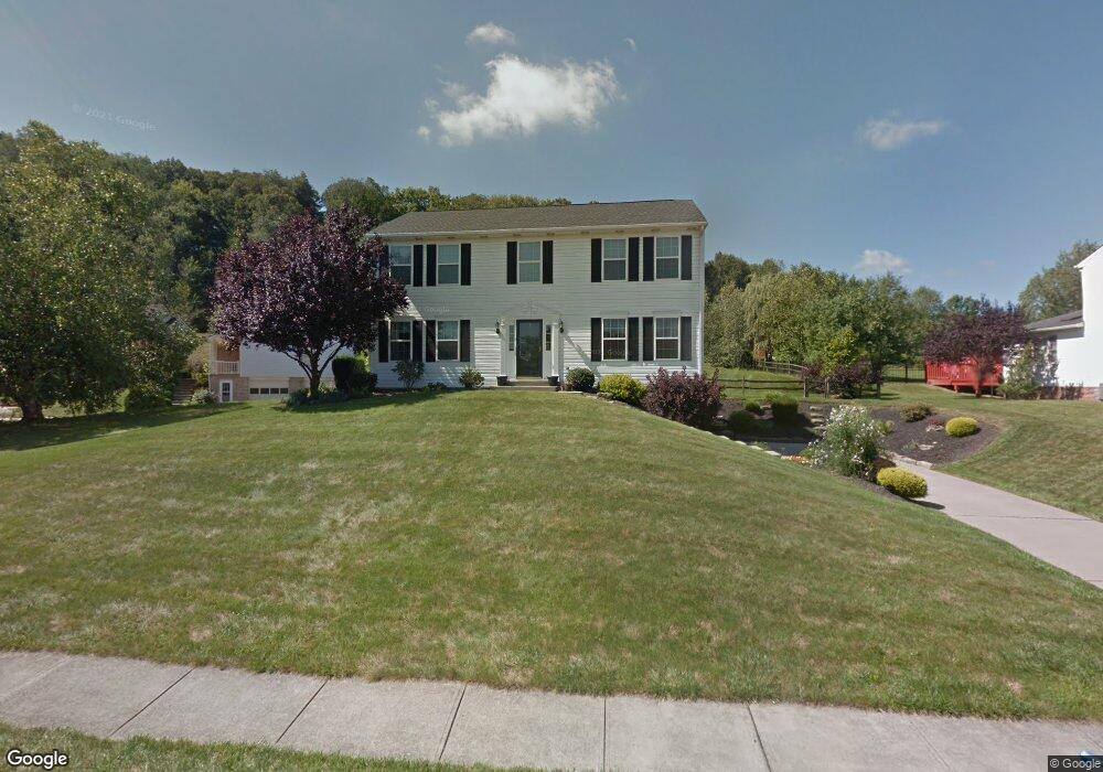
332 Green Fields Ct Cranberry Township, PA 16066
Estimated Value: $415,070 - $484,000
5
Beds
3
Baths
2,160
Sq Ft
$210/Sq Ft
Est. Value
About This Home
This home is located at 332 Green Fields Ct, Cranberry Township, PA 16066 and is currently estimated at $452,768, approximately $209 per square foot. 332 Green Fields Ct is a home located in Butler County with nearby schools including Haine Middle School, Rowan Elementary School, and Ryan Gloyer Middle School.
Ownership History
Date
Name
Owned For
Owner Type
Purchase Details
Closed on
Oct 12, 2007
Sold by
Ferrans Kenneth J
Bought by
Donahue John M
Current Estimated Value
Home Financials for this Owner
Home Financials are based on the most recent Mortgage that was taken out on this home.
Original Mortgage
$218,405
Outstanding Balance
$138,484
Interest Rate
6.51%
Mortgage Type
New Conventional
Estimated Equity
$314,284
Create a Home Valuation Report for This Property
The Home Valuation Report is an in-depth analysis detailing your home's value as well as a comparison with similar homes in the area
Home Values in the Area
Average Home Value in this Area
Purchase History
| Date | Buyer | Sale Price | Title Company |
|---|---|---|---|
| Donahue John M | $229,900 | -- |
Source: Public Records
Mortgage History
| Date | Status | Borrower | Loan Amount |
|---|---|---|---|
| Open | Donahue John M | $218,405 |
Source: Public Records
Tax History Compared to Growth
Tax History
| Year | Tax Paid | Tax Assessment Tax Assessment Total Assessment is a certain percentage of the fair market value that is determined by local assessors to be the total taxable value of land and additions on the property. | Land | Improvement |
|---|---|---|---|---|
| 2025 | $5,222 | $29,140 | $3,740 | $25,400 |
| 2024 | $5,067 | $29,140 | $3,740 | $25,400 |
| 2023 | $4,992 | $29,140 | $3,740 | $25,400 |
| 2022 | $4,992 | $29,140 | $3,740 | $25,400 |
| 2021 | $4,918 | $29,140 | $0 | $0 |
| 2020 | $4,918 | $29,140 | $3,740 | $25,400 |
| 2019 | $4,863 | $29,140 | $3,740 | $25,400 |
| 2018 | $4,863 | $29,140 | $3,740 | $25,400 |
| 2017 | $4,775 | $29,140 | $3,740 | $25,400 |
| 2016 | $1,310 | $29,140 | $3,740 | $25,400 |
| 2015 | $591 | $29,140 | $3,740 | $25,400 |
| 2014 | $591 | $29,140 | $3,740 | $25,400 |
Source: Public Records
Map
Nearby Homes
- 109 Founders St
- Elgin Plan at Brookvue - Single Family
- Ellsworth Plan at Brookvue - Single Family
- Montclair Plan at Brookvue - Single Family
- Dundee Plan at Brookvue - Single Family
- 3500 Unionville Rd Unit Morrison
- Andover Plan at Brookvue - Single Family
- Bromley Plan at Brookvue - Single Family
- 3500 Unionville Rd Unit Dundee
- 3500 Unionville Rd Unit Arundel
- Helston Plan at Brookvue - Single Family
- 3500 Unionville Rd Unit Montclair
- Arundel Plan at Brookvue - Single Family
- 3500 Unionville Rd Unit Bromley
- 3500 Unionville Rd Unit Andover
- Morrison Plan at Brookvue - Single Family
- 405 Mallard Dr
- 205 Broadview Ct
- 311 Palisade Way
- 109 Foundry Pike
- 334 Green Fields Ct
- 330 Green Fields Ct
- 328 Green Fields Ct
- 336 Green Fields Ct
- 326 Green Fields Ct
- 333 Green Fields Ct
- 335 Green Fields Ct
- 337 Green Fields Ct
- 339 Green Fields Ct
- 331 Green Fields Ct
- 324 Green Fields Ct
- 341 Green Fields Ct
- 338 Green Fields Ct
- 322 Green Fields Ct
- 114 Stonefield Dr
- 327 Green Fields Ct
- 320 Green Fields Ct
- 113 Stonefield Dr
- 325 Green Fields Ct
- 318 Green Fields Ct