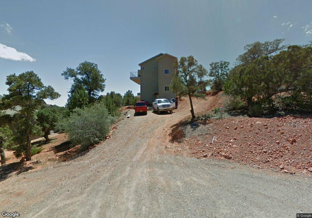
332 Hillside Cir Central, UT 84722
Estimated Value: $384,000 - $486,000
4
Beds
4
Baths
2,235
Sq Ft
$195/Sq Ft
Est. Value
About This Home
This home is located at 332 Hillside Cir, Central, UT 84722 and is currently estimated at $436,259, approximately $195 per square foot. 332 Hillside Cir is a home located in Washington County with nearby schools including Enterprise School and Enterprise High School.
Ownership History
Date
Name
Owned For
Owner Type
Purchase Details
Closed on
Jan 14, 2026
Sold by
Bailey Barbara A
Bought by
Barbara A Bailey Living Trust and Bailey
Current Estimated Value
Purchase Details
Closed on
Aug 20, 2012
Sold by
Burbank Shaelee Marie
Bought by
Burbank Justin Ryan and Burbank Shaelee Marie
Purchase Details
Closed on
Dec 12, 2011
Sold by
Fannie Mae
Bought by
Curtis Shaelee
Home Financials for this Owner
Home Financials are based on the most recent Mortgage that was taken out on this home.
Original Mortgage
$3,689
Interest Rate
3.94%
Mortgage Type
Stand Alone Second
Purchase Details
Closed on
May 2, 2011
Sold by
Robinson Robbie S and Robinson Becci M
Bought by
Federal National Mortgage Association
Purchase Details
Closed on
Jul 10, 2007
Sold by
Augulis Richard P and Augulis Marsha D
Bought by
Robinson Robbie S and Robinson Becci M
Home Financials for this Owner
Home Financials are based on the most recent Mortgage that was taken out on this home.
Original Mortgage
$232,024
Interest Rate
6.51%
Mortgage Type
Purchase Money Mortgage
Create a Home Valuation Report for This Property
The Home Valuation Report is an in-depth analysis detailing your home's value as well as a comparison with similar homes in the area
Home Values in the Area
Average Home Value in this Area
Purchase History
| Date | Buyer | Sale Price | Title Company |
|---|---|---|---|
| Barbara A Bailey Living Trust | -- | None Listed On Document | |
| Burbank Justin Ryan | -- | None Available | |
| Curtis Shaelee | $109,900 | Southern Utah Title Of Cedar | |
| Federal National Mortgage Association | $242,325 | Backman Fptp | |
| Robinson Robbie S | -- | Sun West Title |
Source: Public Records
Mortgage History
| Date | Status | Borrower | Loan Amount |
|---|---|---|---|
| Previous Owner | Curtis Shaelee | $3,689 | |
| Previous Owner | Curtis Shaelee | $107,113 | |
| Previous Owner | Robinson Robbie S | $232,024 |
Source: Public Records
Tax History
| Year | Tax Paid | Tax Assessment Tax Assessment Total Assessment is a certain percentage of the fair market value that is determined by local assessors to be the total taxable value of land and additions on the property. | Land | Improvement |
|---|---|---|---|---|
| 2025 | $1,267 | $219,450 | $49,500 | $169,950 |
| 2023 | $1,377 | $232,430 | $49,500 | $182,930 |
| 2022 | $1,468 | $231,935 | $33,000 | $198,935 |
| 2021 | $1,430 | $339,500 | $50,000 | $289,500 |
| 2020 | $1,347 | $304,200 | $45,000 | $259,200 |
| 2019 | $1,182 | $261,400 | $24,000 | $237,400 |
| 2018 | $1,082 | $121,385 | $0 | $0 |
| 2017 | $951 | $106,700 | $0 | $0 |
| 2016 | $982 | $101,475 | $0 | $0 |
| 2015 | $980 | $97,405 | $0 | $0 |
| 2014 | $755 | $76,065 | $0 | $0 |
Source: Public Records
Map
Nearby Homes
- 324 Hillside Cir
- 375 Hillcrest Cir
- 0 Hillcrest Cir
- 328 E Hillcrest
- 342 E Foothill Cir
- 207 E Red Hill Rd
- 115 E Hunter Ln
- 425 E Mule Deer Rd
- 348 N Lodge Rd
- 0 Utah 18
- 706 E Cottontail Rd
- 202 E Rye Dr
- 183 N Matt Dillon Trail
- 65 N Butch Cassidy Trail
- 380 W Butch Cassidy Cir
- 128 E Forest Dr
- 165 E Forest Dr Unit 4
- 0 E Forest Dr
- 25 N Doc Holiday Ln
- 25 N Doc Holiday Ln Unit 49
- 342 Hillside Cir
- 342 E Hillside Dr
- 331 Hillcrest Cir
- 343 Hillcrest Cir
- 128 N Red Hill Rd
- 319 Hillcrest Cir
- 319 Hillcrest Cir Unit 39
- 150 N Mountain View Dr
- Lot 30 Hillside Cir
- 0 Hillside Cir
- 323 Hillside Cir
- 331 Hillside Cir
- 322 Hillcrest Cir
- 322 Hillside Cir
- 1 N Mountain View Dr
- 0 N Red Hill Rd
- 142 N Red Hill Rd
- 52 N Red Hill Rd
- 52 N Red Hill Rd Unit 20
- 163 N Mountain View Dr
Your Personal Tour Guide
Ask me questions while you tour the home.