Estimated Value: $280,784 - $315,000
--
Bed
--
Bath
1,884
Sq Ft
$157/Sq Ft
Est. Value
About This Home
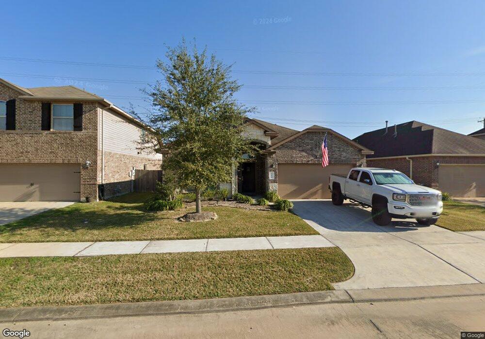
This home is located at 332 Kendall Crest Dr, Alvin, TX 77511 and is currently estimated at $296,196, approximately $157 per square foot. 332 Kendall Crest Dr is a home with nearby schools including Mark Twain Elementary School, G.W. Harby Junior High School, and Alvin High School.
Ownership History
Date
Name
Owned For
Owner Type
Purchase Details
Closed on
Mar 31, 2015
Sold by
D R Horton Texas Ltd
Bought by
Smith Brooke Amelia
Current Estimated Value
Home Financials for this Owner
Home Financials are based on the most recent Mortgage that was taken out on this home.
Original Mortgage
$188,157
Outstanding Balance
$145,267
Interest Rate
3.82%
Mortgage Type
New Conventional
Estimated Equity
$150,929
Purchase Details
Closed on
Oct 16, 2014
Sold by
Skymark Development Company Inc
Bought by
D R Horton Texas Ltd
Create a Home Valuation Report for This Property
The Home Valuation Report is an in-depth analysis detailing your home's value as well as a comparison with similar homes in the area
Home Values in the Area
Average Home Value in this Area
Purchase History
| Date | Buyer | Sale Price | Title Company |
|---|---|---|---|
| Smith Brooke Amelia | -- | Dhi Title | |
| D R Horton Texas Ltd | -- | Dhi Title |
Source: Public Records
Mortgage History
| Date | Status | Borrower | Loan Amount |
|---|---|---|---|
| Open | Smith Brooke Amelia | $188,157 |
Source: Public Records
Tax History Compared to Growth
Tax History
| Year | Tax Paid | Tax Assessment Tax Assessment Total Assessment is a certain percentage of the fair market value that is determined by local assessors to be the total taxable value of land and additions on the property. | Land | Improvement |
|---|---|---|---|---|
| 2025 | $6,235 | $282,811 | $56,920 | $233,960 |
| 2023 | $6,235 | $233,728 | $56,920 | $225,330 |
| 2022 | $7,294 | $212,480 | $32,660 | $179,820 |
| 2021 | $7,358 | $205,130 | $32,660 | $172,470 |
| 2020 | $7,362 | $203,000 | $34,380 | $168,620 |
| 2019 | $7,407 | $200,000 | $23,920 | $176,080 |
| 2018 | $7,253 | $195,560 | $23,920 | $171,640 |
| 2017 | $6,932 | $185,000 | $23,920 | $161,080 |
| 2016 | $7,315 | $195,220 | $28,700 | $166,520 |
| 2014 | -- | $23,920 | $23,920 | $0 |
Source: Public Records
Map
Nearby Homes
- 340 Kendall Crest Dr
- 334 Kendall Crest Dr
- 5307 Camerford Ct
- 350 Selah Ct
- 356 Selah Ct
- 5307 Cascade Ct
- Madison Plan at Kendall Lakes
- Avery Plan at Kendall Lakes
- Elias Plan at Skyview
- Christina Plan at Kendall Lakes
- Rev Plan at Skyview
- Trenton Plan at Kendall Lakes
- 5320 Latigo Ct
- Cleo Plan at Skyview
- Zara Plan at Skyview
- Myrtle Plan at Kendall Lakes
- 310 Kendall Crest Dr
- 5318 Latigo Ct
- The Princeton II Plan at Kendall Lakes
- The Crawford Plan at Kendall Lakes
- 330 Kendall Crest Dr
- 328 Kendall Crest Dr
- 336 Kendall Crest Dr
- 360 Kendall Cove Dr
- 338 Kendall Crest Dr
- 326 Kendall Crest Dr
- 324 Kendall Crest Dr
- 5300 Cascade Ct
- 5302 Cascade Ct
- 342 Kendall Crest Dr
- 344 Kendall Crest Dr
- 319 Kendall Crest Dr
- 5309 Camerford Ct
- 320 Kendall Crest Dr
- 5306 Cascade Ct
- 5295 Cascade Ct
- 317 Kendall Crest Dr
- 346 Kendall Crest Dr
- 5297 Cascade Ct
- 318 Kendall Crest Dr