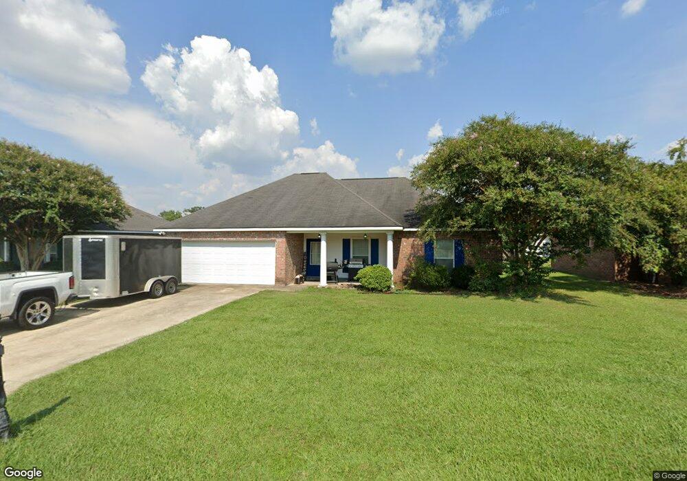
332 Key Largo Dr Port Allen, LA 70767
Estimated Value: $194,517 - $224,000
3
Beds
2
Baths
1,544
Sq Ft
$138/Sq Ft
Est. Value
About This Home
This home is located at 332 Key Largo Dr, Port Allen, LA 70767 and is currently estimated at $212,629, approximately $137 per square foot. 332 Key Largo Dr is a home located in West Baton Rouge Parish with nearby schools including Port Allen Elementary School, Cohn Elementary School, and Port Allen Middle School.
Ownership History
Date
Name
Owned For
Owner Type
Purchase Details
Closed on
Mar 8, 2010
Sold by
Dfw Properties Llc
Bought by
Williams Edwin
Current Estimated Value
Home Financials for this Owner
Home Financials are based on the most recent Mortgage that was taken out on this home.
Original Mortgage
$176,000
Outstanding Balance
$116,474
Interest Rate
4.95%
Mortgage Type
VA
Estimated Equity
$96,155
Create a Home Valuation Report for This Property
The Home Valuation Report is an in-depth analysis detailing your home's value as well as a comparison with similar homes in the area
Home Values in the Area
Average Home Value in this Area
Purchase History
| Date | Buyer | Sale Price | Title Company |
|---|---|---|---|
| Williams Edwin | $176,000 | None Available |
Source: Public Records
Mortgage History
| Date | Status | Borrower | Loan Amount |
|---|---|---|---|
| Open | Williams Edwin | $176,000 |
Source: Public Records
Tax History Compared to Growth
Tax History
| Year | Tax Paid | Tax Assessment Tax Assessment Total Assessment is a certain percentage of the fair market value that is determined by local assessors to be the total taxable value of land and additions on the property. | Land | Improvement |
|---|---|---|---|---|
| 2024 | $598 | $14,360 | $2,700 | $11,660 |
| 2023 | $888 | $14,360 | $2,700 | $11,660 |
| 2022 | $1,681 | $14,360 | $2,700 | $11,660 |
| 2021 | $1,715 | $14,360 | $2,700 | $11,660 |
| 2020 | $1,557 | $12,920 | $2,430 | $10,490 |
| 2019 | $2,195 | $17,460 | $2,700 | $14,760 |
| 2018 | $2,230 | $17,460 | $2,700 | $14,760 |
| 2017 | $2,077 | $17,460 | $2,700 | $14,760 |
| 2015 | $1,726 | $17,460 | $2,700 | $14,760 |
| 2014 | $1,705 | $17,460 | $2,700 | $14,760 |
| 2013 | $1,368 | $14,010 | $2,700 | $11,310 |
Source: Public Records
Map
Nearby Homes
- 289 Melissa Dr
- 245 Melissa Dr
- 309 N 14th St
- 2165 Taylor Dr
- 1625 Rosedale Rd
- 926 Louisiana Ave
- 755 Maryland Ave
- Liberty V G Plan at Westview Crossing
- Connelly IV H Plan at Westview Crossing
- Whitaker II H Plan at Westview Crossing
- Broadway IV H Plan at Westview Crossing
- Wendell IV G Plan at Westview Crossing
- Trinity IV H Plan at Westview Crossing
- Connelly IV G Plan at Westview Crossing
- Midland II G Plan at Westview Crossing
- Whitaker II G Plan at Westview Crossing
- Danbury IV G Plan at Westview Crossing
- Wendell IV H Plan at Westview Crossing
- Princeton IV G Plan at Westview Crossing
- Broadway IV G Plan at Westview Crossing
- 308 Key Largo Dr
- 354 Key Largo Dr
- 331 Melissa St
- 331 Melissa Dr
- 307 Melissa St
- 307 Melissa Ave
- 353 Melissa Dr
- 353 Melissa St
- 290 Key Largo Dr
- 305 Key Largo Dr
- 355 Key Largo Dr
- 289 Melissa St
- 376 Key Largo Dr
- 375 Melissa St
- 375 Melissa Dr
- 287 Key Largo Dr
- 35 Melissa Dr
- 268 Key Largo Dr
- 377 Key Largo Dr
- 267 Melissa St