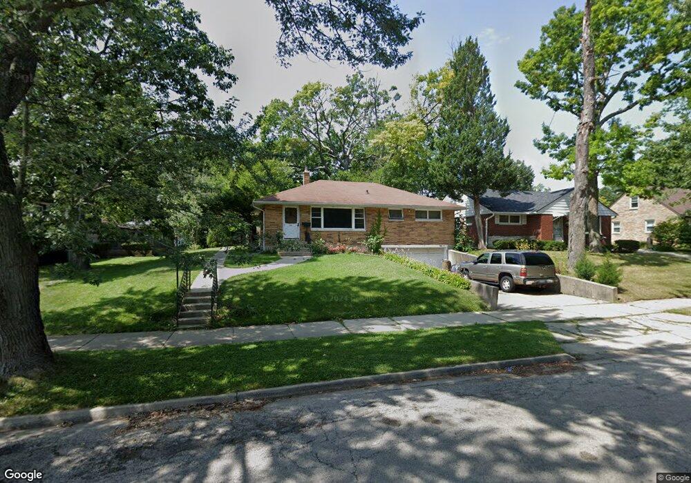
332 Leith Ave Waukegan, IL 60085
West Waukegan NeighborhoodEstimated Value: $234,000 - $253,000
3
Beds
1
Bath
1,134
Sq Ft
$214/Sq Ft
Est. Value
About This Home
This home is located at 332 Leith Ave, Waukegan, IL 60085 and is currently estimated at $242,121, approximately $213 per square foot. 332 Leith Ave is a home located in Lake County with nearby schools including Whittier Elementary School, Robert E. Abbott Middle School, and Waukegan High School.
Ownership History
Date
Name
Owned For
Owner Type
Purchase Details
Closed on
Feb 28, 2001
Sold by
Galinis Charles C and Galinis Phyllis R
Bought by
Jones Craig and Jones Theresa
Current Estimated Value
Home Financials for this Owner
Home Financials are based on the most recent Mortgage that was taken out on this home.
Original Mortgage
$141,780
Outstanding Balance
$52,051
Interest Rate
7.13%
Mortgage Type
VA
Estimated Equity
$190,070
Purchase Details
Closed on
Apr 18, 1994
Sold by
Galinis Charles C
Bought by
Galinis Charles C and Galinis Phyllis R
Create a Home Valuation Report for This Property
The Home Valuation Report is an in-depth analysis detailing your home's value as well as a comparison with similar homes in the area
Home Values in the Area
Average Home Value in this Area
Purchase History
| Date | Buyer | Sale Price | Title Company |
|---|---|---|---|
| Jones Craig | $139,000 | -- | |
| Galinis Charles C | -- | -- |
Source: Public Records
Mortgage History
| Date | Status | Borrower | Loan Amount |
|---|---|---|---|
| Open | Jones Craig | $141,780 |
Source: Public Records
Tax History Compared to Growth
Tax History
| Year | Tax Paid | Tax Assessment Tax Assessment Total Assessment is a certain percentage of the fair market value that is determined by local assessors to be the total taxable value of land and additions on the property. | Land | Improvement |
|---|---|---|---|---|
| 2024 | $4,360 | $60,582 | $13,579 | $47,003 |
| 2023 | $4,265 | $54,239 | $12,157 | $42,082 |
| 2022 | $4,265 | $49,625 | $10,343 | $39,282 |
| 2021 | $4,138 | $45,695 | $9,569 | $36,126 |
| 2020 | $4,146 | $42,571 | $8,915 | $33,656 |
| 2019 | $4,119 | $39,009 | $8,169 | $30,840 |
| 2018 | $3,888 | $36,455 | $10,510 | $25,945 |
| 2017 | $3,734 | $32,252 | $9,298 | $22,954 |
| 2016 | $3,404 | $28,026 | $8,080 | $19,946 |
| 2015 | $3,224 | $25,084 | $7,232 | $17,852 |
| 2014 | $3,022 | $23,399 | $7,770 | $15,629 |
| 2012 | $3,965 | $25,352 | $8,419 | $16,933 |
Source: Public Records
Map
Nearby Homes
- 0 Brookside Ave
- 615 Tiffany Dr
- 1213 Grand Ave
- 24 Washington Terrace
- 132 Dorchester Ct
- 102 Baldwin Ave
- 49 S Lewis Ave
- 1005 N Lewis Ave
- 1416 Hamilton Ct
- 1023 N Elmwood Ave
- 1521 Catalpa Ave
- 824 N Butrick St
- 1038 Indiana Ave
- 621 N Austin Ave
- 12601 W Atlantic Ave
- 2116 & 2101 Williamsburg Dr
- 34887 N Austin Ave
- 603 N Austin Ave
- 3170 W Monroe St Unit 309
- 2726 W Hidden Glen Dr
- 336 Leith Ave
- 2330 Brookside Ave
- 340 Leith Ave
- 333 Lynn Terrace
- 2340 Brookside Ave
- 377 Lynn Terrace
- 331 Leith Ave
- 402 Leith Ave
- 2200 Brookside Ave
- 335 Leith Ave
- 403 Lynn Terrace
- 339 Leith Ave
- 406 Leith Ave
- 403 Leith Ave
- 407 Lynn Terrace
- 410 Leith Ave
- 407 Leith Ave
- 332 Lynn Terrace
- 332 Tiffany Dr
- 336 Lynn Terrace