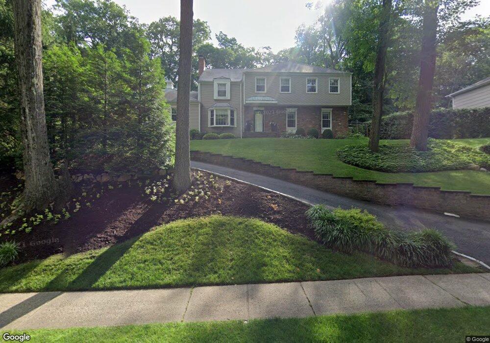
332 Maple St New Providence, NJ 07974
Estimated Value: $905,062 - $1,269,000
Studio
--
Bath
2,548
Sq Ft
$439/Sq Ft
Est. Value
About This Home
This home is located at 332 Maple St, New Providence, NJ 07974 and is currently estimated at $1,117,516, approximately $438 per square foot. 332 Maple St is a home located in Union County with nearby schools including New Providence High School, The Academy of Our Lady of Peace, and Oak Knoll School of the Holy Child.
Ownership History
Date
Name
Owned For
Owner Type
Purchase Details
Closed on
Aug 19, 2004
Sold by
Kleman George
Bought by
Barrington Richard and Rakhi Barrington
Current Estimated Value
Home Financials for this Owner
Home Financials are based on the most recent Mortgage that was taken out on this home.
Original Mortgage
$508,000
Outstanding Balance
$253,248
Interest Rate
6.08%
Estimated Equity
$864,268
Create a Home Valuation Report for This Property
The Home Valuation Report is an in-depth analysis detailing your home's value as well as a comparison with similar homes in the area
Home Values in the Area
Average Home Value in this Area
Purchase History
We collect this data history from publicly available records. To have your information removed, we recommend requesting removal directly through your county’s website.
| Date | Buyer | Sale Price | Title Company |
|---|---|---|---|
| Barrington Richard | $635,000 | -- |
Source: Public Records
Mortgage History
We collect this data history from publicly available records. To have your information removed, we recommend requesting removal directly through your county’s website.
| Date | Status | Borrower | Loan Amount |
|---|---|---|---|
| Open | Barrington Richard | $508,000 |
Source: Public Records
Tax History
| Year | Tax Paid | Tax Assessment Tax Assessment Total Assessment is a certain percentage of the fair market value that is determined by local assessors to be the total taxable value of land and additions on the property. | Land | Improvement |
|---|---|---|---|---|
| 2025 | $16,074 | $311,400 | $166,300 | $145,100 |
| 2024 | $15,592 | $311,400 | $166,300 | $145,100 |
| 2023 | $15,592 | $311,400 | $166,300 | $145,100 |
| 2022 | $15,377 | $311,400 | $166,300 | $145,100 |
| 2021 | $15,265 | $311,400 | $166,300 | $145,100 |
| 2020 | $15,259 | $311,400 | $166,300 | $145,100 |
| 2019 | $15,165 | $311,400 | $166,300 | $145,100 |
| 2018 | $15,087 | $311,400 | $166,300 | $145,100 |
| 2017 | $14,841 | $311,400 | $166,300 | $145,100 |
| 2016 | $14,633 | $311,400 | $166,300 | $145,100 |
| 2015 | $14,430 | $311,400 | $166,300 | $145,100 |
| 2014 | $14,212 | $311,400 | $166,300 | $145,100 |
Source: Public Records
Map
Nearby Homes
- 167 Mountain Ave
- 27 Hillside Terrace
- 51 Chestnut St
- 23 Club Dr
- 175 Division Ave
- 22 Brook Hollow Ln
- 39 Gallinson Dr
- 32 Bergen Rd
- 29 Upper Dr
- 120 Brookside Dr
- 166 1st St
- 106 Division Ave
- 29 Knob Hill Dr
- 110 Woodland Rd
- 26 Crest Dr
- 11 Dorr Rd
- 491 Central Ave Unit 3
- 491 Central Ave Unit 2
- 491 Central Ave Unit 1
- 491 Central Ave Unit 4
- 324 Maple St
- 348 Maple St
- 36 Stoneridge Rd
- 42 Stone Ridge Rd
- 36 Stone Ridge Rd
- 316 Maple St
- 28 Stone Ridge Rd
- 50 Stone Ridge Rd
- 345 Maple St
- 43 Stone Ridge Rd
- 308 Maple St
- 53 Stone Ridge Rd
- 58 Stone Ridge Rd
- 22 Stone Ridge Rd
- 46 Colony Ct
- 23 Stone Ridge Rd
- 366 Maple St
- 38 Colony Ct
- 35 the Fellsway
- 300 Maple St
Your Personal Tour Guide
Ask me questions while you tour the home.