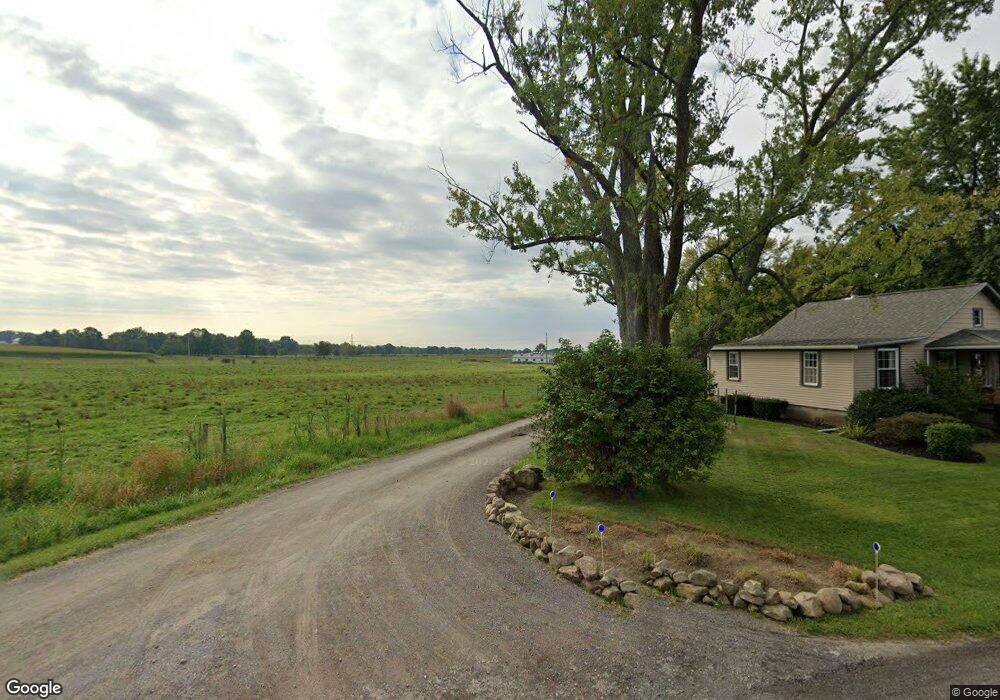
332 Mast Ln New Wilmington, PA 16142
Estimated Value: $188,000 - $379,743
2
Beds
--
Bath
1,376
Sq Ft
$206/Sq Ft
Est. Value
About This Home
This home is located at 332 Mast Ln, New Wilmington, PA 16142 and is currently estimated at $283,186, approximately $205 per square foot. 332 Mast Ln is a home with nearby schools including Wilmington Area Elementary School, Wilmington Area Middle School, and Wilmington Area High School.
Ownership History
Date
Name
Owned For
Owner Type
Purchase Details
Closed on
Jun 14, 2006
Sold by
Mast John D and Mast Leah M
Bought by
Hostetler David D and Hostetler Mary J
Current Estimated Value
Create a Home Valuation Report for This Property
The Home Valuation Report is an in-depth analysis detailing your home's value as well as a comparison with similar homes in the area
Home Values in the Area
Average Home Value in this Area
Purchase History
| Date | Buyer | Sale Price | Title Company |
|---|---|---|---|
| Hostetler David D | -- | None Available |
Source: Public Records
Mortgage History
| Date | Status | Borrower | Loan Amount |
|---|---|---|---|
| Open | Hostetler David D | $300,000 | |
| Open | Diversified Abs Iii Upstream L | $365,000,000 | |
| Closed | Hostetler David D | $133,000 | |
| Closed | Hostetler David D | $70,000 | |
| Closed | Hostetler David D | $10,000 | |
| Closed | Hostetler David D | $175,000 | |
| Closed | Hostetler David D | $80,000 | |
| Closed | Hostetler David D | $15,000 | |
| Closed | Hostetler David D | $84,000 |
Source: Public Records
Tax History Compared to Growth
Tax History
| Year | Tax Paid | Tax Assessment Tax Assessment Total Assessment is a certain percentage of the fair market value that is determined by local assessors to be the total taxable value of land and additions on the property. | Land | Improvement |
|---|---|---|---|---|
| 2025 | $4,668 | $173,200 | $44,900 | $128,300 |
| 2024 | $4,478 | $189,800 | $61,500 | $128,300 |
| 2023 | $3,317 | $189,800 | $61,500 | $128,300 |
| 2022 | $4,773 | $184,600 | $61,500 | $123,100 |
| 2021 | $4,773 | $184,600 | $61,500 | $123,100 |
| 2020 | $4,773 | $184,600 | $61,500 | $123,100 |
| 2019 | $4,134 | $166,300 | $61,500 | $104,800 |
| 2018 | $4,048 | $166,300 | $61,500 | $104,800 |
| 2017 | $3,996 | $166,300 | $61,500 | $104,800 |
| 2016 | $1,258 | $166,300 | $61,500 | $104,800 |
| 2015 | $1,258 | $166,300 | $61,500 | $104,800 |
| 2014 | $1,258 | $166,300 | $61,500 | $104,800 |
Source: Public Records
Map
Nearby Homes
- 5216 Old Pulaski Rd
- 1946 State Route 208
- 334 Dutch Ln
- 400 Oak Hill Rd
- 485 Campground Rd
- 214 Raptor Cir
- 3503 State Route 208
- Lot 28 Wheatland Rd
- 2461 Marr Rd
- 0 Sr-318 & Executive Ct Unit 1676197
- 3956 New Castle Rd
- 4166 Pennsylvania 158
- 402 Woodland Dr
- 88 Mitchell Rd
- 977 Glen Rd
- 4536 State Route 158
- 3660 State Route 208
- 315 Maidenblush Dr
- 3674 Pennsylvania 208
- 419 W Neshannock Ave
- 342 Mast Ln
- 2284 State Route 208
- 2322 State Route 208
- 2332 State Route 208
- 2270 State Route 208
- 2344 State Route 208
- 2260 State Route 208
- 2376 State Route 208
- 329 Shannon Ln
- 2369 State Route 208
- 2443 State Route 208
- 829 Mast Ln
- 2175 State Route 208
- 2175 State Route 208
- 2476 State Route 208
- 452 Double r Ln
- 2477 State Route 208
- 2145 State Route 208
- 2145 State Route 208
- 560 Double r Ln