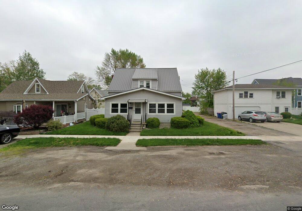
332 N Pierce St Delphos, OH 45833
Estimated Value: $87,000 - $130,028
3
Beds
2
Baths
1,367
Sq Ft
$75/Sq Ft
Est. Value
About This Home
This home is located at 332 N Pierce St, Delphos, OH 45833 and is currently estimated at $103,007, approximately $75 per square foot. 332 N Pierce St is a home located in Allen County with nearby schools including Delphos St. John's High School and Delphos St. John's Elementary School.
Ownership History
Date
Name
Owned For
Owner Type
Purchase Details
Closed on
Oct 19, 2018
Bought by
Honigford Steven J
Current Estimated Value
Purchase Details
Closed on
Jul 5, 2016
Sold by
Bowen Thomas E
Bought by
Honigford Steven J
Purchase Details
Closed on
Dec 21, 2015
Sold by
Bowen Lynn M
Bought by
Bowen Thomas E
Purchase Details
Closed on
May 30, 1990
Bought by
Bowen Thomas
Create a Home Valuation Report for This Property
The Home Valuation Report is an in-depth analysis detailing your home's value as well as a comparison with similar homes in the area
Home Values in the Area
Average Home Value in this Area
Purchase History
| Date | Buyer | Sale Price | Title Company |
|---|---|---|---|
| Honigford Steven J | -- | -- | |
| Honigford Steven J | $48,500 | None Available | |
| Bowen Thomas E | -- | None Available | |
| Bowen Thomas | $34,000 | -- |
Source: Public Records
Tax History Compared to Growth
Tax History
| Year | Tax Paid | Tax Assessment Tax Assessment Total Assessment is a certain percentage of the fair market value that is determined by local assessors to be the total taxable value of land and additions on the property. | Land | Improvement |
|---|---|---|---|---|
| 2024 | $1,028 | $32,210 | $4,520 | $27,690 |
| 2023 | $812 | $24,010 | $3,360 | $20,650 |
| 2022 | $832 | $24,010 | $3,360 | $20,650 |
| 2021 | $838 | $24,010 | $3,360 | $20,650 |
| 2020 | $740 | $22,410 | $3,190 | $19,220 |
| 2019 | $740 | $22,410 | $3,190 | $19,220 |
| 2018 | $766 | $21,990 | $2,770 | $19,220 |
| 2017 | $680 | $20,240 | $2,770 | $17,470 |
| 2016 | $694 | $20,240 | $2,770 | $17,470 |
| 2015 | $770 | $20,240 | $2,770 | $17,470 |
| 2014 | $770 | $22,650 | $2,660 | $19,990 |
| 2013 | $775 | $22,650 | $2,660 | $19,990 |
Source: Public Records
Map
Nearby Homes
- 405 N Franklin St
- 210 E 3rd St
- 628 N Pierce St
- 610 N Washington St
- 704 N Franklin St
- 633 E 2nd St
- 650 E 6th St
- 821 E 3rd St
- 810 N Franklin St
- 903 E 3rd St
- 914 E 3rd St
- 221 S Main St
- 503 W 6th St
- 409 N Bredeick St
- 424 S Canal St
- 604 W 6th St
- 616 W 5th St
- 508 S Washington St
- 606 S Cass St
- 634 S Clay St