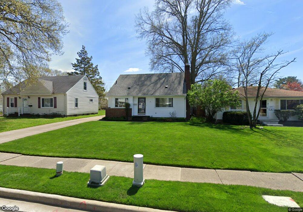
332 Notre Dame Ave Cuyahoga Falls, OH 44221
Mud Brook NeighborhoodEstimated Value: $212,417 - $245,000
3
Beds
2
Baths
907
Sq Ft
$250/Sq Ft
Est. Value
About This Home
This home is located at 332 Notre Dame Ave, Cuyahoga Falls, OH 44221 and is currently estimated at $226,354, approximately $249 per square foot. 332 Notre Dame Ave is a home located in Summit County with nearby schools including Lincoln Elementary School, Roberts Middle School, and Cuyahoga Falls High School.
Ownership History
Date
Name
Owned For
Owner Type
Purchase Details
Closed on
May 25, 2006
Sold by
White Timothy R
Bought by
Brandt William T and Caldren Dawn R
Current Estimated Value
Home Financials for this Owner
Home Financials are based on the most recent Mortgage that was taken out on this home.
Original Mortgage
$102,400
Outstanding Balance
$60,049
Interest Rate
6.62%
Mortgage Type
Fannie Mae Freddie Mac
Estimated Equity
$166,305
Purchase Details
Closed on
Nov 16, 2004
Sold by
Mayer John F and Mayer Karen S
Bought by
White Timothy R
Home Financials for this Owner
Home Financials are based on the most recent Mortgage that was taken out on this home.
Original Mortgage
$108,000
Interest Rate
5.91%
Mortgage Type
Purchase Money Mortgage
Purchase Details
Closed on
Oct 23, 1998
Sold by
Murphy Thelma W
Bought by
Mayer John F and Mayer Karen S
Home Financials for this Owner
Home Financials are based on the most recent Mortgage that was taken out on this home.
Original Mortgage
$84,000
Interest Rate
6.88%
Create a Home Valuation Report for This Property
The Home Valuation Report is an in-depth analysis detailing your home's value as well as a comparison with similar homes in the area
Home Values in the Area
Average Home Value in this Area
Purchase History
| Date | Buyer | Sale Price | Title Company |
|---|---|---|---|
| Brandt William T | $128,000 | Guardian Title Akron | |
| White Timothy R | $120,000 | Land America-Lawyers Title | |
| Mayer John F | $105,000 | American Certified Title |
Source: Public Records
Mortgage History
| Date | Status | Borrower | Loan Amount |
|---|---|---|---|
| Open | Brandt William T | $102,400 | |
| Previous Owner | White Timothy R | $108,000 | |
| Previous Owner | Mayer John F | $84,000 |
Source: Public Records
Tax History Compared to Growth
Tax History
| Year | Tax Paid | Tax Assessment Tax Assessment Total Assessment is a certain percentage of the fair market value that is determined by local assessors to be the total taxable value of land and additions on the property. | Land | Improvement |
|---|---|---|---|---|
| 2025 | $3,104 | $57,495 | $12,698 | $44,797 |
| 2024 | $3,104 | $57,495 | $12,698 | $44,797 |
| 2023 | $3,104 | $57,495 | $12,698 | $44,797 |
| 2022 | $2,773 | $41,717 | $9,135 | $32,582 |
| 2021 | $2,773 | $41,717 | $9,135 | $32,582 |
| 2020 | $2,727 | $41,720 | $9,140 | $32,580 |
| 2019 | $2,634 | $36,690 | $8,770 | $27,920 |
| 2018 | $2,236 | $36,690 | $8,770 | $27,920 |
| 2017 | $2,070 | $36,690 | $8,770 | $27,920 |
| 2016 | $2,072 | $34,420 | $8,770 | $25,650 |
| 2015 | $2,070 | $34,420 | $8,770 | $25,650 |
| 2014 | $2,071 | $34,420 | $8,770 | $25,650 |
| 2013 | $2,067 | $34,650 | $8,770 | $25,880 |
Source: Public Records
Map
Nearby Homes
- 455 Marguerite Ave
- 2890 Bailey Rd
- 3044 Bailey Rd
- 2835 Bailey Rd
- 435 Roanoke Ave
- 2834 Norwood St
- 306 Hollywood Ave
- 3320 Hudson Dr
- 2762 Bailey Rd
- 242 Monroe Ave
- 54 Washington Ave
- 2693 Northland St
- 324 Madison Ave
- 2736 Maplewood St
- 223 Filmore Ave
- 418 Hayes Ave
- 2762 Elmwood St
- 2873 Oakwood Dr
- 2950 Millboro Rd
- 3044 Millboro Rd
- 338 Notre Dame Ave
- 324 Notre Dame Ave
- 348 Notre Dame Ave
- 335 Kathron Ave
- 325 Kathron Ave
- 343 Kathron Ave
- 316 Notre Dame Ave
- 333 Notre Dame Ave
- 349 Kathron Ave
- 308 Notre Dame Ave
- 319 Kathron Ave
- 325 Notre Dame Ave
- 315 Notre Dame Ave
- 3041 Norwood St
- 307 Kathron Ave
- 3041 Norwood St
- 405 Kathron Ave
- 300 Notre Dame Ave
- 300 Notre Dame Ave
- 301 Kathron Ave