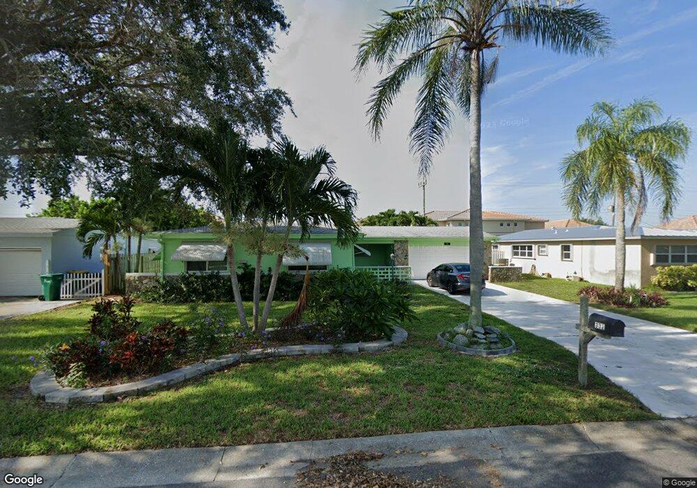
332 Polaris Dr Satellite Beach, FL 32937
Estimated Value: $394,132 - $490,000
3
Beds
2
Baths
1,291
Sq Ft
$333/Sq Ft
Est. Value
About This Home
This home is located at 332 Polaris Dr, Satellite Beach, FL 32937 and is currently estimated at $429,533, approximately $332 per square foot. 332 Polaris Dr is a home located in Brevard County with nearby schools including Spessard L. Holland Elementary School, Satellite Senior High School, and DeLaura Middle School.
Ownership History
Date
Name
Owned For
Owner Type
Purchase Details
Closed on
Jun 30, 2010
Sold by
Harris Richard A and Harris Richard
Bought by
Lds Enterprises L L C
Current Estimated Value
Purchase Details
Closed on
Oct 8, 1993
Sold by
Warren Harry D and Warren Laura J
Bought by
Warren Harry D and Warren Laura J
Home Financials for this Owner
Home Financials are based on the most recent Mortgage that was taken out on this home.
Original Mortgage
$63,000
Interest Rate
6.99%
Purchase Details
Closed on
Oct 7, 1993
Sold by
Warren Harry D and Warren Laura J
Bought by
Warren Harry D and Warren Laura J
Home Financials for this Owner
Home Financials are based on the most recent Mortgage that was taken out on this home.
Original Mortgage
$63,000
Interest Rate
6.99%
Create a Home Valuation Report for This Property
The Home Valuation Report is an in-depth analysis detailing your home's value as well as a comparison with similar homes in the area
Home Values in the Area
Average Home Value in this Area
Purchase History
| Date | Buyer | Sale Price | Title Company |
|---|---|---|---|
| Lds Enterprises L L C | $127,000 | Alliance Title Ins Agency In | |
| Warren Harry D | -- | -- | |
| Warren Harry D | -- | -- |
Source: Public Records
Mortgage History
| Date | Status | Borrower | Loan Amount |
|---|---|---|---|
| Previous Owner | Warren Harry D | $63,000 |
Source: Public Records
Tax History Compared to Growth
Tax History
| Year | Tax Paid | Tax Assessment Tax Assessment Total Assessment is a certain percentage of the fair market value that is determined by local assessors to be the total taxable value of land and additions on the property. | Land | Improvement |
|---|---|---|---|---|
| 2025 | $4,188 | $333,610 | -- | -- |
| 2024 | $4,117 | $334,810 | -- | -- |
| 2023 | $4,117 | $334,720 | $0 | $0 |
| 2022 | $3,831 | $345,140 | $0 | $0 |
| 2021 | $3,384 | $244,400 | $128,000 | $116,400 |
| 2020 | $3,089 | $213,210 | $97,000 | $116,210 |
| 2019 | $2,963 | $208,910 | $90,000 | $118,910 |
| 2018 | $2,854 | $199,500 | $85,000 | $114,500 |
| 2017 | $2,676 | $174,680 | $72,000 | $102,680 |
| 2016 | $2,567 | $158,980 | $65,000 | $93,980 |
| 2015 | $2,457 | $117,220 | $60,000 | $57,220 |
| 2014 | $2,352 | $106,570 | $60,000 | $46,570 |
Source: Public Records
Map
Nearby Homes
- 27 Tortuga Trail
- 29 Tortuga Trail
- 31 Tortuga Trail
- 33 Tortuga Trail
- 35 Tortuga Trail
- 37 Tortuga Trail
- 935 & 937 S Patrick Dr
- 313 Polaris Dr
- 36 Sunset St
- 53 Emerald Ct
- 336 Jupiter Dr
- Pearson End Unit Plan at Tortuga Cay
- Pearson Interior Unit Plan at Tortuga Cay
- 867 S Patrick Dr
- 11 Barbara Ct
- 520 Lee Ave
- 429 S Neptune Dr
- 432 N Neptune Dr
- 100 Matthews St
- 437 N Neptune Dr
- 328 Polaris Dr
- 336 Polaris Dr
- 340 Polaris Dr
- 324 Polaris Dr
- 333 Polaris Dr
- 329 Polaris Dr
- 530 Siena Ct
- 505 Siena Ct Unit 505
- 505 Siena Ct Unit 17
- 531 Siena Ct Unit 30
- 504 Siena Ct
- 506 Siena Ct
- 508 Siena Ct
- 510 Siena Ct
- 518 Siena Ct
- 520 Siena Ct
- 522 Siena Ct
- 524 Siena Ct
- 507 Siena Ct
- 528 Siena Ct Unit 2