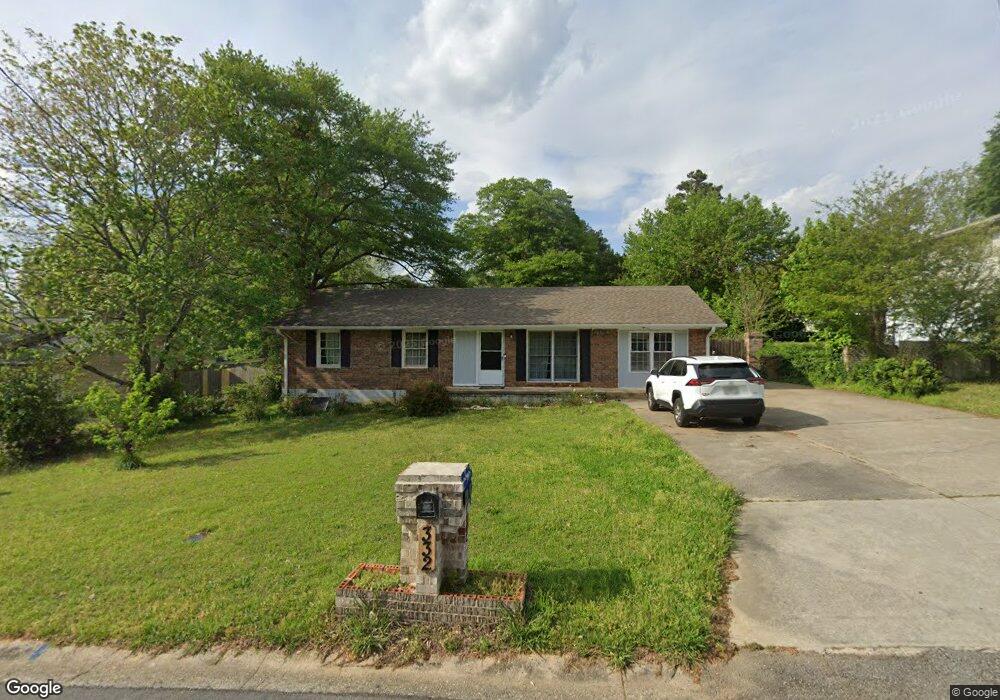
332 Queen Aliese Ln Unit 1 Jonesboro, GA 30236
Estimated Value: $133,000 - $179,000
3
Beds
1
Bath
1,375
Sq Ft
$117/Sq Ft
Est. Value
About This Home
This home is located at 332 Queen Aliese Ln Unit 1, Jonesboro, GA 30236 and is currently estimated at $160,409, approximately $116 per square foot. 332 Queen Aliese Ln Unit 1 is a home located in Clayton County with nearby schools including Kilpatrick Elementary School, Sequoyah Middle School, and Charles R. Drew High School.
Ownership History
Date
Name
Owned For
Owner Type
Purchase Details
Closed on
Sep 3, 2021
Sold by
Pullen Corin
Bought by
Ahp Real Estate Ventures Llc
Current Estimated Value
Purchase Details
Closed on
Mar 7, 2003
Sold by
Looney Joann
Bought by
Dream Builders/Assoc Inc
Purchase Details
Closed on
Jul 27, 1998
Sold by
Appling Calvin W
Bought by
Looney Joann
Home Financials for this Owner
Home Financials are based on the most recent Mortgage that was taken out on this home.
Original Mortgage
$40,500
Interest Rate
6.94%
Mortgage Type
New Conventional
Create a Home Valuation Report for This Property
The Home Valuation Report is an in-depth analysis detailing your home's value as well as a comparison with similar homes in the area
Home Values in the Area
Average Home Value in this Area
Purchase History
| Date | Buyer | Sale Price | Title Company |
|---|---|---|---|
| Ahp Real Estate Ventures Llc | $93,000 | -- | |
| Dream Builders/Assoc Inc | $43,900 | -- | |
| Looney Joann | $45,000 | -- |
Source: Public Records
Mortgage History
| Date | Status | Borrower | Loan Amount |
|---|---|---|---|
| Previous Owner | Looney Joann | $40,500 |
Source: Public Records
Tax History Compared to Growth
Tax History
| Year | Tax Paid | Tax Assessment Tax Assessment Total Assessment is a certain percentage of the fair market value that is determined by local assessors to be the total taxable value of land and additions on the property. | Land | Improvement |
|---|---|---|---|---|
| 2025 | $1,830 | $56,880 | $6,400 | $50,480 |
| 2024 | $1,683 | $52,240 | $6,400 | $45,840 |
| 2023 | $1,895 | $52,480 | $6,400 | $46,080 |
| 2022 | $1,382 | $44,320 | $6,400 | $37,920 |
| 2021 | $996 | $34,320 | $6,400 | $27,920 |
| 2020 | $674 | $25,969 | $6,400 | $19,569 |
| 2019 | $484 | $21,065 | $3,200 | $17,865 |
| 2018 | $393 | $18,824 | $3,200 | $15,624 |
| 2017 | $210 | $14,289 | $3,200 | $11,089 |
| 2016 | $226 | $14,706 | $3,200 | $11,506 |
| 2015 | $231 | $0 | $0 | $0 |
| 2014 | $114 | $11,975 | $3,200 | $8,775 |
Source: Public Records
Map
Nearby Homes
- 7114 Lady Heidi Ct
- 367 Camelot Pkwy
- 7118 Lady Heidi Ct
- 285 Queen Helen Ln
- 446 Queen Aliese Ln
- 474 Autumn Dr
- 7428 Mockingbird Trail
- 213 Whipporwill Way
- 7348 Mockingbird Trail
- 7390 Ovis Ln
- 112 Rivercrest Dr
- 3938 Alderwoods Dr
- 3942 Alderwoods Dr
- 3943 Alderwoods Dr
- 9404 Maple Dr Unit 292
- 9398 Maple Dr
- 543 Wavelyn Way
- 9398 Maple Grove Ln Unit 39
- 9404 Maple Grove Ln Unit 42
- 9404 Maple Grove Ln
- 340 Queen Aliese Ln
- 322 Queen Aliese Ln
- 337 Sir Richard Ct Unit 1
- 7168 Sir Galahad Way
- 348 Queen Aliese Ln
- 327 Sir Richard Ct
- 335 Queen Elise Ln
- 7186 Sir Galahad Way
- 335 Queen Aliese Ln
- 343 Sir Richard Ct Unit 1
- 343 Queen Aliese Ln
- 317 Sir Richard Ct
- 7177 Sir Galahad Way
- 7190 Sir Galahad Way
- 7185 Sir Galahad Way
- 344 Sir Richard Ct
- 7157 Sir Galahad Way
- 358 Camelot Pkwy Unit 1
- 357 Queen Aliese Ln Unit 1
- 354 Camelot Pkwy