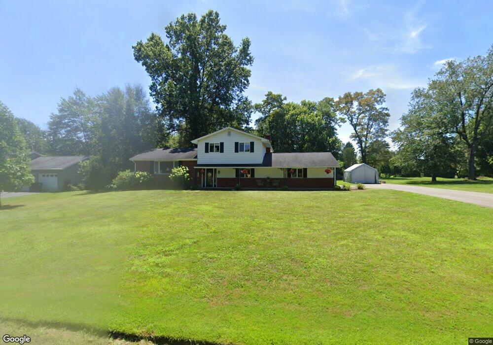
332 Roberts Ln New Castle, PA 16105
Estimated Value: $272,000 - $329,000
3
Beds
3
Baths
2,044
Sq Ft
$149/Sq Ft
Est. Value
About This Home
This home is located at 332 Roberts Ln, New Castle, PA 16105 and is currently estimated at $303,874, approximately $148 per square foot. 332 Roberts Ln is a home located in Lawrence County with nearby schools including Neshannock Memorial Elementary School, Neshannock Junior/Senior High School, and New Castle Christian Academy.
Ownership History
Date
Name
Owned For
Owner Type
Purchase Details
Closed on
Mar 9, 2007
Sold by
Casalandra Robert L and Casalandra Judy C
Bought by
Memo Theodore A and Memo Leanne
Current Estimated Value
Home Financials for this Owner
Home Financials are based on the most recent Mortgage that was taken out on this home.
Original Mortgage
$104,000
Outstanding Balance
$63,431
Interest Rate
6.4%
Mortgage Type
New Conventional
Estimated Equity
$240,443
Create a Home Valuation Report for This Property
The Home Valuation Report is an in-depth analysis detailing your home's value as well as a comparison with similar homes in the area
Home Values in the Area
Average Home Value in this Area
Purchase History
| Date | Buyer | Sale Price | Title Company |
|---|---|---|---|
| Memo Theodore A | $150,000 | None Available |
Source: Public Records
Mortgage History
| Date | Status | Borrower | Loan Amount |
|---|---|---|---|
| Open | Memo Theodore A | $104,000 |
Source: Public Records
Tax History Compared to Growth
Tax History
| Year | Tax Paid | Tax Assessment Tax Assessment Total Assessment is a certain percentage of the fair market value that is determined by local assessors to be the total taxable value of land and additions on the property. | Land | Improvement |
|---|---|---|---|---|
| 2025 | $5,091 | $159,400 | $19,300 | $140,100 |
| 2024 | $4,804 | $159,400 | $19,300 | $140,100 |
| 2023 | $4,631 | $159,400 | $19,300 | $140,100 |
| 2022 | $4,488 | $159,400 | $19,300 | $140,100 |
| 2021 | $4,455 | $158,200 | $19,300 | $138,900 |
| 2020 | $4,371 | $158,200 | $19,300 | $138,900 |
| 2019 | $4,142 | $158,200 | $19,300 | $138,900 |
| 2018 | $4,047 | $158,200 | $19,300 | $138,900 |
| 2017 | $3,871 | $158,200 | $19,300 | $138,900 |
| 2016 | $1,146 | $158,200 | $19,300 | $138,900 |
| 2015 | $1,146 | $158,200 | $19,300 | $138,900 |
| 2014 | $1,146 | $158,200 | $19,300 | $138,900 |
Source: Public Records
Map
Nearby Homes
- 332 E Maitland Ln
- 215 E Maitland Ln
- 411 Lawnview Ave
- 120 Buena Vista Way
- Lot 23 Haven Point Dr
- 2971 Melvin Dr
- 3109 Mercer Rd
- 82 Blews Way
- 2722 Old Plank Rd
- 0 E Maitland Ln Unit 1680590
- 2716 Albert St
- 2560 Blossom Ln
- 3080 Eldogor Ln
- 5 Lilac Rd
- 23 Bellaire Dr
- 407 E Fairfield Ave
- 417 E Hazelcroft Ave
- 3030 Wilmington Rd
- 4305 Matthews Rd
- 702 Court St
- 334 Roberts Ln
- 330 Roberts Ln
- 336 Roberts Ln
- 335 Roberts Ln
- 331 Roberts Ln
- 340 Roberts Ln
- 328 Roberts Ln
- 2911 Locust Ln
- 2919 Mercer Rd
- 337 E Maitland Ln
- 333 E Maitland Ln
- 2915 Mercer Rd
- 2913 Mercer Rd
- 2909 Locust Ln
- 331 E Maitland Ln
- 2934 Trail 1
- 0000 Trail 2 St
- 329 Roberts Ln
- 339 E Maitland Ln
- 2937 Trail 1