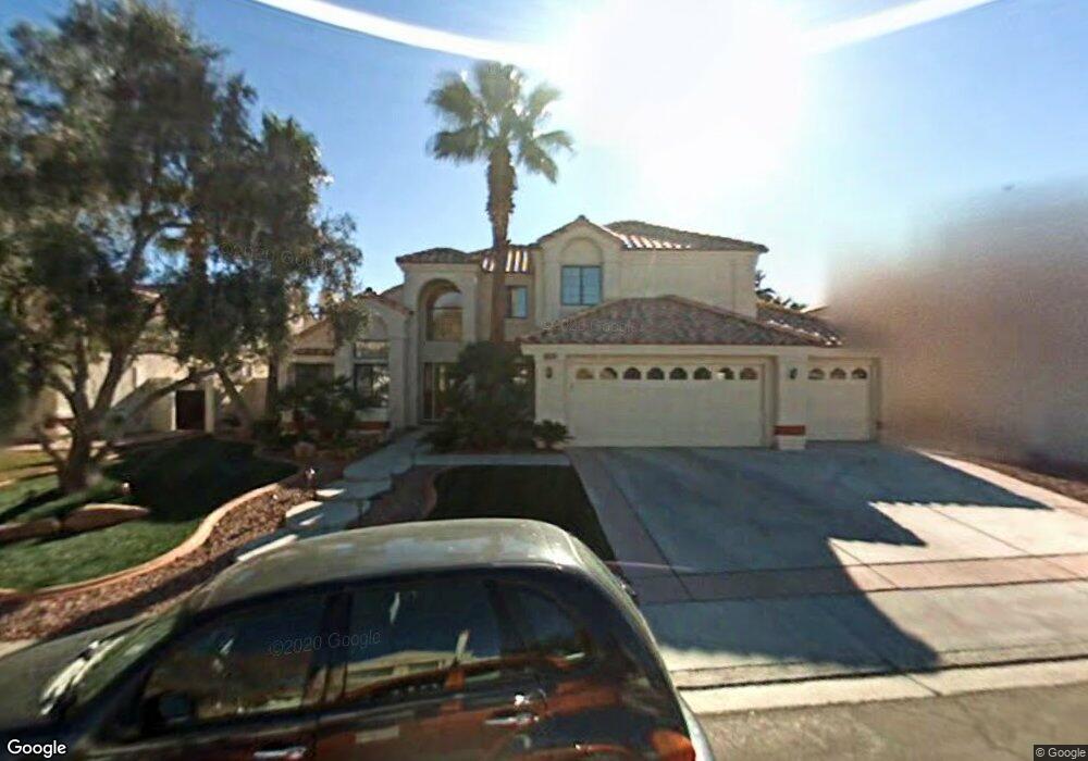
332 S Humboldt Dr Henderson, NV 89074
Green Valley North NeighborhoodEstimated Value: $685,742 - $781,000
5
Beds
3
Baths
2,969
Sq Ft
$243/Sq Ft
Est. Value
About This Home
This home is located at 332 S Humboldt Dr, Henderson, NV 89074 and is currently estimated at $720,686, approximately $242 per square foot. 332 S Humboldt Dr is a home located in Clark County with nearby schools including David M Cox Elementary School, Barbara and Hank Greenspun Junior High School, and Silverado High School.
Ownership History
Date
Name
Owned For
Owner Type
Purchase Details
Closed on
Aug 21, 2025
Sold by
Rubio William and Rubio Juan E
Bought by
Patino William Rubio
Current Estimated Value
Purchase Details
Closed on
Sep 21, 2020
Sold by
Rubio Maria Elsy
Bought by
Rubio William
Home Financials for this Owner
Home Financials are based on the most recent Mortgage that was taken out on this home.
Original Mortgage
$460,000
Interest Rate
2.8%
Mortgage Type
New Conventional
Purchase Details
Closed on
Sep 18, 2020
Sold by
Olson Christopher Michael and Fehrman Debra Mary
Bought by
Rubio Juan E and Rubio William
Home Financials for this Owner
Home Financials are based on the most recent Mortgage that was taken out on this home.
Original Mortgage
$460,000
Interest Rate
2.8%
Mortgage Type
New Conventional
Purchase Details
Closed on
Dec 29, 2017
Sold by
Olson Christopher M and Fehrman Debra M
Bought by
Olson Christopher Michael and Fehrman Debra Mary
Home Financials for this Owner
Home Financials are based on the most recent Mortgage that was taken out on this home.
Original Mortgage
$278,300
Interest Rate
3.92%
Mortgage Type
New Conventional
Purchase Details
Closed on
Nov 3, 2017
Sold by
Olson Christopher M and Fehrman Debra M
Bought by
Olson Christopher M and Fehrman Debra M
Home Financials for this Owner
Home Financials are based on the most recent Mortgage that was taken out on this home.
Original Mortgage
$278,300
Interest Rate
3.92%
Mortgage Type
New Conventional
Purchase Details
Closed on
Apr 3, 2017
Sold by
White Albert G
Bought by
Olson Christopher M and Fehrman Debra M
Home Financials for this Owner
Home Financials are based on the most recent Mortgage that was taken out on this home.
Original Mortgage
$274,500
Interest Rate
4.16%
Mortgage Type
New Conventional
Purchase Details
Closed on
Nov 13, 1996
Sold by
White Terri L
Bought by
White Albert G
Home Financials for this Owner
Home Financials are based on the most recent Mortgage that was taken out on this home.
Original Mortgage
$122,800
Interest Rate
8.06%
Create a Home Valuation Report for This Property
The Home Valuation Report is an in-depth analysis detailing your home's value as well as a comparison with similar homes in the area
Home Values in the Area
Average Home Value in this Area
Purchase History
| Date | Buyer | Sale Price | Title Company |
|---|---|---|---|
| Patino William Rubio | -- | None Listed On Document | |
| Rubio William | -- | Equity Title Of Nevada | |
| Rubio Juan E | $575,000 | Equity Title Of Nevada | |
| Olson Christopher Michael | -- | National Title Co | |
| Olson Christopher M | -- | None Available | |
| Olson Christopher M | $305,000 | Netco | |
| White Albert G | -- | Fidelity National Title |
Source: Public Records
Mortgage History
| Date | Status | Borrower | Loan Amount |
|---|---|---|---|
| Previous Owner | Rubio Juan E | $460,000 | |
| Previous Owner | Olson Christopher Michael | $278,300 | |
| Previous Owner | Olson Christopher M | $274,500 | |
| Previous Owner | White Albert G | $122,800 |
Source: Public Records
Tax History Compared to Growth
Tax History
| Year | Tax Paid | Tax Assessment Tax Assessment Total Assessment is a certain percentage of the fair market value that is determined by local assessors to be the total taxable value of land and additions on the property. | Land | Improvement |
|---|---|---|---|---|
| 2025 | $2,964 | $154,546 | $57,050 | $97,496 |
| 2024 | $2,878 | $154,546 | $57,050 | $97,496 |
| 2023 | $2,294 | $140,458 | $47,250 | $93,208 |
| 2022 | $2,794 | $123,711 | $37,450 | $86,261 |
| 2021 | $2,713 | $120,081 | $37,450 | $82,631 |
| 2020 | $2,631 | $119,901 | $37,450 | $82,451 |
| 2019 | $2,554 | $114,832 | $33,250 | $81,582 |
| 2018 | $2,422 | $104,555 | $27,300 | $77,255 |
| 2017 | $3,102 | $106,999 | $27,300 | $79,699 |
| 2016 | $2,294 | $99,302 | $19,250 | $80,052 |
| 2015 | $2,289 | $90,216 | $16,800 | $73,416 |
| 2014 | $2,222 | $74,422 | $12,250 | $62,172 |
Source: Public Records
Map
Nearby Homes
- 353 Clayton St
- 7483 Forestdale Ct
- 347 Amalfi St
- 2670 Ridgewater Cir
- 319 Carrington St
- 2520 Machado Dr
- 2657 Storey Cir
- 314 Lander Dr
- 367 Lander Dr
- 353 Lander Terrace
- 338 Abbington St
- 2709 Briarcliff Ave
- 346 Abbington St
- 2722 Briarcliff Ave
- 2250 Bowie Cir
- 2544 Wellworth Ave
- 2763 Red Vista Ct
- 2766 Red Vista Ct
- 2775 Red Vista Ct
- 2343 Villandry Ct
- 330 S Humboldt Dr
- 334 S Humboldt Dr
- 328 Humboldt South Dr
- 328 S Humboldt Dr
- 333 Humboldt South Dr
- 333 Humboldt St S
- 335 S Humboldt Dr
- 333 S Humboldt Dr
- 338 S Humboldt Dr
- 337 S Humboldt Dr
- 331 S Humboldt Dr
- 329 S Humboldt Dr
- 340 S Humboldt Dr
- 2566 Machado Dr
- 2564 Machado Dr Unit 422
- 317 Birmingham St
- 339 Keating St
- 342 S Humboldt Dr
- 337 Keating St Unit 422