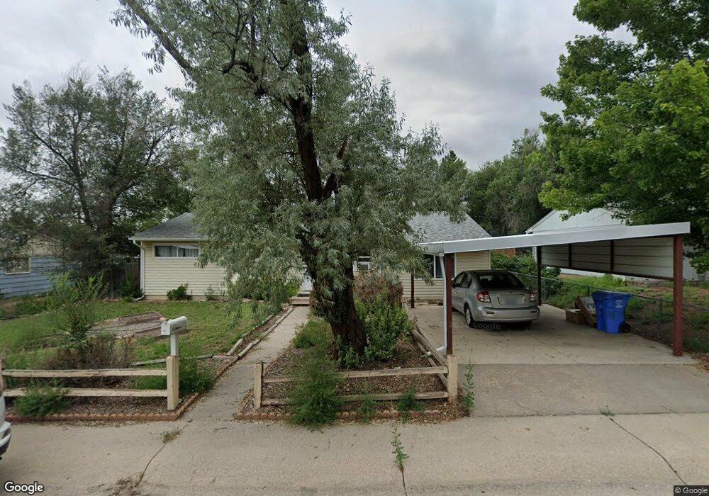
332 Sherri Dr Colorado Springs, CO 80911
Security-Widefield NeighborhoodEstimated Value: $284,000 - $336,000
3
Beds
1
Bath
1,401
Sq Ft
$222/Sq Ft
Est. Value
About This Home
This home is located at 332 Sherri Dr, Colorado Springs, CO 80911 and is currently estimated at $310,946, approximately $221 per square foot. 332 Sherri Dr is a home located in El Paso County with nearby schools including Pinello Elementary School, Sproul Junior High School, and Widefield High School.
Ownership History
Date
Name
Owned For
Owner Type
Purchase Details
Closed on
Aug 8, 2017
Sold by
Lewis David E
Bought by
Dean Marlys C and Dean Ralph W
Current Estimated Value
Home Financials for this Owner
Home Financials are based on the most recent Mortgage that was taken out on this home.
Original Mortgage
$92,250
Interest Rate
3.96%
Mortgage Type
Commercial
Purchase Details
Closed on
Feb 5, 2016
Sold by
Mcadam Family Trust
Bought by
Bottom Line Results Inc
Purchase Details
Closed on
Aug 30, 2004
Sold by
Mcadam Kimberly K
Bought by
Mcadam Family Trust
Purchase Details
Closed on
Feb 7, 2001
Sold by
Mcadam Michael T
Bought by
Mcadam Kimberly K
Purchase Details
Closed on
Jan 31, 1994
Sold by
Scott Christopher A and Scott Kimberly A
Bought by
Mcadam Michael T and Mcadam Kimberly K
Home Financials for this Owner
Home Financials are based on the most recent Mortgage that was taken out on this home.
Original Mortgage
$59,650
Interest Rate
7.5%
Mortgage Type
VA
Purchase Details
Closed on
Jun 12, 1989
Bought by
Dean Ralph W
Purchase Details
Closed on
Oct 1, 1988
Bought by
Dean Ralph W
Purchase Details
Closed on
Aug 28, 1986
Bought by
Dean Marlys C
Purchase Details
Closed on
Dec 1, 1978
Bought by
Dean Ralph W
Create a Home Valuation Report for This Property
The Home Valuation Report is an in-depth analysis detailing your home's value as well as a comparison with similar homes in the area
Home Values in the Area
Average Home Value in this Area
Purchase History
| Date | Buyer | Sale Price | Title Company |
|---|---|---|---|
| Dean Marlys C | $123,000 | Fidelity National Title | |
| Bottom Line Results Inc | -- | None Available | |
| Mcadam Family Trust | -- | -- | |
| Mcadam Kimberly K | -- | -- | |
| Mcadam Michael T | $65,500 | -- | |
| Dean Ralph W | -- | -- | |
| Dean Ralph W | -- | -- | |
| Dean Marlys C | -- | -- | |
| Dean Ralph W | -- | -- |
Source: Public Records
Mortgage History
| Date | Status | Borrower | Loan Amount |
|---|---|---|---|
| Closed | Dean Marlys C | $92,250 | |
| Previous Owner | Mcadam Michael T | $59,650 |
Source: Public Records
Tax History Compared to Growth
Tax History
| Year | Tax Paid | Tax Assessment Tax Assessment Total Assessment is a certain percentage of the fair market value that is determined by local assessors to be the total taxable value of land and additions on the property. | Land | Improvement |
|---|---|---|---|---|
| 2025 | $1,215 | $22,170 | -- | -- |
| 2024 | $1,147 | $20,200 | $4,020 | $16,180 |
| 2023 | $1,147 | $20,200 | $4,020 | $16,180 |
| 2022 | $1,050 | $14,060 | $2,780 | $11,280 |
| 2021 | $1,132 | $14,460 | $2,860 | $11,600 |
| 2020 | $803 | $9,970 | $2,500 | $7,470 |
| 2019 | $799 | $9,970 | $2,500 | $7,470 |
| 2018 | $768 | $8,950 | $1,870 | $7,080 |
| 2017 | $777 | $8,950 | $1,870 | $7,080 |
| 2016 | $607 | $8,540 | $1,990 | $6,550 |
| 2015 | $622 | $8,540 | $1,990 | $6,550 |
| 2014 | $573 | $7,900 | $1,790 | $6,110 |
Source: Public Records
Map
Nearby Homes
- 324 Davie Dr
- 309 Davie Dr
- 308 Steven Dr
- 605 Birch Dr
- 317 Everett Dr
- 405 Birch Dr
- 257 Sherri Dr
- 217 Steven Dr
- 4790 Hennings Dr
- 213 Sumac Dr
- 208 Davie Dr
- 1620 Widefield Dr
- 4666 Hennings Dr
- 4658 Hennings Dr
- 124 Sumac Dr
- 1209 Rosemont Dr
- 509 Inca Dr
- 4950 Elm Grove Dr
- 4634 Cassidy St
- 4613 Pleasant Port View Unit 2