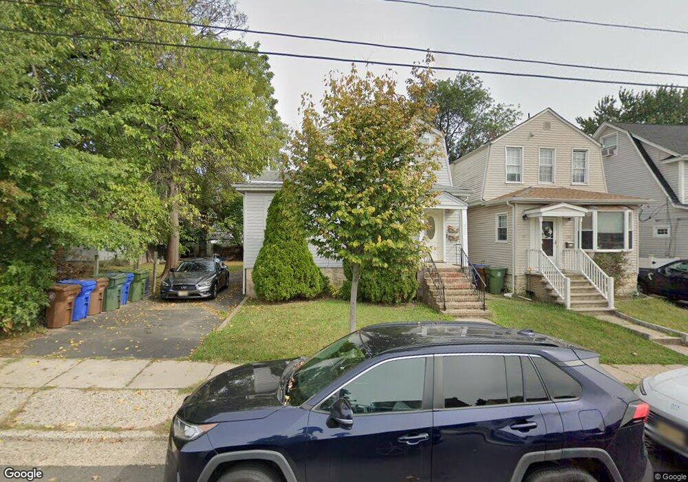
332 Spruce St Linden, NJ 07036
Estimated Value: $510,000 - $675,000
--
Bed
--
Bath
1,275
Sq Ft
$466/Sq Ft
Est. Value
About This Home
This home is located at 332 Spruce St, Linden, NJ 07036 and is currently estimated at $594,126, approximately $465 per square foot. 332 Spruce St is a home located in Union County with nearby schools including School No. 8, Myles J. McManus Middle School, and Linden High School.
Ownership History
Date
Name
Owned For
Owner Type
Purchase Details
Closed on
Mar 22, 2004
Sold by
Garrido Freddie
Bought by
Roca Gerardo and Roca Flor
Current Estimated Value
Home Financials for this Owner
Home Financials are based on the most recent Mortgage that was taken out on this home.
Original Mortgage
$334,594
Outstanding Balance
$156,812
Interest Rate
5.71%
Mortgage Type
FHA
Estimated Equity
$437,314
Purchase Details
Closed on
Apr 19, 1996
Sold by
Levine Murray and Levine Louis A
Bought by
Garrido Freddie and Garrido Maria Victoria
Create a Home Valuation Report for This Property
The Home Valuation Report is an in-depth analysis detailing your home's value as well as a comparison with similar homes in the area
Home Values in the Area
Average Home Value in this Area
Purchase History
| Date | Buyer | Sale Price | Title Company |
|---|---|---|---|
| Roca Gerardo | $347,000 | -- | |
| Garrido Freddie | $180,000 | -- |
Source: Public Records
Mortgage History
| Date | Status | Borrower | Loan Amount |
|---|---|---|---|
| Open | Roca Gerardo | $334,594 |
Source: Public Records
Tax History Compared to Growth
Tax History
| Year | Tax Paid | Tax Assessment Tax Assessment Total Assessment is a certain percentage of the fair market value that is determined by local assessors to be the total taxable value of land and additions on the property. | Land | Improvement |
|---|---|---|---|---|
| 2025 | $12,116 | $172,300 | $68,500 | $103,800 |
| 2024 | $11,851 | $172,300 | $68,500 | $103,800 |
| 2023 | $11,851 | $172,300 | $68,500 | $103,800 |
| 2022 | $11,913 | $172,300 | $68,500 | $103,800 |
| 2021 | $11,973 | $172,300 | $68,500 | $103,800 |
| 2020 | $11,909 | $172,300 | $68,500 | $103,800 |
| 2019 | $11,870 | $172,300 | $68,500 | $103,800 |
| 2018 | $11,866 | $172,300 | $68,500 | $103,800 |
| 2017 | $11,610 | $172,300 | $68,500 | $103,800 |
| 2016 | $11,244 | $172,300 | $68,500 | $103,800 |
| 2015 | $10,815 | $172,300 | $68,500 | $103,800 |
| 2014 | $10,605 | $172,300 | $68,500 | $103,800 |
Source: Public Records
Map
Nearby Homes
- 505 Knopf St
- 324 Dewitt St
- 606 Knopf St
- 435 Miner Terrace
- 419 Lafayette St
- 428 Brook St
- 420 Miltonia St
- 349 Miltonia St
- 28 W Elizabeth Ave Unit A3
- 600 W Henry St
- 312 Amon Terrace
- 18 Hussa St
- 10 N Wood Ave Unit 706
- 10 N Wood Ave Unit 312
- 10 N Wood Ave Unit 700
- 10 N Wood Ave Unit 214
- 10 N Wood Ave Unit 323
- 212 W Morris Ave
- 30 E Henry St
- 717 Summit St
- 330 Spruce St
- 411 Knopf St
- 419 Knopf St
- 333 Miner Terrace
- 325 Miner Terrace
- 407 Knopf St Unit 409
- 326 Spruce St
- 323 Miner Terrace
- 405 Knopf St Unit 1
- 405 Knopf St
- 501 Knopf St
- 317 Miner Terrace
- 401 Knopf St
- 339 Spruce St
- 335 Spruce St
- 331 Spruce St
- 318 Spruce St
- 315 Miner Terrace
- 314 Spruce St
- 309 Miner Terrace