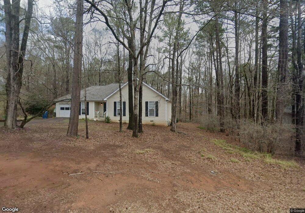
332 Stonybrook Cir Athens, GA 30605
Estimated Value: $288,000 - $320,000
3
Beds
2
Baths
1,327
Sq Ft
$230/Sq Ft
Est. Value
About This Home
This home is located at 332 Stonybrook Cir, Athens, GA 30605 and is currently estimated at $305,821, approximately $230 per square foot. 332 Stonybrook Cir is a home located in Clarke County with nearby schools including Barnett Shoals Elementary School, Hilsman Middle School, and Cedar Shoals High School.
Ownership History
Date
Name
Owned For
Owner Type
Purchase Details
Closed on
Jun 1, 2010
Sold by
Kent Robert B
Bought by
Wilson Suzanne
Current Estimated Value
Home Financials for this Owner
Home Financials are based on the most recent Mortgage that was taken out on this home.
Original Mortgage
$133,403
Outstanding Balance
$91,023
Interest Rate
5.5%
Mortgage Type
FHA
Estimated Equity
$214,798
Purchase Details
Closed on
Oct 17, 1994
Sold by
Rod Wright J and Rod Wright
Bought by
Kent Robert B and Kent Celeste Z
Purchase Details
Closed on
Jun 20, 1994
Sold by
Brookstone Subdivision Inc
Bought by
Rod Wright J and Rod Wright
Create a Home Valuation Report for This Property
The Home Valuation Report is an in-depth analysis detailing your home's value as well as a comparison with similar homes in the area
Home Values in the Area
Average Home Value in this Area
Purchase History
| Date | Buyer | Sale Price | Title Company |
|---|---|---|---|
| Wilson Suzanne | $135,200 | -- | |
| Kent Robert B | $89,900 | -- | |
| Rod Wright J | $14,000 | -- |
Source: Public Records
Mortgage History
| Date | Status | Borrower | Loan Amount |
|---|---|---|---|
| Open | Wilson Suzanne | $133,403 |
Source: Public Records
Tax History Compared to Growth
Tax History
| Year | Tax Paid | Tax Assessment Tax Assessment Total Assessment is a certain percentage of the fair market value that is determined by local assessors to be the total taxable value of land and additions on the property. | Land | Improvement |
|---|---|---|---|---|
| 2025 | $1,793 | $110,015 | $12,000 | $98,015 |
| 2024 | $1,793 | $102,683 | $12,000 | $90,683 |
| 2023 | $617 | $97,562 | $12,000 | $85,562 |
| 2022 | $1,796 | $82,903 | $10,400 | $72,503 |
| 2021 | $1,656 | $65,560 | $10,400 | $55,160 |
| 2020 | $1,554 | $58,137 | $10,400 | $47,737 |
| 2019 | $1,519 | $54,730 | $10,400 | $44,330 |
| 2018 | $1,429 | $52,078 | $10,400 | $41,678 |
| 2017 | $1,275 | $47,568 | $10,400 | $37,168 |
| 2016 | $1,184 | $44,862 | $10,400 | $34,462 |
| 2015 | $1,327 | $49,021 | $10,400 | $38,621 |
| 2014 | $1,343 | $49,413 | $10,400 | $39,013 |
Source: Public Records
Map
Nearby Homes
- 375 Brookstone Dr
- 123 Stonybrook Ct
- 153 Stonybrook Ct
- 309 Twin Creek Shores
- 355 Discovery Trail
- 145 Myles Ct
- 365 Discovery Trail
- 350 Discovery Trail
- 345 Richard Way
- 0 Williamsburg Ln Unit Lot 5
- 0 Williamsburg Ln Unit Lot 7
- 0 Williamsburg Ln Unit Lot 6
- 439 River Chase Dr
- 200 Wiltshire Dr
- 440 Wood Ln
- 489 River Chase Dr
- 322 Stonybrook Cir
- 342 Stonybrook Cir
- 312 Stonybrook Cir
- 321 Stonybrook Cir
- 351 Stonybrook Cir
- 302 Stonybrook Cir
- 281 Stonybrook Cir
- 135 Brookstone Place
- 292 Stonybrook Cir
- 120 Brookstone Place
- 271 Stonybrook Cir
- 105 Stonybrook Place
- 251 Stonybrook Cir
- 125 Brookstone Place
- 230 Pebble Creek Dr
- 240 Pebble Creek Dr
- 221 Stonybrook Cir
- 110 Brookstone Place
- 231 Stonybrook Cir