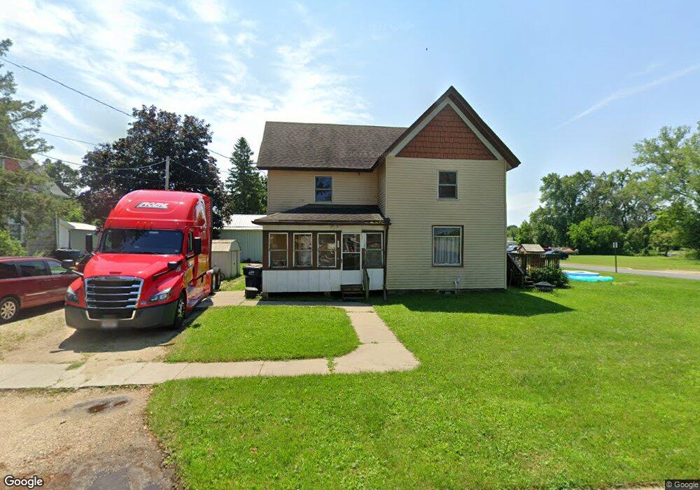
332 Tweedy St Hustisford, WI 53034
Estimated Value: $197,431 - $385,000
--
Bed
--
Bath
--
Sq Ft
8,276
Sq Ft Lot
About This Home
This home is located at 332 Tweedy St, Hustisford, WI 53034 and is currently estimated at $265,858. 332 Tweedy St is a home located in Dodge County with nearby schools including John Hustis Elementary School, Hustisford High School, and Bethany Lutheran School.
Ownership History
Date
Name
Owned For
Owner Type
Purchase Details
Closed on
Dec 12, 2014
Sold by
U S Bank Na
Bought by
Tweedy Llc
Current Estimated Value
Purchase Details
Closed on
Dec 8, 2012
Sold by
White Richard C
Bought by
U S Bank Na
Purchase Details
Closed on
May 9, 2007
Sold by
Lem Financial
Bought by
White Richard C
Home Financials for this Owner
Home Financials are based on the most recent Mortgage that was taken out on this home.
Original Mortgage
$118,750
Interest Rate
9.85%
Mortgage Type
Adjustable Rate Mortgage/ARM
Purchase Details
Closed on
Mar 19, 2007
Sold by
Terwelp Kathy J
Bought by
Lem Financial
Home Financials for this Owner
Home Financials are based on the most recent Mortgage that was taken out on this home.
Original Mortgage
$118,750
Interest Rate
9.85%
Mortgage Type
Adjustable Rate Mortgage/ARM
Create a Home Valuation Report for This Property
The Home Valuation Report is an in-depth analysis detailing your home's value as well as a comparison with similar homes in the area
Home Values in the Area
Average Home Value in this Area
Purchase History
| Date | Buyer | Sale Price | Title Company |
|---|---|---|---|
| Tweedy Llc | $38,000 | None Available | |
| U S Bank Na | -- | None Available | |
| White Richard C | $125,000 | None Available | |
| Lem Financial | -- | None Available |
Source: Public Records
Mortgage History
| Date | Status | Borrower | Loan Amount |
|---|---|---|---|
| Previous Owner | White Richard C | $118,750 |
Source: Public Records
Tax History Compared to Growth
Tax History
| Year | Tax Paid | Tax Assessment Tax Assessment Total Assessment is a certain percentage of the fair market value that is determined by local assessors to be the total taxable value of land and additions on the property. | Land | Improvement |
|---|---|---|---|---|
| 2024 | $2,012 | $157,600 | $32,000 | $125,600 |
| 2023 | $2,002 | $86,000 | $23,700 | $62,300 |
| 2022 | $2,249 | $86,000 | $23,700 | $62,300 |
| 2021 | $2,306 | $86,000 | $23,700 | $62,300 |
| 2020 | $2,344 | $86,000 | $23,700 | $62,300 |
| 2019 | $2,248 | $86,000 | $23,700 | $62,300 |
| 2018 | $2,023 | $86,000 | $23,700 | $62,300 |
| 2017 | $2,044 | $86,000 | $23,700 | $62,300 |
| 2016 | $2,136 | $86,000 | $23,700 | $62,300 |
| 2015 | $2,124 | $86,000 | $23,700 | $62,300 |
| 2014 | $2,143 | $86,000 | $23,700 | $62,300 |
Source: Public Records
Map
Nearby Homes
- .68 Acre Parcel Anthony Island
- 252 S Hustis St
- 244 S Ridge St
- 441 Sandy Ln
- 727 E Lakeview Rd Unit 8
- W4436 E Lakeview Rd
- N4510 & N4504 Anthony Island
- 827 E Lakeview Rd
- N4510 Anthony Island -
- N4569 Hazelwood Rd
- N4557 Lakeview Rd
- N4554 Lakeview Rd
- N4973 Lake Dr
- Lt38 Sinissippi Point Rd
- N4550 County Road Dj
- N3220 Hale Rd
- N5413 County Rd S
- W2824 Fox Rd
- 0 Burkwald Ave
- Lot 2 Sleepy Hollow
- 322 Tweedy St
- 130 S Hustis St
- 337 Tweedy St
- 337 Tweedy St
- 337 W Tweedy St
- 122 S Hustis St
- 325 Tweedy St
- 141 N Highland St
- 125 N Highland St
- 305 Tweedy St
- 211 N Highland St
- 335 W Juneau St
- 325 W Juneau St
- W3910 State Road 60
- 313 W Juneau St
- 405 W Juneau St
- 221 N Highland St
- 132 Highland St
- 303 W Juneau St
- 415 W Juneau St