Estimated Value: $110,000 - $153,000
3
Beds
1
Bath
1,210
Sq Ft
$103/Sq Ft
Est. Value
About This Home
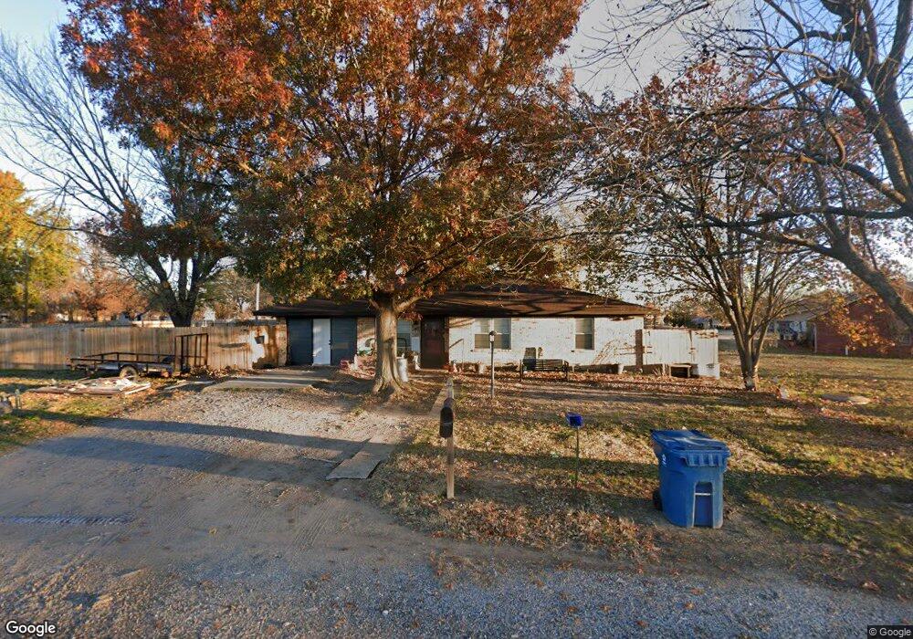
This home is located at 332 W 4th St, Kiowa, OK 74553 and is currently estimated at $124,311, approximately $102 per square foot. 332 W 4th St is a home with nearby schools including Kiowa High School.
Ownership History
Date
Name
Owned For
Owner Type
Purchase Details
Closed on
Jan 30, 2024
Sold by
Santino John Michael
Bought by
Horn Mandy and Horn Tanner B
Current Estimated Value
Purchase Details
Closed on
May 15, 2020
Sold by
Stone Randi
Bought by
Adams Faith and Horn Tanner
Home Financials for this Owner
Home Financials are based on the most recent Mortgage that was taken out on this home.
Original Mortgage
$82,828
Interest Rate
3.3%
Mortgage Type
New Conventional
Purchase Details
Closed on
Feb 12, 2018
Sold by
Annie L Maxwell Trust
Bought by
Stone Randi
Home Financials for this Owner
Home Financials are based on the most recent Mortgage that was taken out on this home.
Original Mortgage
$68,000
Interest Rate
3.99%
Mortgage Type
Commercial
Create a Home Valuation Report for This Property
The Home Valuation Report is an in-depth analysis detailing your home's value as well as a comparison with similar homes in the area
Home Values in the Area
Average Home Value in this Area
Purchase History
| Date | Buyer | Sale Price | Title Company |
|---|---|---|---|
| Horn Mandy | -- | None Listed On Document | |
| Adams Faith | $82,000 | Nations Title Of Okc | |
| Stone Randi | $60,000 | None Available |
Source: Public Records
Mortgage History
| Date | Status | Borrower | Loan Amount |
|---|---|---|---|
| Previous Owner | Adams Faith | $82,828 | |
| Previous Owner | Stone Randi | $68,000 |
Source: Public Records
Tax History Compared to Growth
Tax History
| Year | Tax Paid | Tax Assessment Tax Assessment Total Assessment is a certain percentage of the fair market value that is determined by local assessors to be the total taxable value of land and additions on the property. | Land | Improvement |
|---|---|---|---|---|
| 2024 | $765 | $10,166 | $300 | $9,866 |
| 2023 | $765 | $9,682 | $300 | $9,382 |
| 2022 | $694 | $9,221 | $300 | $8,921 |
| 2021 | $679 | $9,020 | $295 | $8,725 |
| 2020 | $563 | $7,480 | $300 | $7,180 |
| 2019 | $563 | $7,480 | $300 | $7,180 |
| 2018 | $244 | $3,237 | $213 | $3,024 |
| 2017 | $82 | $3,083 | $299 | $2,784 |
| 2016 | $78 | $3,037 | $299 | $2,738 |
| 2015 | $78 | $3,037 | $299 | $2,738 |
| 2014 | $78 | $3,037 | $299 | $2,738 |
Source: Public Records
Map
Nearby Homes
- 16379 N Highway 69
- 0 N Highway 69
- 803 S Jackson St
- 31 8th St
- 707 W 9th St
- 644 S Dewey St
- 630 S Oyama St
- 1032 Cherry St
- 18639 S Us Highway 69
- 19118 U S 69
- 609 First St
- 210 4th St
- 00 Adele Rd
- 0 Patton Unit 2538586
- 6363 S Brewer Rd
- 438 S Taylor
- 0 S Brewer Rd Unit 2503451
- 0 S Brewer Rd Unit 2503395
- 1780 S Blanco Rd
- 1197 Burns
- 401 W 4th St
- 321 S Van Buren St
- 308 S Van Buren St
- 336 S Van Buren St
- 345 W 3rd St
- 409 S Taylor St
- 1811 Nightingale Cir
- 298 W 3rd St
- 439 W Taylor Ave
- 437 W 4th St
- 438 W 3rd St
- 908 S Lincoln Ave
- 54 Country Aire Ave
- 429 W 6th St
- 118 W 5th St
- 436 S Grant Ave
- 309 S Jackson St
- 501 W 4th St
- 305 S Jackson St
- 338 SE 7th St