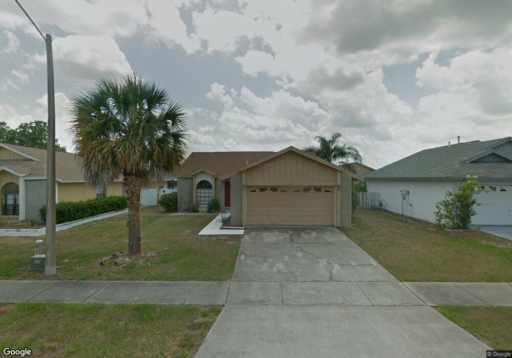
3320 Smoke Signal Cir Unit 5 Kissimmee, FL 34746
North Kissimmee NeighborhoodEstimated Value: $301,000 - $369,000
3
Beds
2
Baths
1,328
Sq Ft
$248/Sq Ft
Est. Value
About This Home
This home is located at 3320 Smoke Signal Cir Unit 5, Kissimmee, FL 34746 and is currently estimated at $329,932, approximately $248 per square foot. 3320 Smoke Signal Cir Unit 5 is a home located in Osceola County with nearby schools including Reedy Creek Elementary School, Kissimmee Middle School, and Celebration High School.
Ownership History
Date
Name
Owned For
Owner Type
Purchase Details
Closed on
Jul 6, 2011
Sold by
Naqvi Ahmed Farid and Naqvi Mukhtar Ali
Bought by
Lamnawar Mohamed and Allouch Amina
Current Estimated Value
Home Financials for this Owner
Home Financials are based on the most recent Mortgage that was taken out on this home.
Original Mortgage
$62,500
Interest Rate
4.62%
Mortgage Type
Purchase Money Mortgage
Purchase Details
Closed on
Feb 4, 2002
Sold by
Twenhofel Robert W and Peterson Karen R
Bought by
Niqui Ahmed Farid and Naqui Mukhtar Ali
Create a Home Valuation Report for This Property
The Home Valuation Report is an in-depth analysis detailing your home's value as well as a comparison with similar homes in the area
Home Values in the Area
Average Home Value in this Area
Purchase History
| Date | Buyer | Sale Price | Title Company |
|---|---|---|---|
| Lamnawar Mohamed | $112,500 | Medallion Title Services Inc | |
| Niqui Ahmed Farid | $110,500 | -- |
Source: Public Records
Mortgage History
| Date | Status | Borrower | Loan Amount |
|---|---|---|---|
| Closed | Lamnawar Mohamed | $62,500 |
Source: Public Records
Tax History Compared to Growth
Tax History
| Year | Tax Paid | Tax Assessment Tax Assessment Total Assessment is a certain percentage of the fair market value that is determined by local assessors to be the total taxable value of land and additions on the property. | Land | Improvement |
|---|---|---|---|---|
| 2024 | $1,529 | $95,147 | -- | -- |
| 2023 | $1,529 | $92,376 | $0 | $0 |
| 2022 | $1,415 | $88,624 | $0 | $0 |
| 2021 | $1,376 | $86,043 | $0 | $0 |
| 2020 | $1,322 | $84,856 | $0 | $0 |
| 2019 | $1,265 | $82,470 | $0 | $0 |
| 2018 | $1,169 | $80,933 | $0 | $0 |
| 2017 | $1,152 | $79,269 | $0 | $0 |
| 2016 | $1,133 | $77,639 | $0 | $0 |
| 2015 | $1,117 | $77,100 | $0 | $0 |
| 2014 | $1,109 | $76,489 | $0 | $0 |
Source: Public Records
Map
Nearby Homes
- 3149 Bear Path
- 3105 Arrow Dr
- 3228 Running Bear Way
- 3192 Running Deer Path
- 5118 Adelaide Dr
- 5149 Adelaide Dr
- 5117 Killarney Way
- 5160 Adelaide Dr
- 5371 Lonesome Dove Dr
- 3143 Tocoa Cir
- 5112 Killarney Way
- 3143 Pinto Dr
- 5267 Images Cir Unit 303
- 3181 Tocoa Cir
- 5263 Images Cir Unit 306
- 3201 Tocoa Cir Unit 3
- 0 Polynesian Isles Blvd
- 5291 Images Cir Unit 302
- 3013 Bonfire Beach Dr Unit 101
- 3017 Bonfire Beach Dr Unit 203
- 3310 Smoke Signal Cir
- 3330 Smoke Signal Cir
- 3617 Anibal St
- 3605 Anibal St
- 3170 Smoke Signal Cir
- 3300 Smoke Signal Cir
- 3340 Smoke Signal Cir
- 3160 Smoke Signal Cir
- 3190 Smoke Signal Cir
- 3200 Smoke Signal Cir
- 3150 Smoke Signal Cir
- 3325 Smoke Signal Cir
- 3315 Smoke Signal Cir
- 3335 Smoke Signal Cir
- 3278 Smoke Signal Cir
- 3305 Smoke Signal Cir
- 3345 Smoke Signal Cir
- 3240 Smoke Signal Cir
- 3130 Smoke Signal Cir
- 3230 Smoke Signal Cir