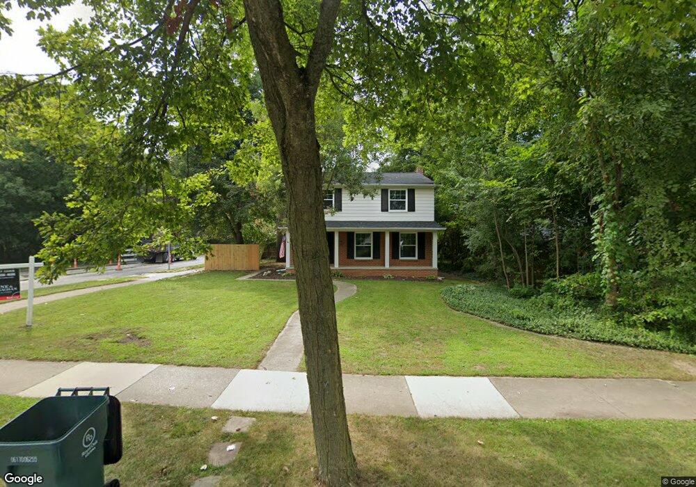
3320 Vinsetta Blvd Unit Bldg-Unit Royal Oak, MI 48073
Estimated Value: $538,000 - $677,000
4
Beds
3
Baths
1,932
Sq Ft
$307/Sq Ft
Est. Value
About This Home
This home is located at 3320 Vinsetta Blvd Unit Bldg-Unit, Royal Oak, MI 48073 and is currently estimated at $594,001, approximately $307 per square foot. 3320 Vinsetta Blvd Unit Bldg-Unit is a home located in Oakland County with nearby schools including Northwood Elementary School, Royal Oak Middle School, and Royal Oak High School.
Ownership History
Date
Name
Owned For
Owner Type
Purchase Details
Closed on
Apr 26, 2019
Sold by
Swartz Frankie D
Bought by
Baker Derek and Baker Alyssa
Current Estimated Value
Home Financials for this Owner
Home Financials are based on the most recent Mortgage that was taken out on this home.
Original Mortgage
$395,000
Outstanding Balance
$347,285
Interest Rate
4.2%
Mortgage Type
New Conventional
Estimated Equity
$246,716
Purchase Details
Closed on
Feb 23, 2018
Sold by
The Estate Of Doris Jane Mcdonald
Bought by
Swartz Frankie D
Create a Home Valuation Report for This Property
The Home Valuation Report is an in-depth analysis detailing your home's value as well as a comparison with similar homes in the area
Home Values in the Area
Average Home Value in this Area
Purchase History
| Date | Buyer | Sale Price | Title Company |
|---|---|---|---|
| Baker Derek | $395,000 | None Available | |
| Swartz Frankie D | $275,000 | None Available |
Source: Public Records
Mortgage History
| Date | Status | Borrower | Loan Amount |
|---|---|---|---|
| Open | Baker Derek | $395,000 |
Source: Public Records
Tax History Compared to Growth
Tax History
| Year | Tax Paid | Tax Assessment Tax Assessment Total Assessment is a certain percentage of the fair market value that is determined by local assessors to be the total taxable value of land and additions on the property. | Land | Improvement |
|---|---|---|---|---|
| 2024 | $6,174 | $223,570 | $0 | $0 |
| 2022 | $7,295 | $200,230 | $0 | $0 |
| 2020 | $5,999 | $181,930 | $0 | $0 |
| 2018 | $7,295 | $128,180 | $0 | $0 |
| 2017 | $5,029 | $128,180 | $0 | $0 |
| 2015 | -- | $123,250 | $0 | $0 |
| 2014 | -- | $120,370 | $0 | $0 |
| 2011 | -- | $139,410 | $0 | $0 |
Source: Public Records
Map
Nearby Homes
- 3316 Vinsetta Blvd
- 3303 Vinsetta Blvd
- 127 La Plaza Ct
- 227 W Houstonia Ave
- 2115 Marywood Dr
- 508 W Houstonia Ave
- 436 Girard Ave
- 2931 N Main St
- 419 Linden Ave
- 1833 N Washington Ave
- 1828 N Lafayette Ave
- 1821 N Washington Ave
- 214 W 12 Mile Rd
- 629 W Houstonia Ave
- 412 Oak Run Ct Unit 6
- 333 E La Salle Ave
- 817 Magnolia Ave
- 626 Fairway Dr
- 140 E Lawrence Ave
- 903 Hickory Ave
- 3320 Vinsetta Blvd
- 2415 N Main St
- 2405 N Main St
- 3310 Vinsetta Blvd
- 118 Potawatomi Blvd
- 3304 Vinsetta Blvd
- 122 Potawatomi Blvd
- 3321 Vinsetta Blvd
- 3315 Vinsetta Blvd
- 3309 Vinsetta Blvd
- 132 Potawatomi Blvd
- 3220 Vinsetta Blvd
- 202 Potawatomi Blvd
- 2341 N Main St
- 3212 Vinsetta Blvd
- 2333 N Main St
- 3208 Vinsetta Blvd
- 123 Potawatomi Blvd
- 3215 Vinsetta Blvd
- 2517 N Main St