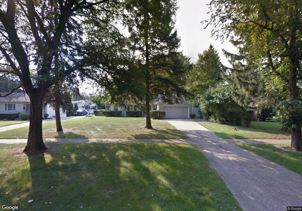
3321 Hawthorne Dr Flint, MI 48503
Woodcroft Estates NeighborhoodEstimated Value: $154,150 - $238,000
3
Beds
3
Baths
1,572
Sq Ft
$127/Sq Ft
Est. Value
About This Home
This home is located at 3321 Hawthorne Dr, Flint, MI 48503 and is currently estimated at $199,788, approximately $127 per square foot. 3321 Hawthorne Dr is a home located in Genesee County with nearby schools including Durant-Tuuri-Mott Elementary School, Flint Southwestern Classical Academy, and St. Paul Lutheran School.
Ownership History
Date
Name
Owned For
Owner Type
Purchase Details
Closed on
Mar 22, 2004
Sold by
Valacak Kimberly W
Bought by
Taylor Debby
Current Estimated Value
Home Financials for this Owner
Home Financials are based on the most recent Mortgage that was taken out on this home.
Original Mortgage
$89,200
Outstanding Balance
$38,249
Interest Rate
4.5%
Mortgage Type
Purchase Money Mortgage
Estimated Equity
$161,539
Purchase Details
Closed on
Mar 17, 2004
Sold by
Valacak Kimberly W and The Estate Of Charlotte Doroth
Bought by
Valacak Kimberly W
Home Financials for this Owner
Home Financials are based on the most recent Mortgage that was taken out on this home.
Original Mortgage
$89,200
Outstanding Balance
$38,249
Interest Rate
4.5%
Mortgage Type
Purchase Money Mortgage
Estimated Equity
$161,539
Create a Home Valuation Report for This Property
The Home Valuation Report is an in-depth analysis detailing your home's value as well as a comparison with similar homes in the area
Home Values in the Area
Average Home Value in this Area
Purchase History
| Date | Buyer | Sale Price | Title Company |
|---|---|---|---|
| Taylor Debby | $120,000 | Title Michigan Agency Ltd | |
| Valacak Kimberly W | -- | Title Michigan Agency Ltd |
Source: Public Records
Mortgage History
| Date | Status | Borrower | Loan Amount |
|---|---|---|---|
| Open | Taylor Debby | $89,200 | |
| Closed | Taylor Debby | $30,800 |
Source: Public Records
Tax History Compared to Growth
Tax History
| Year | Tax Paid | Tax Assessment Tax Assessment Total Assessment is a certain percentage of the fair market value that is determined by local assessors to be the total taxable value of land and additions on the property. | Land | Improvement |
|---|---|---|---|---|
| 2025 | $1,741 | $68,300 | $0 | $0 |
| 2024 | $1,551 | $66,800 | $0 | $0 |
| 2023 | $1,508 | $62,000 | $0 | $0 |
| 2022 | $0 | $52,500 | $0 | $0 |
| 2021 | $1,586 | $48,400 | $0 | $0 |
| 2020 | $1,403 | $43,800 | $0 | $0 |
| 2019 | $1,351 | $43,800 | $0 | $0 |
| 2018 | $1,408 | $42,400 | $0 | $0 |
| 2017 | $1,363 | $0 | $0 | $0 |
| 2016 | $1,352 | $0 | $0 | $0 |
| 2015 | -- | $0 | $0 | $0 |
| 2014 | -- | $0 | $0 | $0 |
| 2012 | -- | $26,500 | $0 | $0 |
Source: Public Records
Map
Nearby Homes
- 3401 Westwood Pkwy
- 3102 Westwood Pkwy
- 3402 Brandon St
- 3001 Yale St
- 3506 Chicago Blvd
- 3305 Larchmont St
- 2926 Yale St
- 3214 Clairmont St
- 3217 Arlene Ave
- 1414 Knapp Ave
- 3813 Larchmont St
- 1326 Hughes Ave
- 1318 Knapp Ave
- 1412 S Ballenger Hwy
- 3918 Larchmont St
- 1308 Barney Ave
- 1217 Barney Ave
- 1202 Knapp Ave
- 3413 Augusta St
- 1122 Stocker Ave
- 3311 Hawthorne Dr
- 2011 Briar Hill Rd
- 2021 Briar Hill Rd
- 3301 Hawthorne Dr
- 3322 Hawthorne Dr
- 2041 Briar Hill Rd
- 2038 Crooked Ln
- 3401 Hawthorne Dr
- 3211 Hawthorne Dr
- 3330 Hawthorne Dr
- 2046 Crooked Ln
- 3302 Hawthorne Dr
- 2010 Briar Hill Rd
- 2020 Crooked Ln
- 3402 Hawthorne Dr
- 2054 Crooked Ln
- 3216 Hawthorne Dr
- 3411 Hawthorne Dr
- 3325 Miller Rd
- 3313 Miller Rd