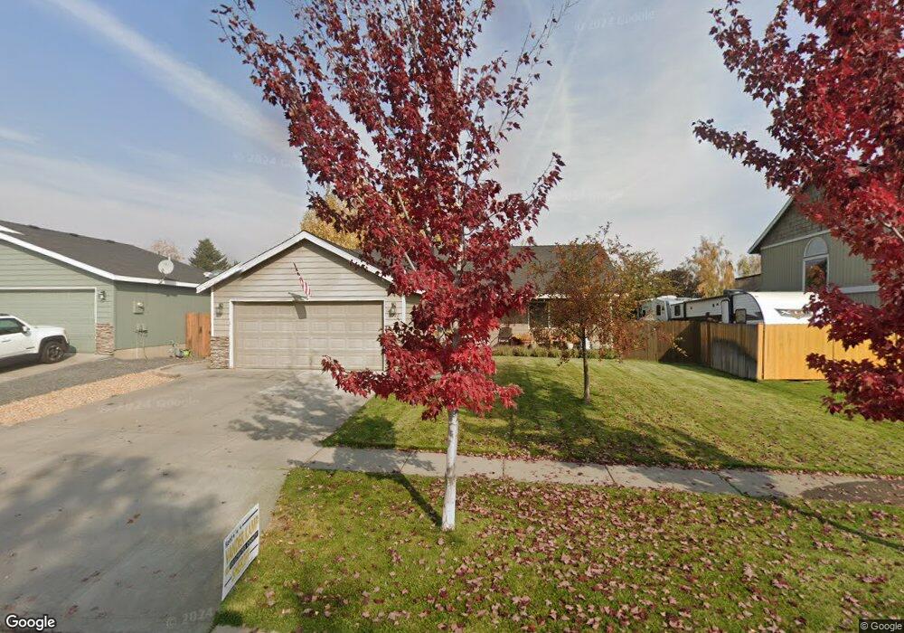
3322 NE Mendenhall Dr Bend, OR 97701
Mountain View NeighborhoodEstimated Value: $502,000 - $525,000
4
Beds
2
Baths
1,366
Sq Ft
$375/Sq Ft
Est. Value
About This Home
This home is located at 3322 NE Mendenhall Dr, Bend, OR 97701 and is currently estimated at $512,558, approximately $375 per square foot. 3322 NE Mendenhall Dr is a home located in Deschutes County with nearby schools including Buckingham Elementary School, Pilot Butte Middle School, and Mountain View Senior High School.
Ownership History
Date
Name
Owned For
Owner Type
Purchase Details
Closed on
Sep 30, 2004
Sold by
Scott Regan L and Scott Lynn O
Bought by
Ewing Jacob A and Ewing Jessica L
Current Estimated Value
Home Financials for this Owner
Home Financials are based on the most recent Mortgage that was taken out on this home.
Original Mortgage
$139,900
Outstanding Balance
$67,061
Interest Rate
5.5%
Mortgage Type
Unknown
Estimated Equity
$445,497
Create a Home Valuation Report for This Property
The Home Valuation Report is an in-depth analysis detailing your home's value as well as a comparison with similar homes in the area
Home Values in the Area
Average Home Value in this Area
Purchase History
| Date | Buyer | Sale Price | Title Company |
|---|---|---|---|
| Ewing Jacob A | $174,900 | Amerititle |
Source: Public Records
Mortgage History
| Date | Status | Borrower | Loan Amount |
|---|---|---|---|
| Open | Ewing Jacob A | $139,900 | |
| Closed | Ewing Jacob A | $35,000 |
Source: Public Records
Tax History Compared to Growth
Tax History
| Year | Tax Paid | Tax Assessment Tax Assessment Total Assessment is a certain percentage of the fair market value that is determined by local assessors to be the total taxable value of land and additions on the property. | Land | Improvement |
|---|---|---|---|---|
| 2025 | $3,176 | $187,960 | -- | -- |
| 2024 | $3,056 | $182,490 | -- | -- |
| 2023 | $2,833 | $177,180 | $0 | $0 |
| 2022 | $2,643 | $167,010 | $0 | $0 |
| 2021 | $2,647 | $162,150 | $0 | $0 |
| 2020 | $2,511 | $162,150 | $0 | $0 |
| 2019 | $2,441 | $157,430 | $0 | $0 |
| 2018 | $2,372 | $152,850 | $0 | $0 |
| 2017 | $2,303 | $148,400 | $0 | $0 |
| 2016 | $2,196 | $144,080 | $0 | $0 |
| 2015 | $2,135 | $139,890 | $0 | $0 |
| 2014 | $2,072 | $135,820 | $0 | $0 |
Source: Public Records
Map
Nearby Homes
- 3325 NE Mendenhall Dr
- 3318 NE Hoona Dr
- 3362 NE Collier Ct
- 3336 NE Hoona Dr
- 62453 Eagle Rd
- 62466 Eagle Rd
- 21533 Stony Ridge Rd
- 3151 NE Barrington Ct
- 1938 NE Curtis Dr
- 2741 NE Laramie Way
- 1297 NE Dawson Dr Unit A&B
- 62540 Eagle Rd
- 2966 NE Dogwood Dr
- 2943 NE Dogwood Dr
- 1188 NE 27th St Unit 71
- 1188 NE 27th St Unit 82
- 2876 NE Forum Dr
- 21347 Starling Dr
- 21344 Pelican Dr
- 21420 Belknap Dr
- 3328 NE Mendenhall Dr
- 3316 NE Mendenhall Dr
- 3329 NE Collier Ct
- 3334 NE Mendenhall Dr
- 3335 NE Collier Ct
- 3347 NE Collier Ct
- 3323 NE Collier Ct
- 3331 NE Mendenhall Dr
- 3340 NE Mendenhall Dr
- 3313 NE Mendenhall Dr
- 3337 NE Mendenhall Dr
- 3353 NE Collier Ct
- 3326 NE Collier Ct
- 3343 NE Mendenhall Dr
- 3324 NE Hoona Dr
- 3332 NE Collier Ct
- 3346 NE Mendenhall Dr
- 3330 NE Hoona Dr