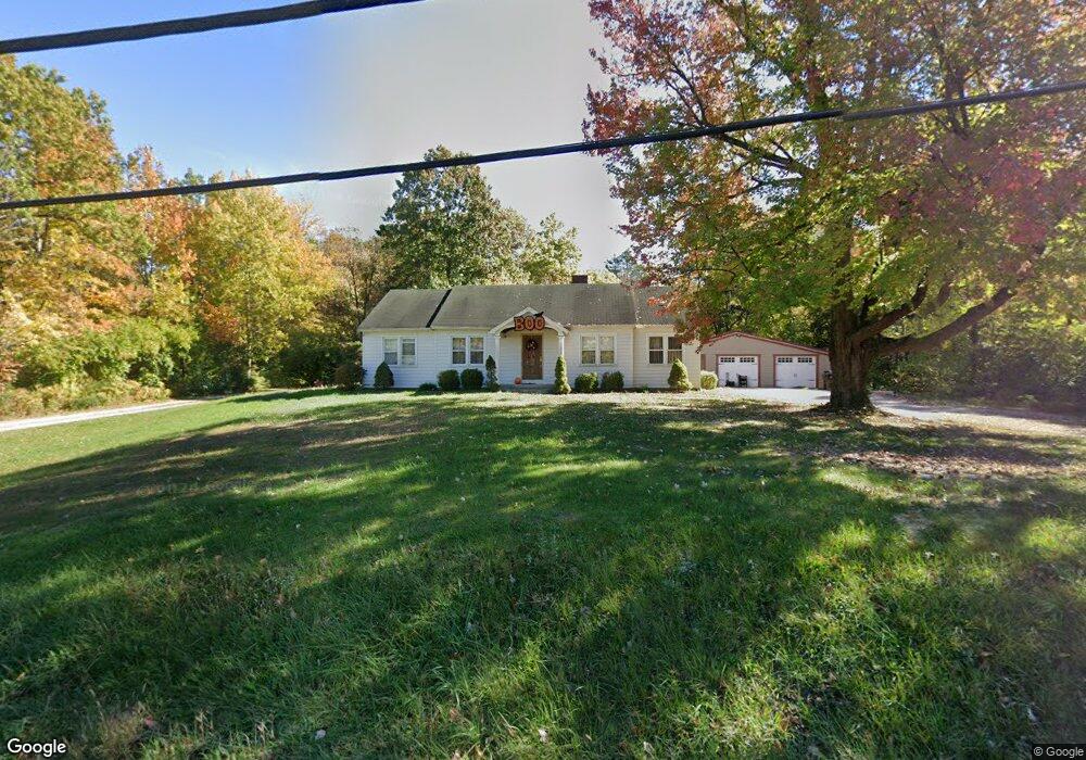
3326 State Route 132 Amelia, OH 45102
Estimated Value: $263,000 - $283,000
3
Beds
2
Baths
1,882
Sq Ft
$144/Sq Ft
Est. Value
About This Home
This home is located at 3326 State Route 132, Amelia, OH 45102 and is currently estimated at $270,312, approximately $143 per square foot. 3326 State Route 132 is a home located in Clermont County with nearby schools including Holly Hill Elementary School, West Clermont Middle School, and West Clermont High School.
Ownership History
Date
Name
Owned For
Owner Type
Purchase Details
Closed on
May 6, 2008
Sold by
Nixon Mark C and Nixon Charlene
Bought by
Spaulding Aaron
Current Estimated Value
Home Financials for this Owner
Home Financials are based on the most recent Mortgage that was taken out on this home.
Original Mortgage
$85,000
Outstanding Balance
$51,275
Interest Rate
4.99%
Mortgage Type
Purchase Money Mortgage
Estimated Equity
$219,037
Create a Home Valuation Report for This Property
The Home Valuation Report is an in-depth analysis detailing your home's value as well as a comparison with similar homes in the area
Home Values in the Area
Average Home Value in this Area
Purchase History
| Date | Buyer | Sale Price | Title Company |
|---|---|---|---|
| Spaulding Aaron | $106,300 | Attorney |
Source: Public Records
Mortgage History
| Date | Status | Borrower | Loan Amount |
|---|---|---|---|
| Open | Spaulding Aaron | $85,000 |
Source: Public Records
Tax History
| Year | Tax Paid | Tax Assessment Tax Assessment Total Assessment is a certain percentage of the fair market value that is determined by local assessors to be the total taxable value of land and additions on the property. | Land | Improvement |
|---|---|---|---|---|
| 2024 | $2,916 | $57,090 | $14,110 | $42,980 |
| 2023 | $2,920 | $57,090 | $14,110 | $42,980 |
| 2022 | $2,516 | $42,770 | $10,500 | $32,270 |
| 2021 | $2,488 | $42,770 | $10,500 | $32,270 |
| 2020 | $2,488 | $42,770 | $10,500 | $32,270 |
| 2019 | $1,973 | $36,820 | $10,290 | $26,530 |
| 2018 | $1,992 | $36,820 | $10,290 | $26,530 |
| 2017 | $1,947 | $36,820 | $10,290 | $26,530 |
| 2016 | $1,947 | $32,590 | $9,100 | $23,490 |
| 2015 | $1,825 | $32,590 | $9,100 | $23,490 |
| 2014 | $1,825 | $32,590 | $9,100 | $23,490 |
| 2013 | $1,965 | $34,900 | $9,800 | $25,100 |
Source: Public Records
Map
Nearby Homes
- 1700 White Birch
- 1770 Ohio 125
- 115 Woodside Park Dr
- 1613 W Concord Rd
- 212 Wooded Ridge Dr
- 1770 Sunny Acres Ln
- 21 Mallard Dr
- 23 Mallard Dr
- 149 Wooded Ridge Dr
- 1889 Ohio 125
- 19 Bobwhite Ct
- 0 St Rt 125 Unit 1849632
- 16 Sperling Dr
- 52 Charmalee Dr
- 9 Mynah Dr
- 253 Deer Creek Dr
- 3395 Brown
- 27 Heron Dr
- 108 Wooded Ridge Dr
- 1542 Denny Dr
- 3328 State Route 132
- 3326 State Route 132
- 3320 State Route 132
- 3329 State Route 132
- 1734 Tib Day Ln
- 1738 Tib Day Ln
- 3308 State Route 132
- 3323 State Route 132
- 3317 State Route 132
- 6 Tib Day Ln
- 8 Tib Day Ln
- 3335 State Route 132
- 3296 State Route 132
- 3335 St Rt 132
- 1ac Tib Day Ln
- 67 White Blossom Ct
- 3347 Ohio 132
- 1754 Tib Day Ln
- 3288 State Route 132
- 3288 St Rt 132
Your Personal Tour Guide
Ask me questions while you tour the home.