33287 W I-40 Frontage Rd Chambers, AZ 86502
Estimated payment $7,882/month
Highlights
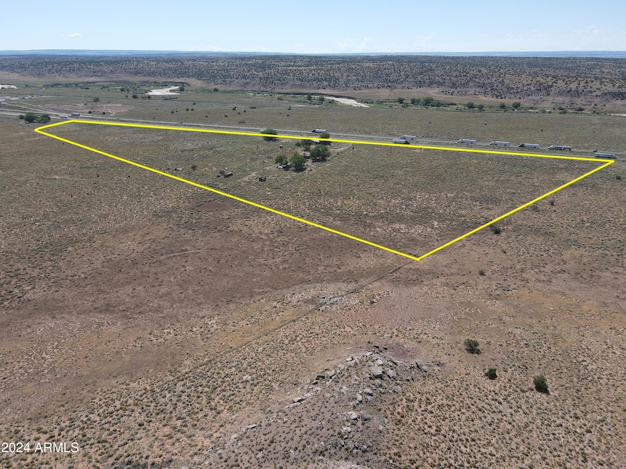
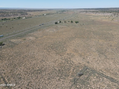
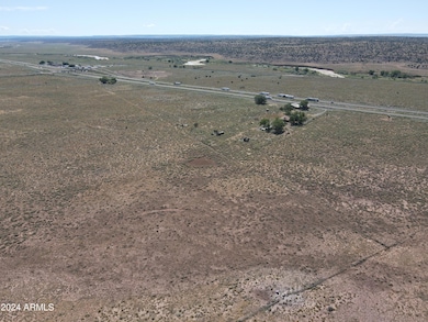
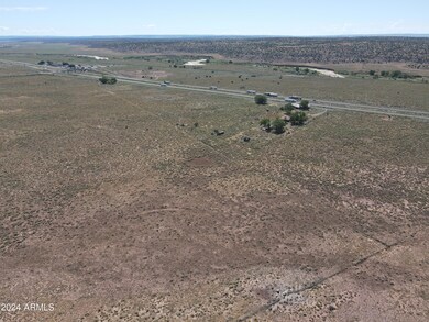
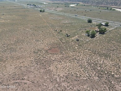
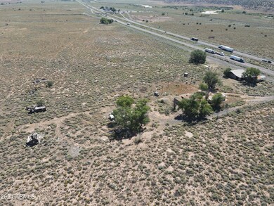
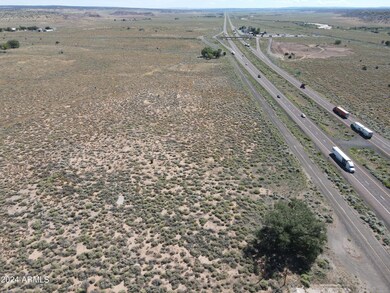
- 37.09 Acre Lot
- Shed
- Gentle Sloping Lot
- No HOA
- Garage
About This Lot
This home is located at 33287 W I-40 Frontage Rd, Chambers, AZ 86502 and is currently priced at $1,490,000. 33287 W I-40 Frontage Rd is a home located in Apache County.
Listing Agent
Whitetail Properties Real Estate LLC License #SA703923000 Listed on: 02/14/2024

Property Details
Property Type
- Land
Est. Annual Taxes
- $336
Lot Details
- 37.09 Acre Lot
- Wire Fence
- Gentle Sloping Lot
- Property is zoned A-G
Parking
- Garage
Mobile Home
Utilities
- Well
Listing and Financial Details
- Assessor Parcel Number 207-13-005
Community Details
Overview
- No Home Owners Association
Recreation
- Shed
Map
Home Values in the Area
Average Home Value in this Area
Tax History
| Year | Tax Paid | Tax Assessment Tax Assessment Total Assessment is a certain percentage of the fair market value that is determined by local assessors to be the total taxable value of land and additions on the property. | Land | Improvement |
|---|---|---|---|---|
| 2026 | $364 | $4,301 | -- | -- |
| 2025 | $336 | $4,026 | -- | -- |
| 2024 | $336 | $3,828 | $0 | $0 |
| 2023 | $336 | $3,645 | $0 | $0 |
| 2022 | $321 | $3,434 | $0 | $0 |
| 2021 | $313 | $3,226 | $0 | $0 |
| 2020 | $1,380 | $14,020 | $0 | $0 |
| 2019 | $1,304 | $13,353 | $0 | $0 |
| 2018 | $1,222 | $12,707 | $0 | $0 |
| 2017 | $1,188 | $11,466 | $0 | $0 |
| 2016 | $810 | $10,129 | $0 | $0 |
| 2015 | $810 | $9,849 | $0 | $0 |
| 2014 | $810 | $4,015 | $1,218 | $2,798 |
Property History
| Date | Event | Price | List to Sale | Price per Sq Ft |
|---|---|---|---|---|
| 01/31/2025 01/31/25 | Price Changed | $1,490,000 | -11.8% | -- |
| 02/14/2024 02/14/24 | For Sale | $1,690,000 | -- | -- |
Purchase History
| Date | Type | Sale Price | Title Company |
|---|---|---|---|
| Quit Claim Deed | -- | None Available |
Source: Arizona Regional Multiple Listing Service (ARMLS)
MLS Number: 6663842
APN: 207-13-005
Disclaimer: Certain information contained herein is derived from information provided by parties other than Homes.com. All information provided is deemed reliable, but is not guaranteed to be accurate and should be independently verified.
![]() All information should be verified by the recipient and none is guaranteed as accurate by ARMLS
All information should be verified by the recipient and none is guaranteed as accurate by ARMLS
Listing Information presented by local MLS brokerage: Ten-X, local REALTOR®- Arlene Richardson - (888)-952-6393
- 33287 W I-40 Frontage Rd Unit LotWP001
- U S 191
- 0 Bell Brand Ranches Lot 39 - 40 Unit 257923
- 7060th
- 7060th
- 0 Unit 257641
- 7060 Us-191 Frontage Rd
- Unnamed Dirt Rd Unit Chambers AZ 86512
- 0 Chambers Unit 250746
- 20 acres In Chambers --
- 15 County Rd N7397 --
- Close To N7356 Unit SANDERS AZ 86512 0-0
- 0 N7010 Unit 242873
- TBD County Road N7012 40 Acres --
- Close To N7356 Unit SANDERS AZ 86512 0-0
- 35 Acres In Chambers --
- N7350 Unit Sanders Unified Dist
- Unknown Rd
- Close To N7356 Unit SANDERS AZ 86512
- 0 Bell Brand Ranches Lot 115 Unit 258518